
Dayton's Bluff in Saint Paul in Ramsey County, Minnesota — The American Midwest (Upper Plains)
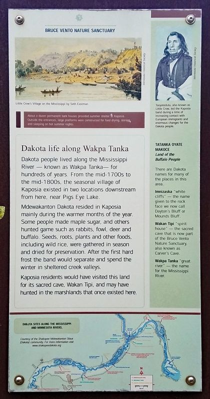
Dakota life along Wakpa Tanka
Bruce Vento Nature Sanctuary
Photographed by McGhiever, August 21, 2021
1. Dakota life along Wakpa Tanka Marker
Dakota people lived along the Mississippi River — known as Wakpa Tanka— for hundreds of years. From the mid-1700s to the mid-1800s, the seasonal village of Kaposia existed in two locations downstream from here, near Pigs Eye Lake.
Mdewakanton Dakota resided in Kaposia mainly during the warmer months of the year. Some people made maple sugar, and others hunted game such as rabbits, fowl, deer and buffalo. Seeds, roots, plants and other foods, including wild rice, were gathered in season and dried for preservation. After the first hard frost the band would separate and spend the winter in sheltered creek valleys.
Kaposia residents would have visited this land for its sacred cave, Wakan Tipi, and may have hunted in the marshlands that once existed here.
[Captions:]
About a dozen permanent bark houses provided summer shelter at Kaposia. Outside the entrances, large platforms were constructed for food drying, storage and sleeping on hot summer nights.
Taoyateduta, also known as Little Crow, led the Kaposia band during a time of increasing contact with European immigrants and enormous changes for the Dakota people.
Tatanka Oyate Makoce
Land of the Buffalo People
There are Dakota names for many of the places in this area.
Imnizaska "white cliffs" — the name given to the rock face we now call Dayton's Bluff or Mounds Bluff.
Wakan Tipi "spirit house" — the sacred cave that is now part of the Bruce Vento Nature Sanctuary, also known as Carver's Cave.
Wakpa Tanka "great river" — the name for the Mississippi River.
Dakota Sites along the Mississippi and Minnesota Rivers.
Topics. This historical marker is listed in these topic lists: Anthropology & Archaeology • Indigenous Peoples and Communities. A significant historical year for this entry is 1750.
Location. 44° 57.159′ N, 93° 4.456′ W.
this page online

Regionally, this marker is in the Twin Cities Metropolitan Area. It is also in the American Midwest, in the Corn Belt, and in the Great River Road Region. Globally, it is in North America, the Western Hemisphere, the Western World, and the Anglosphere. Historically, it finds itself in what was once Rupert’s Land, the territory of the Mississippian Culture, and the Louisiana Purchase.
Other nearby markers. At least 8 other markers are within walking distance of this marker: Nature and history in the Phalen Creek valley (here, next to this marker); A time of environmental and cultural change (here, next to this marker); Preserving history on the land (here, next to this marker); Remnants of a Former Rail Yard
Photographed by McGhiever, August 21, 2021
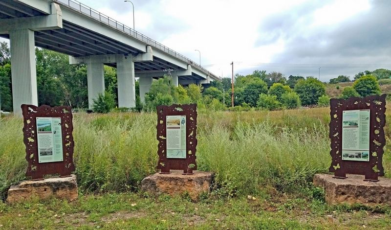
2. Marker (center) in Bruce Vento Nature Sanctuary
Credits. This page was last revised on August 20, 2023. It was originally submitted on August 16, 2023, by McGhiever of Minneapolis, Minnesota. This page has been viewed 455 times since then and 40 times this year. Photos: 1, 2. submitted on August 16, 2023, by McGhiever of Minneapolis, Minnesota. • Devry Becker Jones was the editor who published this page.
