Logan Square in Philadelphia in Philadelphia County, Pennsylvania — The American Northeast (Mid-Atlantic)
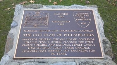
The City Plan of Philadelphia
Photographed by Keith S Smith, December 18, 2011
1. The City Plan of Philadelphia Marker
1682
Dedicated
1997
National Historic Civil Engineering Landmark
The City Plan of Philadelphia
Surveyor General Thomas Holme, Governor
William Penn & others Planned the open
Public Squares and Rational Street Layout
that we enjoy today. These original
features have inspired City engineers for
300 years.
Erected 1997 by American Society of Civil Engineers – Fairmont Park Commission.
Topics and series. This historical marker is listed in these topic lists: Colonial Era • Settlements & Settlers. In addition, it is included in the ASCE Civil Engineering Landmarks series list. A significant historical year for this entry is 1682.
Location. 39° 57.454′ N, 75° 10.288′ W. Marker is in Philadelphia, Pennsylvania, in Philadelphia County. It is in Logan Square. It is at the intersection of Benjamin Franklin Parkway and Race Street on Benjamin Franklin Parkway. Marker is in Logan Square. Touch for map. Marker is at or near this postal address: 1916 Race St, Philadelphia PA 19103, United States of America. Touch for directions.

Regionally, this marker is in Southeast Pennsylvania. It is also in the American
this page online
Other nearby markers. At least 8 other markers are within walking distance of this marker: US Sanitary Commission Great Central Fair (within shouting distance of this marker); Moore College of Art & Design / A Vibrant Visual Arts College (within shouting distance of this marker); Moore College of Art & Design (within shouting distance of this marker); Meriwether Lewis (within shouting distance of this marker); Connecting People to Nature (within shouting distance of this marker); Parkway Museums District (within shouting distance of this marker); Swann Memorial Fountain (within shouting distance of this marker); Aero Memorial (within shouting distance of this marker). Touch for a list and map of all markers in Philadelphia.
Related markers. Click here for a list of markers that are related to this marker.
Also see . . . Thomas Holme - Wikipedia.
Photographed by Keith S Smith, December 18, 2011
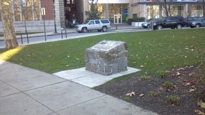
2. The City Plan of Philadelphia Marker
Photographed by Keith S Smith, December 18, 2011
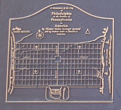
3. The City Plan of Philadelphia
Photographed by Thomas Holmes Map of 1687
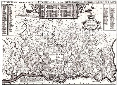
4. Philadelphia map by Thomas Holmes - 1687
Credits. This page was last revised on August 19, 2023. It was originally submitted on December 27, 2011, by Keith S Smith of West Chester, Pennsylvania. This page has been viewed 990 times since then and 35 times this year. Last updated on August 17, 2023, by Carl Gordon Moore Jr. of North East, Maryland. Photos: 1, 2, 3, 4. submitted on December 27, 2011, by Keith S Smith of West Chester, Pennsylvania. • Bill Pfingsten was the editor who published this page.
