
Upper Merion Township near King of Prussia in Montgomery County, Pennsylvania — The American Northeast (Mid-Atlantic)
Valley Creek
Meandering through History
| — | Valley Forge National Historical Park | — |
Photographed by Bill Coughlin, March 20, 2010
1. Valley Creek Marker
< Sidebar: >
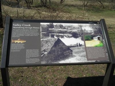
Valley Creek is cleaner than at any time in the last 300 years. Threats to the creek have changed over time. Once polluted by raw sewage and toxic chemicals, today sediment and warm temperatures degrade aquatic habitat, a result of paving and building on lands upstream of the park. With less open land where rainwater can sink in, there are increasingly frequent and intense floods. Floodwaters are warm, contain sediment from collapsing stream banks, and wash in roadway pollutants such as oil. Raging waters also wash out archeological resources along the creek, and even threaten the Covered Bridge and Washington’s Headquarters.
Erected by National Park Service.
Topics. This historical marker is listed in these topic
this page online
Location. 40° 6.063′ N, 75° 27.702′ W. Marker is near King of Prussia, Pennsylvania, in Montgomery County. It is in Upper Merion Township. It is on Valley Creek Road, on the left when traveling north. Marker is on the tour road in Valley Forge National Historical Park at stop 6, Washington’s Headquarters. Touch for map. Marker is at or near this postal address: 1080 Valley Creek Rd, King of Prussia PA 19406, United States of America. Touch for directions.

Regionally, this marker is in Southeast Pennsylvania and in Greater Philadelphia. It is also in the American Northeast and in the Mid-Atlantic. Globally, it is in North America, the Western Hemisphere, the Western World, and the Anglosphere. Historically, it finds itself in what was once the Haudenosaunee (Iroquois) Confederacy and also one of the original Thirteen Colonies.
Other nearby markers. At least 8 other markers are within walking distance of this marker: Washington’s Headquarters (about 300 feet away, measured in a direct line); American Icon (about 400 feet
Photographed by Bill Coughlin, March 20, 2010
2. Marker in Valley Forge
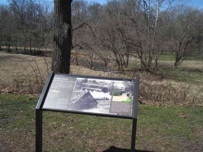
Another marker is no longer nearby. The Village of Valley Forge (was about 300 feet away but has been permanently removed).
More about this marker. The background of the marker contains a 19th century photo of Valley Creek with Washington’s Headquarters nearby. It has a caption of “In the 18th and 19th centuries, this scene looked very different. Iron works, mills, and other industries were located along the stream. These were ‘working waters.’ Dams in several places provided water power and also created large ponds where now you see flowing water. The land on either side of the creek below is composed of sediments that settled behind one of these dams.
In the 19th century, a mill stood between Washington’s Headquarters (at upper left) and Valley Creek. Like
Photographed by Bill Coughlin, March 20, 2010
3. Valley Creek
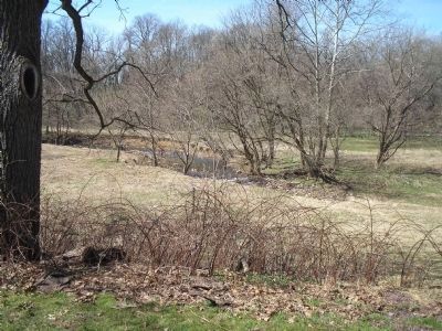
This photo of Valley Creek was taken from in front of the marker.
A picture of a trout on the left of the marker has a caption of “In spite of its location in an urbanized region, Valley Creek supports a naturally reproducing population of wild trout. Numerous springs from the limestone bedrock along the creek’s length provide a steady supply of the cool water that trout and native stream species need. New York State Department of Environmental Conservation”
A photo of Valley Creek’s covered bridge appear on the marker’s right, above the sidebar.
Photographed by Tom Bosse, September 16, 2025
4. Valley Creek Marker
Credits. This page was last revised on February 19, 2026. It was originally submitted on March 25, 2010, by Bill Coughlin of Woodland Park, New Jersey. This page has been viewed 2,416 times since then and 57 times this year. Last updated on August 17, 2023, by Carl Gordon Moore Jr. of North East, Maryland. Photos: 1, 2, 3. submitted on March 25, 2010, by Bill Coughlin of Woodland Park, New Jersey. 4. submitted on January 31, 2026, by Tom Bosse of Jefferson City, Tennessee. • Bill Pfingsten was the editor who published this page.
