Sidney in Cheyenne County, Nebraska — The American Midwest (Upper Plains)
Cheyenne County
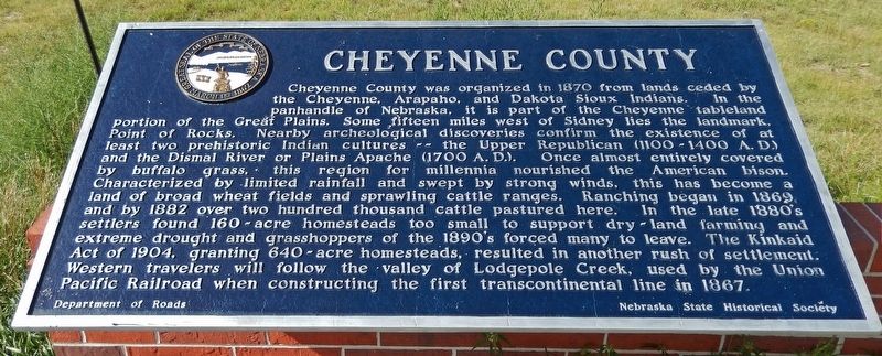
Cheyenne County was organized in 1870 from lands ceded by the Cheyenne, Arapaho, and Dakota Sioux Indians. In the panhandle of Nebraska, it is part of the Cheyenne tableland portion of the Great Plains. Some fifteen miles west of Sidney lies the landmark, Point of Rocks. Nearby archeological discoveries confirm the existence of at least two prehistoric Indian cultures — the Upper Republican (1100-1400 A.D.) and the Dismal River or Plains Apache (1700 A.D.). Once almost entirely covered by buffalo grass, this region for millennia nourished the American bison. Characterized by limited rainfall and swept by strong winds, this has become a land of broad wheat fields and sprawling cattle ranges. Ranching began in 1869, and by 1882 over two hundred thousand cattle pastured here. In the late 1880’s settlers found 160-acre homesteads too small to support dry-land farming and extreme drought and grasshoppers of the 1890’s forced many to leave. The Kinkaid Act of 1904, granting 640-acre homesteads, resulted in another rush of settlement. Western travelers will follow the valley of Lodgepole Creek, used by the Union Pacific Railroad when constructing the first transcontinental line in 1867.
Erected by Nebraska State Historical Society; and Department of Roads. (Marker Number 77.)
Topics and series. This historical marker is listed in these topic lists: Agriculture • Native Americans • Railroads & Streetcars • Settlements & Settlers. In addition, it is included in the Nebraska State Historical Society series list. A significant historical year for this entry is 1870.
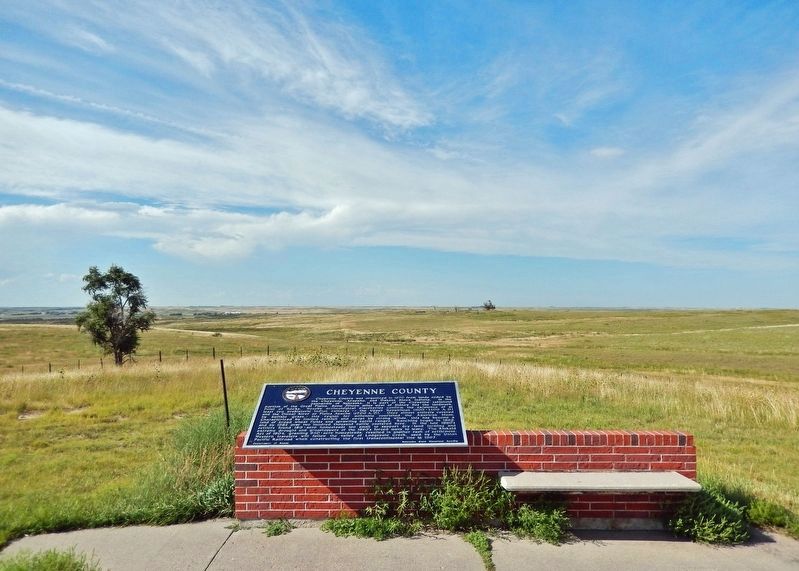
Location. 41° 6.877′ N, 102° 55.456′ W. Marker is in Sidney, Nebraska, in Cheyenne County. Marker can be reached from Interstate 80 (at milepost 61), 1.3 miles east of Upland Parkway (Alternate Interstate 80), on the right when traveling west. Marker is located at the Interstate 80 rest stop just east of Sidney. Touch for map. Marker is in this post office area: Sidney NE 69162, United States of America. Touch for directions.
Other nearby markers. At least 8 other markers are within 11 miles of this marker, measured as the crow flies. Purple Heart Trail (about 300 feet away, measured in a direct line); Sidney ~ Cheyenne County (about 300 feet away); Nebraska’s Earliest Documented Burial (approx. 2˝ miles away); Fort Sidney (approx. 3.1 miles away); Carnegie Library (approx. 3.3 miles away); Hickory Square (approx. 3˝ miles away);
Sidney-Black Hills Trail (approx. 4˝ miles away); Discovery Oil Well - Marathon Oil Company (approx. 10.4 miles away). Touch for a list and map of all markers in Sidney.
Also see . . .
1. Cheyenne County History: Early Settlement. Excerpt:
Contemporaneous with and following the building of the Union Pacific, the cattlemen came into the country. All was government and railroad land, and the stockmen came to use the ranges. Originally they described their brands and range, thereby indicating a claim for so many miles of prairie that assured plenty of territory. Ranges seldom overlapped, but the cattle became mixed and the round up instituted. In 1869 and 1870, cattle were wintered in the country now comprised in Cheyenne county though the ranges had been used before that time for oxen. For a number of years no taxes were levied against the cattle, no investments in real estate were necessary and the profits were large.(Submitted on August 18, 2023, by Cosmos Mariner of Cape Canaveral, Florida.)
2. Kinkaid Act of 1904 (Wikipedia). Excerpt:
A U.S. statute that amended the 1862 Homestead Act so that one section (640 acres) of public domain land could be acquired free of charge, apart from a modest filing fee. It applied specifically to 37 counties in northwest Nebraska, in the general area of the Nebraska Sandhills. The legal provisions of the Kinkaid Act were very similar to those of the Homestead Act. Only non-irrigable lands were eligible to be claimed under the provisions of the Kinkaid Act; those that were deemed to be practicably irrigable by the Secretary of the Interior were excluded.(Submitted on August 18, 2023, by Cosmos Mariner of Cape Canaveral, Florida.)
Credits. This page was last revised on August 18, 2023. It was originally submitted on August 18, 2023, by Cosmos Mariner of Cape Canaveral, Florida. This page has been viewed 67 times since then and 16 times this year. Photos: 1, 2. submitted on August 18, 2023, by Cosmos Mariner of Cape Canaveral, Florida.

