Littlestown in Adams County, Pennsylvania — The American Northeast (Mid-Atlantic)
Littlestown
Early History
— 1762-1815 —
Inscription.
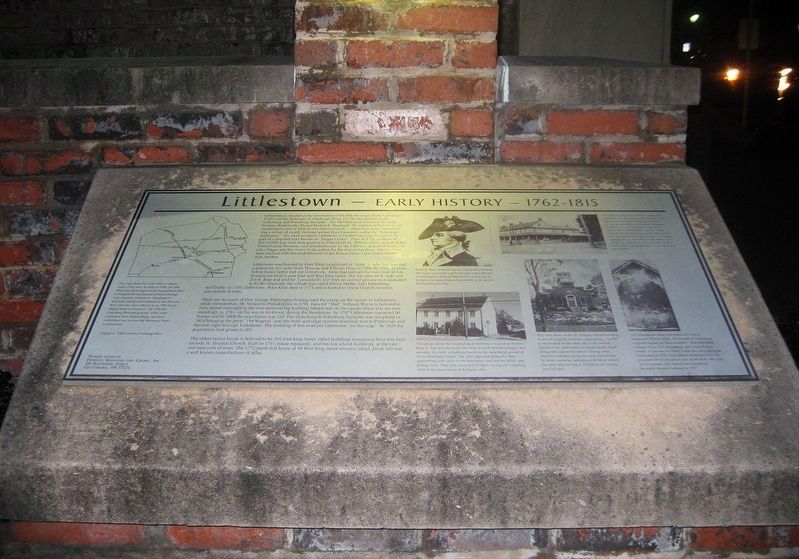
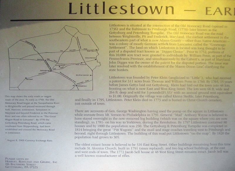
Littlestown is situated at the intersection of the Old Monocacy Road (opened in 1736) and the Baltimore to Pittsburgh Road, (1770) later known as the Gettysburg and Petersburg Turnpike. The Old Monocacy Road was the road between Wrightsville, PA and Frederick, Maryland. The earliest settlement in the southeastern part of what is now Adams County—other than Native Americans—was a colony of mostly German settlers from Lancaster, called the "Conewago Settlement". The land on which Littlestown is located was long thought to be part of a disputed tract known as "Digges Choice". Prior to 1751, portions of this 10,000 acre tract were granted to individuals by William Penn, as part of the Pennsylvania Province, and simultaneously by the Calvert's as part of Maryland. John Digges was the owner of the patent for the disputed portion. The issue was later resolved with the establishment of the Mason—Dixon Line, clarifying the state borders.
Littlestown was founded by Peter Klein (anglicized to "Little"), who had received a patent for 311 acres from Thomas and William Penn in 1760. By 1765, 15 years before James Gettys laid out Gettysburg, Klein had laid out the town into 48 lots, front what is now East and West King Street. The lots were 66 ft. wide and 264 ft. deep and sold for 3 pounds ($5.33)* with an annual ground rent equivalent to $1.00. Originally the village was called Kleina Stedtle, later Petersburg, and finally in 1795, Littlestown, Peter Klein died in 1773 and is buried in Christ Church cemetery just outside of town.
There are accounts of Gen. George Washington having used the pump on the square of Littlestown while enroute from Mt. Vernon to Philadelphia in 1791. General "Mad" Anthony Wayne is believed to have stayed overnight in the now-removed log building (which was on the square where you are now standing), 1781—on his way to Yorktown, during the Revolution. By 1797 Littlestown contained 80 houses and by 1800 the population was 250. The Gettysburg & Petersburg Turnpike was completed in 1814 bringing the great "Pitt Wagons" and the mail and stage coaches traveling west to Pittsburgh and beyond, right through Littlestown. The building of this road put Littlestown "on the map". By 1820 the population had grown to 305.
The oldest extant house is believed to be 316 East King Street. Other building remaining from this time include St. Aloysius Church, built in 1791 (since replaced), and two log school buildings in the east and west end of town. The 1772 Jacob Sell house at 48 West King Street remains intact. Jacob Sell was a well known manufacturer of rifles.
(Map Image Text)
This map shows the early roads or wagon roads of the area. As early as 1740, the Old
Monocacy Road began at the Susquehanna River in Wrightsville and passed westward through York, Hanover, Littlestown, Taneytown in Maryland and beyond to Frederick to the Potomac River and was often referred to as "The Great Wagon Road to Lancaster". by 1770 the Gettysburg—Petersburg Road, which came southward from Shippensburg, had been established and crossed the Monocacy Road in Littlestown.
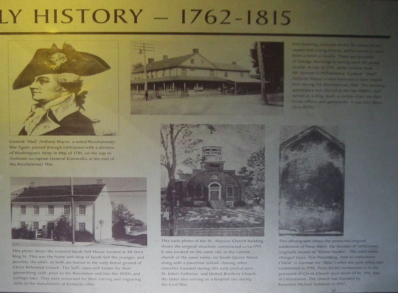
(General "Mad" Anthony Wayne Image Text)
General "Mad" Anthony Wayne, noted Revolutionary War figure, passed through Littlestown with a division of Washington's Army in May 1781, on the way to Yorktown to capture General Cornwallis at the end of the Revolutionary War.
(Jacob Sell House Image Text)
This photo shows the restored Jacob Sell House located at 48 West King St. This was the home and shop of Jacob Sell the younger, and possibly, the elder, as both are buried in the early burial ground of Christ Reformed Church. The Sell's were were known for their gunsmithing craft, prior to the Revolution and into the 1820's and perhaps later. They were renowned for their carving and engraving skills in the manufacture of Kentucky rifles.
(St. Aloysius Church Image Text)
This early photo of the St. Aloysius Church building shows the original structure, constructed circa 1791. It was located on the same site as the current church of the same name, on
South Queen Street, along with a parochial school. Among other churches founded during this early period were St. John's Lutheran, and United Brethren Church, the latter also serving as a hospital site during the Civil War.
(SE Corner Building Image Text)
This building pictured on the SE corner of the square had a long history, and is known to have been a hotel or tavern. There are accounts of George Washington having used the pump nearby, in July 1791, while enroute from Mt. Vernon to Philadelphia. General "Mad" Anthony Wayne is also believed to have stayed here during the Revolutionary War. The building appearance was altered in the late 1800's, and served as a drug store, a variety store, the Red Cross offices, and apartments. It was torn down circa 1970's.
(Tombstone of Peter Klein Image Text)
This photograph shows the protected original tombstone of Peter Klein, the founder of Littlestown, originally known as "Kleina Stedtle". The town named changed twice, first Petersburg, then to Littlestown ("klein" is German for "little") when the post office was established in 1795. Peter Klein's tombstone is in the graveyard of Christ Church (just north of Rt. 194, east of Littlestown). The church was founded by Reverend Michael Schlatter in 1747.
*August 8, 2005 Currency Exchange Rate
Erected by Herbert, Rowland and Grubic, Inc., 116 Baltimore Street, Gettysburg, PA 17325.
Topics. This historical marker is listed in these topic lists: Colonial Era • Roads & Vehicles • Settlements & Settlers • War, US Revolutionary. A significant historical year for this entry is 1762.
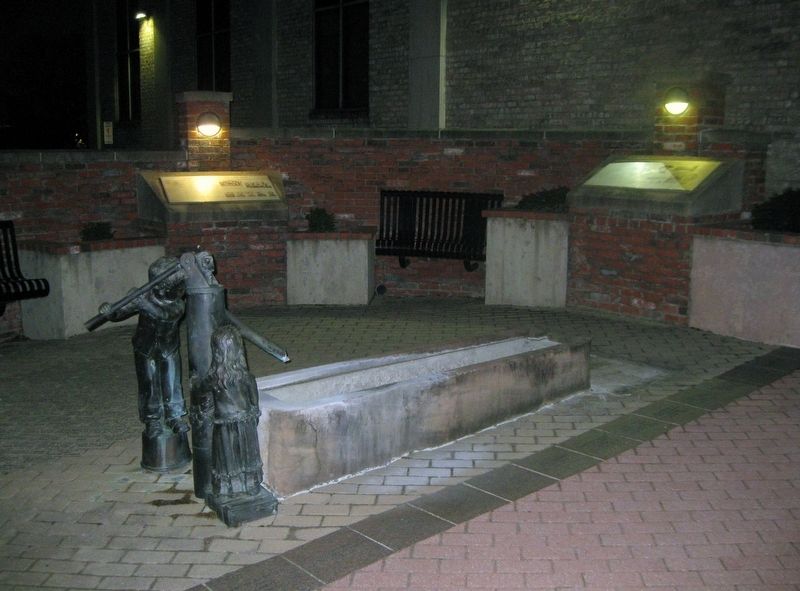
Location. 39° 44.681′ N, 77° 5.281′ W. Marker is in Littlestown, Pennsylvania, in Adams County. Marker is at the intersection of South Queen Street and East King Street, on the right when traveling north on South Queen Street. The marker is located at Littlestown History Plaza. Touch for map. Marker is in this post office area: Littlestown PA 17340, United States of America. Touch for directions.
Other nearby markers. At least 8 other markers are within walking distance of this marker. Littlestown 250 Years (here, next to this marker); a different marker also named Littlestown (here, next to this marker); a different marker also named Littlestown (here, next to this marker); a different marker also named Littlestown (here, next to this marker); Peter (Klein) Little (here, next to this marker); a different marker also named Littlestown (a few steps from this marker); Littlestown War Memorial (within shouting distance of this marker); Army of the Potomac (about 300 feet away, measured in a direct line). Touch for a list and map of all markers in Littlestown.
Credits. This page was last revised on September 3, 2023. It was originally submitted on January 13, 2019, by David Lassman of Waldorf, Maryland. This page has been viewed 642 times since then and 84 times this year. Last updated on August 19, 2023, by Carl Gordon Moore Jr. of North East, Maryland. Photos: 1, 2, 3, 4, 5, 6. submitted on January 13, 2019, by David Lassman of Waldorf, Maryland. • J. Makali Bruton was the editor who published this page.
