
Helena in Phillips County, Arkansas — The American South (West South Central)
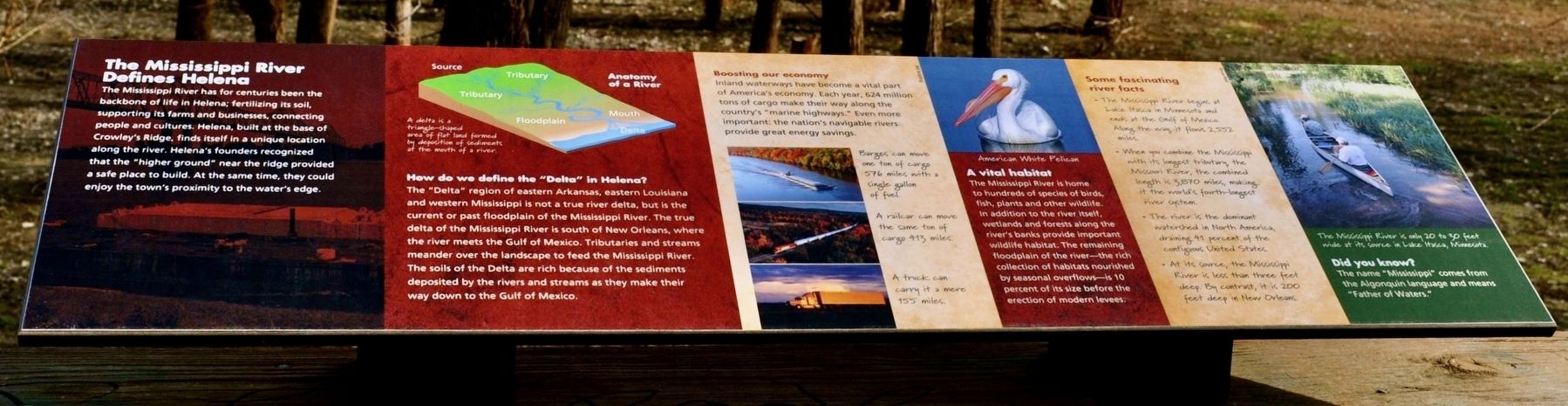
The Mississippi River Defines Helena
Photographed by Sandra Hughes Tidwell, January 17, 2012
1. The Mississippi River Defines Helena Marker
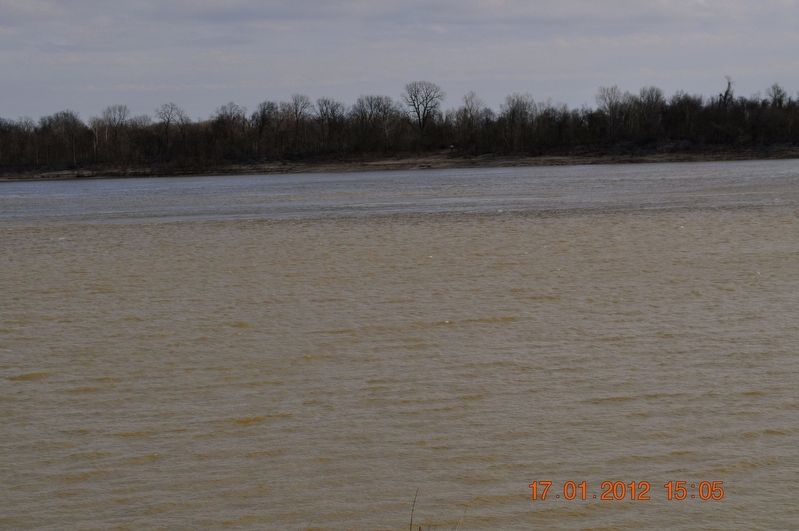
The Mississippi River has for centuries been the backbone of life in Helena; fertilizing its soil, supporting its farms and businesses, connecting people and cultures. Helena, built at the base of Crowley’s Ridge, finds itself in a unique location along the river. Helena’s founders recognized that the “higher ground” near the ridge provided a safe place to build. At the same time, they could enjoy the town’s proximity to the water’s edge.
Anatomy of a River
A delta is a triangle-shaped area of flat land formed by deposition of sediment of the mouth of the river.
How do we define the “Delta” in Helena?
The “Delta” region of eastern Arkansas, eastern Louisiana and western Mississippi is not a true river delta, but is the current or past floodplain of the Mississippi River. The true delta of the Mississippi River is south of New Orleans, where the river meets the Gulf of Mexico. Tributaries and streams meander over the landscape to feed the Mississippi River. The soils of the Delta are rich because of the sediments deposited by the rivers and streams as they make their way down to the Gulf of Mexico.
Boosting our economy
Island
this page online
Barges can move one ton of cargo 576 miles with a single gallon of fuel.
A railcar can move the same ton of cargo 425 miles.
A truck can carry it a mere 155 miles.
American White Pelican
A vital habitat
The Mississippi River is home to hundreds of species of birds, fish, plants and other wildlife. In addition to the river itself, wetlands and forests along the river’s banks provide important wildlife habitat. The remaining floodplain of the river-the rich collection of habitats nourished by seasonal overflows-is 10 percent of its size before the erection of modern levees.
Some fascinating river facts
* The Mississippi River begins at Lake Itasca in Minnesota, and ends at the Gulf of Mexico. Along the way it flows 2,552 miles.
* When you combine the Mississippi with its longest tributary the Missouri River, the combined length is 3,870 miles, making it the world’s fourth-longest river
Photographed by Sandra Hughes, January 17, 2012
2. The Mississippi River Defines Helena Marker
* The river is the dominant watershed in North America, draining 41 percent of the contiguous United States.
* At its source, the Mississippi River is less than three feet deep. By contrast, it is 200 feet deep in New Orleans.
The Mississippi River is only 20 to 30 feet wide at its source in Lake Itasca, Minnesota.
Did you Know?
The name “Mississippi” comes from the Algonquin language and means “Father of Waters.”
Topics. This historical marker is listed in these topic lists: Animals • Industry & Commerce • Waterways & Vessels.
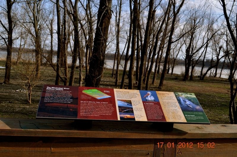
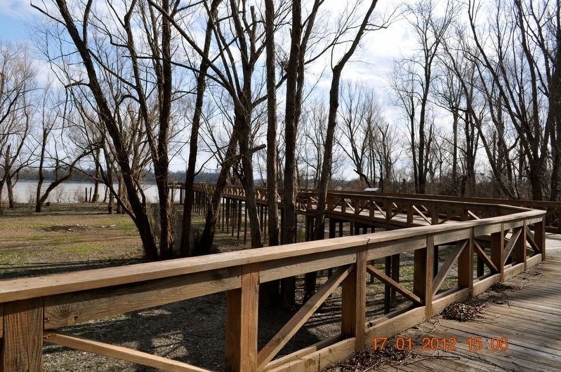
Location. 34° 31.467′ N, 90° 35.06′ W. Marker is in Helena, Arkansas, in Phillips County. It is on Helena River Park. The marker is located on the boardwalk in Helena River Park. Touch for map. Marker is in this post office area: Helena AR 72342, United States of America. Touch for directions.

Regionally, this marker is in the Arkansas Delta, in Crowley’s Ridge, in the Mississippi Alluvial Plain, and in the Quapaw Homeland. It is also in the American South, specifically in the Upper South, in the Mississippi Delta, and in the
Photographed by Sandra Hughes, January 17, 2012
3. The Mississippi River Defines Helena Marker
Other nearby markers. At least 8 other markers are within walking distance of this marker: River Birds (here, next to this marker); Those who have come before (here, next to this marker); The river connects communities (here, next to this marker); The Helena Bridge (here, next to this marker); Does the river ever flood? (here, next to this marker); Explore Our Top Outdoor Destinations (here, next to this marker); The Blues Trail: Mississippi to Helena (about 600 feet away, measured in a direct line); KFFA 1360 Helena (about 700 feet away). Touch for a list and map of all markers in Helena.
Also see . . . Visit Helena. City website entry:
Levee Walk & Pavilion: Take in panoramic views of downtown Helena on one side and the Mississippi River on the other while learning more about Helena’s history. (Submitted on November 17, 2024, by Larry Gertner of New York, New York.)
Photographed by Sandra Hughes, January 17, 2012
4. The Mississippi River Defines Helena Marker
Credits. This page was last revised on November 17, 2024. It was originally submitted on September 1, 2017, by Sandra Hughes Tidwell of Killen, Alabama, USA. This page has been viewed 680 times since then and 50 times this year. Last updated on August 27, 2023, by Carl Gordon Moore Jr. of North East, Maryland. Photos: 1. submitted on September 10, 2023. 2, 3, 4. submitted on September 1, 2017, by Sandra Hughes Tidwell of Killen, Alabama, USA. • J. Makali Bruton was the editor who published this page.
