Marker Logo
THE HISTORICAL
MARKER DATABASE
“Bite-Size Bits of Local, National, and Global History”
Holland Township near Prinsburg in Kandiyohi County, Minnesota — The American Midwest (Upper Plains)
 

Washburn Farm
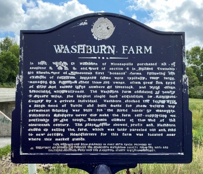
 
 
Washburn Farm Marker image. Click for full size.
August 26, 2023
1. Washburn Farm Marker
Inscription. In 1877, William D. Washburn of Minneapolis purchased all of sections 3, 4, 5, 9, and part of section 6 in Holland Township to create one of Minnesota's first "bonanza" farms. Following the example of factories, bonanza farms were typically very large, managed by someone other than the owner, often grew one type of crop and raised large numbers of livestock, and were often associated with railroads. The Washburn Farm consisted of nearly 5 square miles, the largest single land acquisition in Kandiyohi County by a private individual. Washburn stocked the farm with a large herd of cattle and built barns for them before any permanent housing was built for the hired hands or managers. Washburn's managers never did make the farm self-supporting or profitable in the tough economic climate at the end of the nineteenth century. The place never showed profit and Washburn ended up selling the farm, which was later parceled out and sold to new settlers. Headquarters for this farm was located near where this marker stands.
 
Erected by the State of Minnesota through the Minnesota Historical Society from the Arts and Cultural Heritage
Paid Advertisement
Click or scan to see
this page online
Fund and the Kandiyohi County Historical Society.
 
Topics. This historical marker is listed in these topic lists: AgricultureSettlements & Settlers. A significant historical year for this entry is 1877.
 
Location. 44° 57.824′ N, 95° 11.214′ W. Marker is near Prinsburg, Minnesota, in Kandiyohi County. It is in Holland Township. It is at the intersection of 165th Avenue Southwest (County Road 80) and 105th Street Southwest (County Highway 1), on the right when traveling east on 165th Avenue Southwest. Touch for map. Marker is in this post office area: Raymond MN 56282, United States of America. Touch for directions.

Regionally, this marker is in Central Minnesota and specifically in Southwest Minnesota. It is also in the American Midwest and in the Corn Belt. Globally, it is in North America, the Western Hemisphere, the Western World, and the Anglosphere. Historically, it finds itself in what was once Rupert’s Land, the territory of the Mississippian Culture, and the Louisiana Purchase.

Other nearby markers. At least 8 other markers are within 14 miles of this marker, measured as the crow flies: Dakota Camp (approx.
Washburn Farm Marker image. Click for full size.
August 26, 2023
2. Washburn Farm Marker
2.7 miles away); Raymond, Minnesota Veterans Memorial (approx. 4.4 miles away); 1873 Blizzard (approx. 6.8 miles away); Whitefield Town Site (approx. 10.1 miles away); Renville Legion Post 180 (approx. 12.1 miles away); Kandiyohi County Indian History (approx. 12.7 miles away); "Kandiyohi" (approx. 12.7 miles away); Geology of the Willmar Region (approx. 13.2 miles away).
 
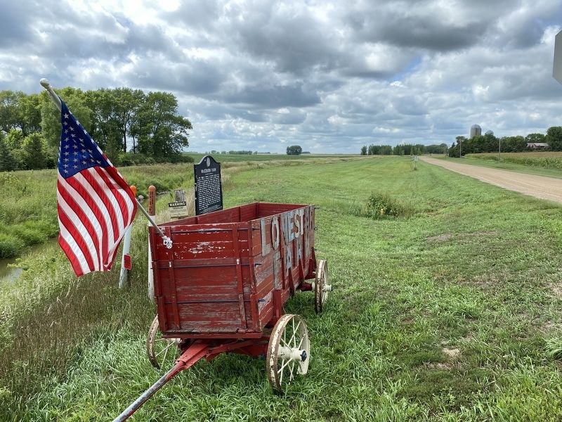
Washburn Farm Marker, from the east image. Click for full size.
August 26, 2023
3. Washburn Farm Marker, from the east
 
 
Credits. This page was last revised on August 29, 2023. It was originally submitted on August 29, 2023. This page has been viewed 333 times since then and 33 times this year. Photos:   1, 2, 3. submitted on August 29, 2023.

m=231702

CeraNet Cloud Computing sponsors the Historical Marker Database.
This website earns income from purchases you make after using our links to Amazon.com. We appreciate your support.
Paid Advertisement
Sep. 3, 2026