Old Glebe in Arlington in Arlington County, Virginia — The American South (Mid-Atlantic)
Fort Ethan Allen
Mr. Lincoln’s Forts
— Defenses of Washington - 1861-1865 —
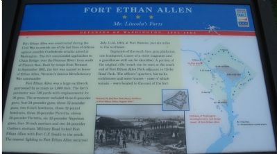
Fort Ethan Allen was constructed during the Civil War to provide one of the last lines of defense against possible Confederate attacks aimed at Washington. The fort commanded approaches to Chain Bridge (over the Potomac River) from the south of Pimmit Run. Built by troops from Vermont in September 1861, the fort was named in honor of Ethan Allen, Vermont’s famous Revolutionary War commander.
Fort Ethan Allen was a large earthwork garrisoned by as many as 1,000 men. The fort’s perimeter was 736 yards with emplacements for 36 guns. The armament included three 6-pounder guns, four 24-pounder guns, three 32-pound howitzers, three 10-pounder Parrotts, eleven 30-pounder Parrotts, six 12-pounder Napoleon guns, four 10-inch mortars and two 24-pounder Coehorn mortars. Military Road linked Fort Ethan Allen with Fort C.F. Smith to the south. The nearest fighting to Fort Ethan Allen occurred July 11-12, 1864, at Fort Stevens, just six miles to the northeast.
Segments of the south face, gun platforms, one bombproof, traces of a stone magazine and a guardhouse still can be identified. A portion of the original rifle trench can be seen at the south end of Fort Ethan Allen Park adjacent to Glebe Road Park. The officer’s quarters, barracks, cookhouses and mess houses—none of which remain—were located to the east of the fort.
Erected by Virginia Civil War Trails.
Topics and series. This historical marker is listed in these topic lists: Forts and Castles • War, US Civil. In addition, it is included in the Defenses of Washington, and the Virginia Civil War Trails series lists. A significant historical date for this entry is July 11, 1861.
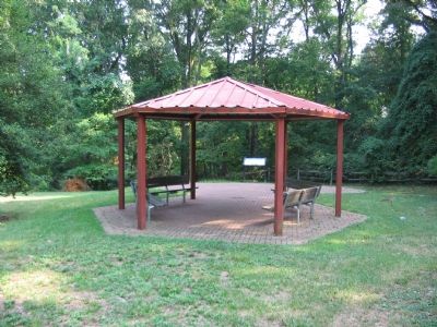
Location. This marker has been replaced by another marker nearby. It was located near 38° 55.338′ N, 77° 7.506′ W. Marker was in Arlington, Virginia, in Arlington County. It was in Old Glebe. Marker was on Old Glebe Road, on the right when traveling north. Inside Glebe Road Park, to the north of the tennis courts, behind a gazebo. Touch for map. Marker was in this post office area: Arlington VA 22207, United States of America. Touch for directions.
Other nearby markers. At least 8 other markers are within walking distance of this location. A different marker also named Fort Ethan Allen (here, next to this marker); The Sanctuary (about 500 feet away, measured in a direct line); Saegmuller Public School (about 500 feet away); a different marker also named Fort Ethan Allen (about 500 feet away); Welcome to Fort Ethan Allen (about 500 feet away); A Bastion-Style Fort Is a Mighty Fortress (about 500 feet away); A Defensive Stronghold, Heavily Armed (about 500 feet away); The View in 1865 (about 700 feet away). Touch for a list and map of all markers in Arlington.
More about this marker. The marker displays a map of the Washington defenses as well as a drawing of the design of Fort Ethan Allen. An inset picture shows “Battery M, 2nd New York Heavy Artillery at Fort Ethan Allen, August 1865.”
Related marker. Click here for another marker that is related to this marker. This marker has been replaced with the linked marker, which has slightly different text.
Also see . . .
1. Replica 30-Pounder Parrott Rifle Firing. Designed to penetrate and disable ironclad ships, these weapons would have been used to counter enemy artillery firing on the fort. With a range of over 6000 yards, these massive weapons out ranged most anything else used by field armies during the Civil War. (Submitted on September 4, 2007, by Craig Swain of Leesburg, Virginia.)
2. Video of 10 in Mortar Firing. The mortars were intended for use against enemy engineers and infantry attempting to build siege lines around the fort. These weapons would drop heavy shells into the besieger's trenches. (Submitted on September 4, 2007, by Craig Swain of Leesburg, Virginia.)
3. Video of 12 pounder Napoleon Firing. The 12 pounder Napoleon was a common field piece used during the Civil War, but at Fort Ethan Allen it would have been used to cover the flanks and blind spots of the approaches to the fort. In particular, used against enemy infantry that penetrated within musket range of the fort. In that role, the Napoleons would have fired anti-personnel cannister rounds, turning the cannon into giant shotguns. (Submitted on September 4, 2007, by Craig Swain of Leesburg, Virginia.)
Additional keywords. Defenses of Washington
Credits. This page was last revised on February 1, 2023. It was originally submitted on September 4, 2007, by Craig Swain of Leesburg, Virginia. This page has been viewed 4,224 times since then and 49 times this year. Photos: 1, 2. submitted on September 4, 2007, by Craig Swain of Leesburg, Virginia. • J. J. Prats was the editor who published this page.

