Roxborough in Philadelphia in Philadelphia County, Pennsylvania — The American Northeast (Mid-Atlantic)
Transformation in the heart of Roxborough

Photographed By Devry Becker Jones (CC0), September 2, 2023
1. Transformation in the heart of Roxborough Marker
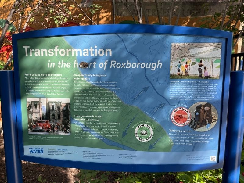
From vacant lot to pocket park
After a fire destroyed the two buildings that once stood here, this space was an unused asphalt lot from the late 1970s until 2015. Community-driven efforts transformed the lot into a pocket of green to soak up stormwater and provide residents with a relaxing reprieve from busy Ridge Avenue.
An opportunity to improve water quality
Ridge Avenue roughly marks the divide between the Schuylkill and the Wissahickon watersheds. You can think of a watershed as a big bowl or valley where rain and melting snow flow downhill to a shared low point and form a body of water, like a creek or river. Below Domino Lane, most land east of Ridge Avenue drains into the Wissahickon Creek, and the land on this side of the street drains into the Schuylkill River. The green stormwater management tools in this park help protect the Schuylkill River.
How green tools create healthier waterways
Green tools—like the rain garden and rain-absorbing bricks found here—use materials such as plants, stone, and special surfaces to capture, slow, filter, and soak up water during storms. These tools make our creeks and rivers healthier by filtering polluted runoff that can harm water quality.
What you can do
Storm drain markers remind us that cleaner streets and neighborhoods mean cleaner rivers and creeks! Help keep waterways clean by disposing of trash properly.
"Watershed": The Pocket Park Mural by Paul Santoleri
Watershed blends nature and history to express the role water plays in creating and sustaining life. Waves and ripples flow through the mural, connecting Roxborough's past to the vision of a greener city. The mural features native wildlife living in the neighborhood's two watersheds. Among the species shown is the red fox—a nod to local folklore claiming that the name "Roxborough" means "where the foxes burrow under the rocks." The red salamander also calls the Wissahickon watershed home, living under streamside rocks.
[Caption:]
After the fire in 1978, the two buildings were demolished and the lot sat unused for decades.
Erected by Philadelphia Water Department.
Topics. This historical marker is listed in these topic lists: Natural Features • Parks & Recreational Areas. A significant historical year for this entry is 2015.
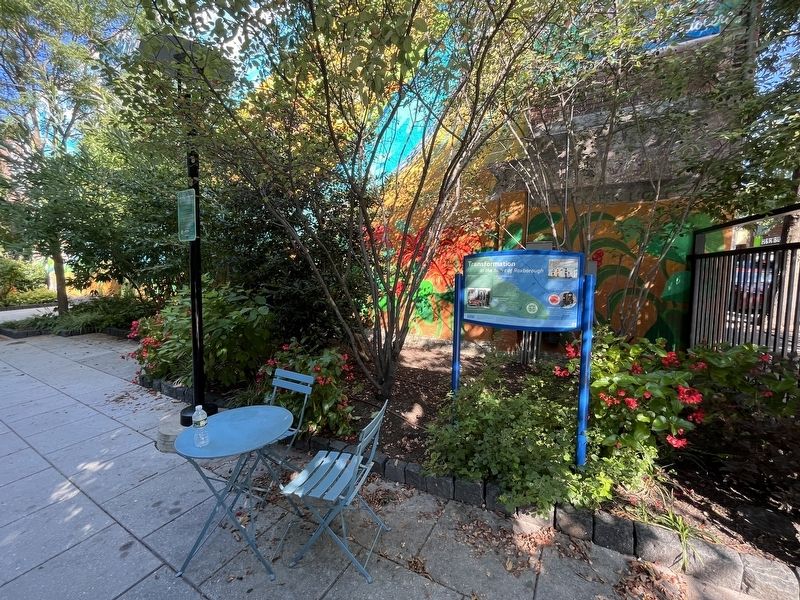
Location. 40° 2.106′ N, 75° 13.022′ W. Marker is in Philadelphia, Pennsylvania, in Philadelphia County. It is in Roxborough. Marker is on Ridge Avenue just south of Leverington Avenue, on the left when traveling north. The marker stands

Photographed By Devry Becker Jones (CC0), September 2, 2023
2. Transformation in the heart of Roxborough Marker
Other nearby markers. At least 8 other markers are within walking distance of this marker. Original cornerstone of the old Leverington Hotel (about 700 feet away, measured in a direct line); Leverington Cemetery (approx. 0.2 miles away); a different marker also named Leverington Cemetery (approx. 0.2 miles away); 21st Ward World War Memorial (approx. ¼ mile away); 21st Ward Korean and Vietnam War Memorial (approx. 0.3 miles away); World War II (approx. 0.3 miles away); World War I (approx. 0.3 miles away); Welcome to Manayunk (approx. ¾ mile away). Touch for a list and map of all markers in Philadelphia.
Credits. This page was last revised on September 4, 2023. It was originally submitted on September 4, 2023, by Devry Becker Jones of Washington, District of Columbia. This page has been viewed 51 times since then and 14 times this year. Photos: 1, 2. submitted on September 4, 2023, by Devry Becker Jones of Washington, District of Columbia.