Marker Logo
THE HISTORICAL
MARKER DATABASE
“Bite-Size Bits of Local, National, and Global History”
West Poplar in Philadelphia in Philadelphia County, Pennsylvania — The American Northeast (Mid-Atlantic)
 

Samuel Staten, Sr.

1935 - 2016


Samuel Staten, Sr. Marker image. Click for full size.
Photographed by Devry Becker Jones (CC0), September 3, 2023
1. Samuel Staten, Sr. Marker
Inscription. Samuel Staten, Sr. was a Philadelphia Icon who served as the 7th Business Manager of Laborers' Local 332 from 1978 to 2008 and is the architect of the Local's current structure. He brought unity and a sense of pride to Local 332 members, a sense of unity and partnership to the Laborer's District Council and a sense of unity and brotherhood to the Philadelphia Building and Construction Trade unions. To the broader community he was most known for his charitable work raising millions of dollars and providing educational opportunities to thousands of young people, food for the hungry, housing for the homeless, homeownership to low-income families, toys for children and other charitable deeds. On July 23, 2016, the City of Philadelphia paid tribute to Samuel Staten, Sr., renaming this section of Wallace Street Samuel Staten, Sr. Drive.
 
Erected by Laborer's Local 332.
 
Topics. This historical marker is listed in these topic lists: African AmericansArchitectureCharity & Public WorkLabor Unions. A significant historical date for this entry is July 23, 2016.
 
Location. 39° 57.928′ N, 75° 9.633′ W. Marker is in Philadelphia,
Paid Advertisement
Click or scan to see
this page online
Pennsylvania, in Philadelphia County. It is in West Poplar. It is on North Broad Street (Pennsylvania Route 611) just north of Wallace Street when traveling north. Touch for map. Marker is at or near this postal address: 663 N Broad St, Philadelphia PA 19130, United States of America. Touch for directions.

Regionally, this marker is in Southeast Pennsylvania. It is also in the American Northeast and in the Mid-Atlantic. Globally, it is in North America, the Western Hemisphere, the Western World, and the Anglosphere. Historically, it finds itself in what was once the Haudenosaunee (Iroquois) Confederacy, New Netherland, and one of the original Thirteen Colonies.

Other nearby markers. At least 8 other markers are within walking distance of this marker: Father Divine (about 500 feet away, measured in a direct line); Robert Purvis (approx. 0.2 miles away); Thomas Eakins (approx. 0.3 miles away); Rail Park (approx. 0.4 miles away); Workshop of the World (approx. 0.4 miles away); Inquirer Building (approx. 0.4 miles away); Terminal Commerce Building (approx. 0.4 miles away); Hershey’s First Candy Store (approx. 0.4 miles away).
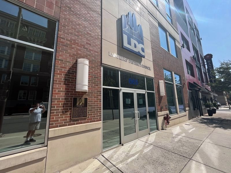
Samuel Staten, Sr. Marker image. Click for full size.
Photographed by Devry Becker Jones (CC0), September 3, 2023
2. Samuel Staten, Sr. Marker
Touch for a list and map of all markers in Philadelphia.
 
 
Credits. This page was last revised on June 19, 2024. It was originally submitted on September 5, 2023, by Devry Becker Jones of Washington, District of Columbia. This page has been viewed 250 times since then and 23 times this year. Photos:   1, 2. submitted on September 5, 2023, by Devry Becker Jones of Washington, District of Columbia.

m=232167

CeraNet Cloud Computing sponsors the Historical Marker Database.
This website earns income from purchases you make after using our links to Amazon.com. We appreciate your support.
Paid Advertisement
Jul. 11, 2026
