Fort Cronkhite near Sausalito in Marin County, California — The American West (Pacific Coastal)
Marin Headlands
An Army Legacy: A Landscape Preserved
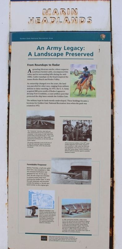
From Roundups to Radar
A sprawling Mexican rancho, where vaqueros (cowboys) herded cattle, encompassed this valley and its surrounding hills during the mid-1800s. Cattle roundups on the beach inspired the names Rodeo Beach and Rodeo Valley.
As ownership changed over the years, the land was parceled for other uses, ranging from military defense to dairy ranching. In 1937, the U. S. Army acquired 800 acres north of Rodeo Lagoon to develop Fort Cronkhite, a coast artillery post that protected the ship lanes outside the Golden Gate.
The military kept its lands mostly undeveloped. These holdings became a keystone for Golden Gate National Recreation Area when the park was created in 1972.
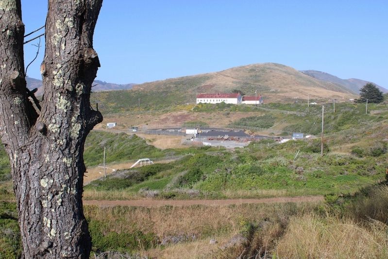
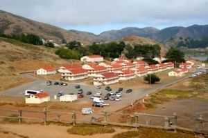
The "temporary" barracks, mess halls and other wood structures at Fort Cronkhite were completed in the summer of 1941, before the United States entered World War II. They could house more than 2,200 men. These troops manned the fortifications on the hills north of Rodeo Lagoon.
This group of barracks is one of only two of its type still preserved. Note in this photo the absence of trees, which the army later introduced.
African-American soldiers of the 54th Coast Artillery Regiment were briefly assigned to Fort Cronkhite in 1942, when the army was still segregated. From here they were sent, with their tractor-drawn 155mm howitzers, to defend California beaches against a possible Japanese invasion.
Formidable Firepower
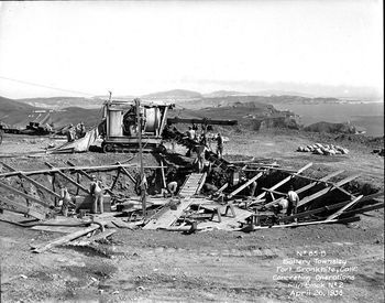
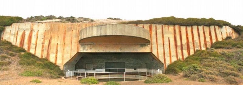
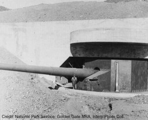
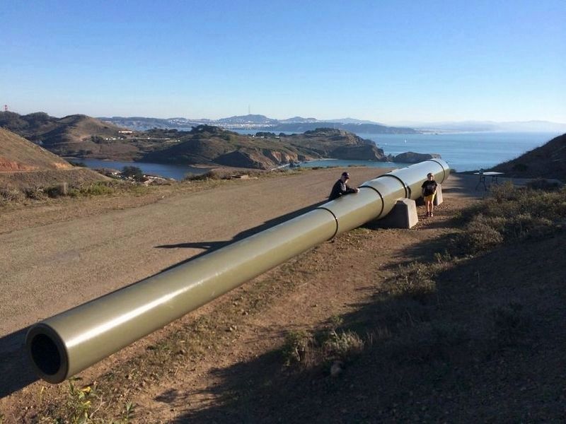
Battery Townsley, a half-mile uphill from here, was completed in 1940. This immense fortification was designed for two 16-inch guns. Their 26-mile range was intended to prevent enemy ships from reaching the Golden Gate. In 2014 the park obtained, and mounted outside the battery, a 16-inch gun barrel similar to the original gun.
Pillboxes embedded in the hillsides enabled World War II observers to scan the sea and skies for enemy craft without being detected. Powerful searchlights, shielded from view from above, probed the nighttime darkness for seaborne infiltrators.
In 1955, during the Cold War, a Nike missile launch site was built at Fort Cronkhite to defend against the threat of Soviet planes. Atop Hill 88, a radar site controlled another missile battery at Fort Barry across Rodeo Lagoon. That facility, restored and operated by park volunteers, is the only U. S. Nike missile complex still intact, complete with missiles. The historic site is open to the public on a limited schedule.
Erected by Golden Gate National Parks Conservancy.
Topics. This historical marker is listed in these topic lists: Forts and Castles • Parks & Recreational Areas • War, Cold • War, World II. A significant historical year for this entry is 1937.
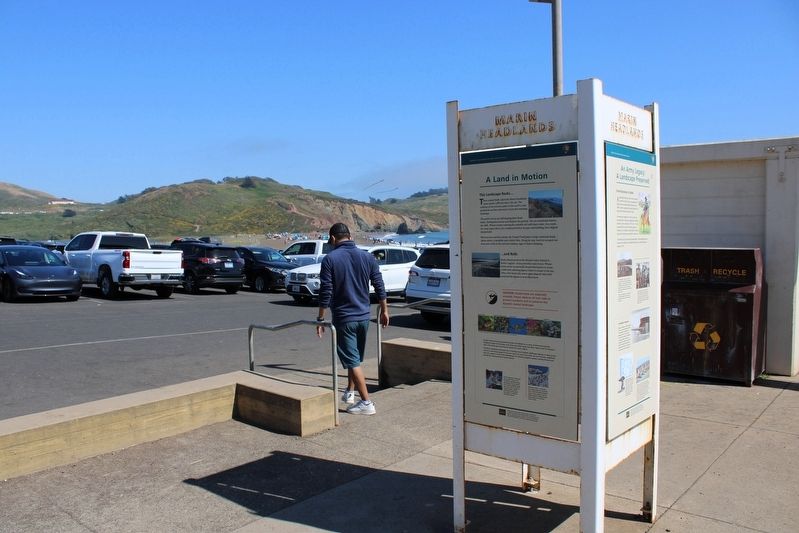
Location. 37° 49.95′ N, 122° 32.357′ W. Marker is near Sausalito, California, in Marin County. It is in Fort Cronkhite. Marker is on Mitchell Road west of Kirkpatrick Street, on the right when traveling west. The resin marker is mounted in a metal kiosk near the beach showers. Touch for map. Marker is in this post office area: Sausalito CA 94965, United States of America. Touch for directions.
Other nearby markers. At least 8 other markers are within 3 miles of this marker, measured as the crow flies. Cold War Legacy: Missiles to Marine Mammals (approx. half a mile away); Battery Alexander (approx. 0.7 miles away); a different marker also named Battery Alexander (approx. ¾ mile away); Nike Missile Site SF88 (approx. ¾ mile away); Battery Mendell (approx. 0.8 miles away); Point Bonita Lighthouse (approx. 0.9 miles away); Battery Construction No. 129 (approx. 2.2 miles away); The Golden Gate (approx. 2.2 miles away). Touch for a list and map of all markers in Sausalito.
Also see . . .
1. Historical Stories in the Marin Headlands. National Park Service
"Commonly told historical stories in the Marin Headlands include: Coast Miwok Peoples, Portuguese Dairy Farmers, Lighthouse Keeping History, Coastal Defense (From the Endicott Period, through WW2, and the Cold War), Marincello, and the creation of the Golden Gate National Recreation Area."(Submitted on September 5, 2023, by Joseph Alvarado of Livermore, California.)
2. Battery Townsley. Fort Wiki
"Part of the Harbor Defense of San Francisco. Battery Townsley and Battery Davis at Fort Funston were two 16" batteries planned to guard the entrance to San Francisco harbor."(Submitted on September 5, 2023, by Joseph Alvarado of Livermore, California.)
3. Fort Cronkhite: Battery Townsley. militarymuseum.org. Includes an interesting 15 minute video.
"Like Battery Davis, Battery Townsley was officially named before it was completed. In a secret letter dated December 31, 1937, the adjutant general wrote that the battery would be named in honor of Major General Clarence P. Townsley, another artilleryman. At one time, Townsley had been superintendent at West Point and later, the Commanding Officer on Corregidor in Manila Bay. In World War I he was one of the first American officers to arrive in France, where he later commanded the 30th Infantry Division. Townsley died in 1926."(Submitted on September 5, 2023, by Joseph Alvarado of Livermore, California.)
Credits. This page was last revised on September 5, 2023. It was originally submitted on September 5, 2023, by Joseph Alvarado of Livermore, California. This page has been viewed 89 times since then and 39 times this year. Photos: 1, 2, 3, 4, 5, 6, 7, 8. submitted on September 5, 2023, by Joseph Alvarado of Livermore, California.
