Northeast Park in Minneapolis in Hennepin County, Minnesota — The American Midwest (Upper Plains)
Minneapolis Diagonal Trail
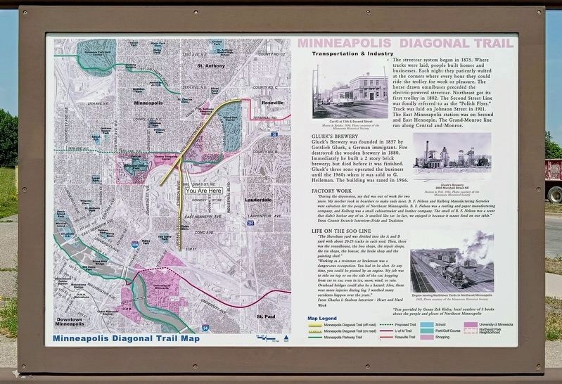
Transportation & Industry
The streetcar system began in 1875. Where tracks were laid, people built homes and businesses. Each night they patiently waited at the corners where every hour they could ride the trolley for work or pleasure. The horse drawn omnibuses preceded the electric-powered streetcar. Northeast got its first trolley in 1882. The Second Street Line was fondly referred to as the "Polish Flyer." Track was laid on Johnson Street in 1911. The East Minneapolis station was on Second and East Hennepin. The Grand-Monroe line ran along Central and Monroe.
Car #2 at 13th & Second Street
Moore & Retzke, 1950, Photo courtesy of the Minnesota Historical Society
Gluek's Brewery
Gluek's Brewery was founded in 1857 by Gottlieb Gluek, a German immigrant. Fire destroyed the wooden brewery in 1880. Immediately he built a 2 story brick brewery; but died before it was finished. Gluek's three sons operated the business until the 1960s when it was sold to G. Heileman. The building was razed in 1966.
Gluek's Brewery
2000 Marshall Steet NE
Norton & Peel, 1963, Photo courtesy of the Minnesota Historical Society
Factory Work
"During the depression, my dad was out of work for two years. My mother took in boarders to make ends meet. B. F. Nelson and Kulberg Manufacturing factories were the salvation for the people of Northeast Minneapolis. B. F. Nelson was a roofing and paper manufacturing company, and Kulberg was a small cabinetmaker and lumber company. The smell of B. F. Nelson was a scent that didn't bother any of us. It smelled like tar. In fact, we enjoyed it because it meant food on our table."
From Connie Szczech Interview–Pride and Tradition
Life on the Soo Line
"The Shoreham yard was divided into the A and B yard with about 20-25 tracks in each yard. Then, there was the roundhouse, the Soo shops, the repair shops, the tin shops, the boxcar, the brake shop and the painting shed."
"Working as a trainman or brakeman was a dangerous occupation. You had to be alert. At any time, you could be pinned by an engine. My job was to ride on top or on the side of the car, hopping from car to car, even in ice, snow, wind, or rain. Overhead bridges could be a hazard. Also, there were more injuries during fog. I watched many accidents happen over the years."
From Charles I. Snelson Interview - Heart and Hard Work
Engine leaving Northtown Yards in Northeast Minneapolis
1925, Photo courtesy of the Minnesota Historical Society
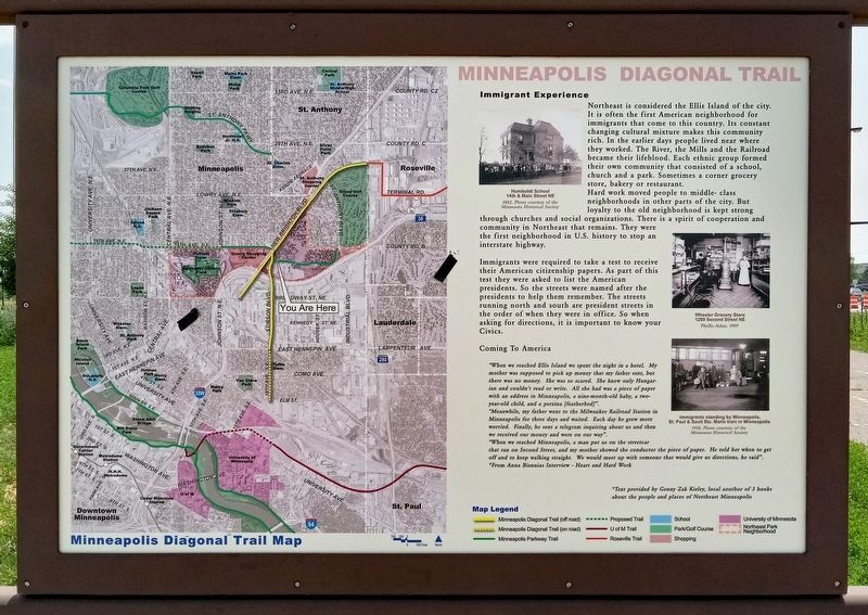
Immigrant Experience
Northeast is considered the Ellis Island of the city. It is often the first American neighborhood for immigrants that come to this country. Its constant changing cultural mixture makes this community rich. In the earlier days people lived near where they worked. The River, the Mills and the Railroad became their lifeblood. Each ethnic group formed their own community that consisted of a school, church and a park. Sometimes a corner grocery store, bakery or restaurant.
Hard work moved people to middle- class neighborhoods in other parts of the city. But loyalty to the old neighborhood is kept strong through churches and social organizations. There is a spirit of cooperation and community in Northeast that remains. They were the first neighborhood in U.S. history to stop an interstate highway.
Immigrants were required to take a test to receive their American citizenship papers. As part of this test they were asked to list the American presidents. So the streets were named after the presidents to help them remember. The streets running north and south are president streets in order of when they were in office. So when asking for directions, it is important to know your Civics.
Humboldt School
14th & Main Street NE
1882, Photo courtesy of the Minnesota Historical Society
Wheeler Grocery Store
1200 Second Street NE
Phyllis Askay, 1909
Coming To America
"When we reached Ellis Island we spent the night in a hotel. My mother was supposed to pick up money that my father sent, but there was no money. She was so scared. She knew only Hungarian and couldn't read or write. All she had was a piece of paper with an address in Minneapolis, a nine-month-old baby, a two-year-old child, and a perzina (featherbed)".
"Meanwhile, my father went to the Milwaukee Railroad Station in Minneapolis for three days and waited. Each day he grew more worried. Finally, he sent a telegram inquiring about us and then we received our money and were on our way".
"When we reached Minneapolis, a man put us on the streetcar that ran on Second Street, and my mother showed the conductor the piece of paper. He told her when to get off and to keep walking straight. We would meet up with someone that would give us directions, he said".
*From Anna Biennias Interview - Heart and Hard Work
Immigrants standing by Minneapolis, St. Paul & Sault Ste. Marie train in Minneapolis
1910, Photo courtesy of the Minnesota Historical Society
*Text provided by Genny Zak Kieley, local author of 3 books about the people and places of Northeast Minneapolis
Topics. This historical marker is listed in these topic lists: Immigration • Industry & Commerce • Railroads & Streetcars • Roads & Vehicles. A significant historical year for this entry is 1857.
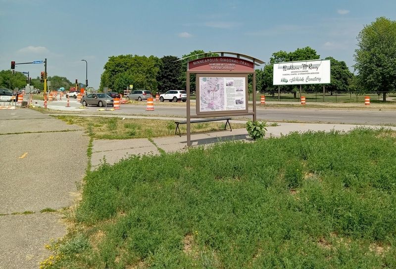
Location. 45° 0.283′ N, 93° 13.626′ W. Marker is in Minneapolis, Minnesota, in Hennepin County. It is in Northeast Park. Marker is at the intersection of Stinson Boulevard NE and New Brighton Boulevard, on the right when traveling south on Stinson Boulevard NE. Touch for map. Marker is in this post office area: Minneapolis MN 55413, United States of America. Touch for directions.
Other nearby markers. At least 8 other markers are within 2 miles of this marker, measured as the crow flies. The Quarry (approx. ¼ mile away); a different marker also named Minneapolis Diagonal Trail (approx. half a mile away); Beltrami Park (approx. 0.9 miles away); Maple Hill Cemetery (approx. 0.9 miles away); Logan Field House (approx. 1.3 miles away); Bicycle Paths (approx. 1.7 miles away); Home of Alpha Phi (approx. 1.7 miles away); The Ard Godfrey House (approx. 1.9 miles away). Touch for a list and map of all markers in Minneapolis.
Credits. This page was last revised on September 6, 2023. It was originally submitted on July 16, 2023, by McGhiever of Minneapolis, Minnesota. This page has been viewed 85 times since then and 27 times this year. Last updated on September 5, 2023, by McGhiever of Minneapolis, Minnesota. Photos: 1, 2, 3. submitted on July 16, 2023, by McGhiever of Minneapolis, Minnesota. • Devry Becker Jones was the editor who published this page.


