Near Mesa in Adams County, Idaho — The American West (Mountains)
Mesa Orchards
Photographed by Rebecca Maxwell, October 11, 2009
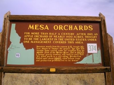
1. Mesa Orchards Marker
Investors, mostly from the eastern U.S., bought 10-acre shares to finance the project. An eight mile wooden flume carried water for irrigation from the Middle Fork of the Weiser River, and in 1920, a unique gravity tramway was built to carry fruit 3 1/2 miles north to a rail siding. Production lasted until about 1960 when frozen crops and production problems led to its demise.
Erected by Idaho Historical Society. (Marker Number 374.)
Topics and series. This historical marker is listed in these topic lists: Agriculture • Natural Resources. In addition, it is included in the Idaho State Historical Society series list. A significant historical year for this entry is 1910.
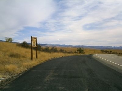
Location. 44° 37.628′ N, 116° 26.383′ W. Marker is near Mesa, Idaho, in Adams County. It is on U.S. 95 at milepost 128 north of Mesa Road, on the right. Touch for map. Marker is at or near this postal address: 1273 Hwy 95, Mesa ID 83643, United States of America. Touch for directions.

Regionally,
this page online
Other nearby markers. At least one other marker is within 7 miles of this marker, measured as the crow flies: Old Railroads (approx. 7 miles away).
Photographed by Rebecca Maxwell, October 11, 2009
2. Mesa Orchards Marker Along Hwy 95
Credits. This page was last revised on May 22, 2025. It was originally submitted on October 12, 2009, by Rebecca Maxwell of Boise, Idaho. This page has been viewed 3,699 times since then and 203 times this year. Last updated on May 22, 2025, by Roger Scot Johns of Eagle, Idaho. Photos: 1, 2. submitted on October 12, 2009, by Rebecca Maxwell of Boise, Idaho. • Devry Becker Jones was the editor who published this page.
