Bristow in Prince William County, Virginia — The American South (Mid-Atlantic)
Bristoe Station Battlefield Heritage Park
Photographed by Craig Swain, June 12, 2009
1. Bristoe Station Battlefield Heritage Park Marker
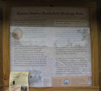
This land endured significant military activity during the Civil War. Soldiers camped here in 1861 and 1862. Federal and Confederate armies clashed here at the Battle of Kettle Run on August 27, 1862 when Gen. "Stonewall" Jackson's Confederate forces raided Federal supplies at Manassas Junction. Gen. Joseph Hooker's Federal troops attacked Jackson's rear guard, led by Gen. Richard Ewell, along Kettle Run. Ewell's troops fought Hooker's men then withdrew. On August 28-30, Ewell's forces faced Federal troops again during Second Manassas.
Bury these poor men and let us say no more about it.
In October and November 1863, Gen. Robert E. Lee's Confederate army and Maj. Gen. George Meade's Federal forces fought a series of battles known as the Bristoe Campaign. The October 14, 1863 Battle of Bristoe
this page online
In 2000, Centex Homes purchased this land. Two years later, Centex Homes developed New Bristow Village and gave the battlefield parcel to the Civil War Preservation Trust. Prince William County acquired the 133-acre site in 2007. This park demonstrates how developers, residents, preservationists and local governments can work together to save historic resources.
Erected 2008 by Prince William County and Virginia Civil War Trails.
Topics and series. This historical marker is listed in this topic list: War, US Civil. In addition, it is included in the Orange and Alexandria Railroad series list. A significant historical month for this entry is November 1863.
Location. This marker has been replaced by another marker nearby. It was located near 38° 43.632′ N, 77° 32.644′ W. Marker was
Photographed by Craig Swain, June 12, 2009
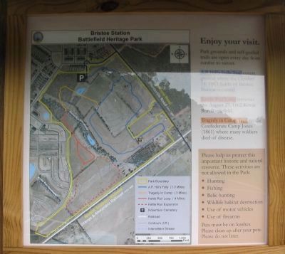
2. Park Map on the Back of the Kiosk
Trails in the park include:
-A.P. Hill's Folly covering the October 14, 1863 Battle of Bristoe Station.
- Kettle Run Loop for the August 27, 1862 Battle of Kettle Run.
- Tragedy in Camp Trail over Confederate Camp Jones where many soldiers died of disease.
-A.P. Hill's Folly covering the October 14, 1863 Battle of Bristoe Station.
- Kettle Run Loop for the August 27, 1862 Battle of Kettle Run.
- Tragedy in Camp Trail over Confederate Camp Jones where many soldiers died of disease.

Regionally, this marker was in the Washington Metropolitan Area, in Northern Virginia, and in the Piedmont. It was also in the American South, specifically in the Upper South, in the Mid-Atlantic, and on the Eastern Seaboard. Globally, it was in the North Atlantic Region, North America, the Western Hemisphere, the Western World, and the Anglosphere. Historically, it found itself in what was once the territory of the Mississippian Culture, one of the original Thirteen Colonies, one of the Confederate States of America, and the Antebellum South.
Other nearby markers. At least 8 other markers are within walking distance of this location: Lee's Last Move North: The Bristoe Station Campaign of 1863 (a few steps from this marker); Bristoe 1863 Trail (a few steps from this marker); a different marker also named Bristoe Station Battlefield Heritage Park

Related marker. Click here for another marker that is related to this marker. New Marker At This Location also titled " Bristoe Station Battlefield Heritage Park"
Also see . . .
1. Battle of Bristoe Station. American BattleTrust site detailing the battlefield. (Submitted on June 22, 2009, by Craig Swain of Leesburg, Virginia.)
2. Bristoe Station Battlefield Heritage Park. Prince William County Website. Includes links to printable trail guides and battle maps. (Submitted on July 19, 2009.)
Photographed by Craig Swain, June 12, 2009
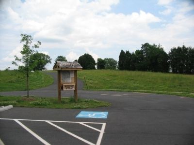
4. Bristoe Station Battlefield Heritage Park Kiosk
Photographed by Craig Swain, June 12, 2009
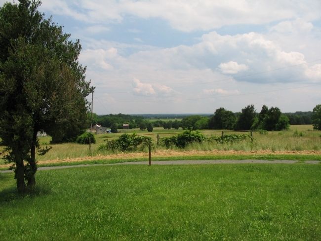
5. Bristoe Station Battlefield
View looking across the center part of the battlefield from stop seven of the walking trail. In the distance, just behind the rusty shed in the center of view, is the old Orange and Alexandria Railroad. Hays' and Webb's Federal Divisions defended that sector. Advancing down the slope, Cooke's North Carolina Brigade advanced toward that sector, dressing on the Brentsville Road (CR 619) to the left of view. After their repulse, Cooke's men fell back to a point northwest of the road, outside the park grounds.
Credits. This page was last revised on September 13, 2023. It was originally submitted on June 22, 2009, by Craig Swain of Leesburg, Virginia. This page has been viewed 3,170 times since then and 49 times this year. Last updated on September 12, 2023, by Linda Walcroft of Woodstock, Virginia. Photos: 1, 2, 3, 4, 5. submitted on June 22, 2009, by Craig Swain of Leesburg, Virginia. • Bernard Fisher was the editor who published this page.
