Buckhead in Atlanta in Fulton County, Georgia — The American South (South Atlantic)
Reynold’s Brigade
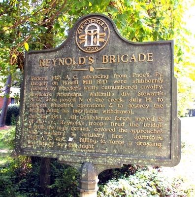
Photographed by David Seibert, October 11, 2009
1. Reynold’s Brigade Marker
July 18, 1864. All Confederate forces moved S. of the cr.; Reynold’s troops fired the bridge & from the high ground, covered the approaches with musketry & artillery fire. Johnson’s 14th A.C. div. [US], failing to force a crossing, was halted for the night.
Erected 1984 by Georgia Department of Natural Resources. (Marker Number 060-52.)
Topics and series. This historical marker is listed in this topic list: War, US Civil. In addition, it is included in the Georgia Historical Society series list. A significant historical year for this entry is 1864.
Location. 33° 49.417′ N, 84° 24.958′ W. Marker is in Atlanta, Georgia, in Fulton County. It is in Buckhead. It is on Howell Mill Road 0.7 miles Peachtree Battle Road, on the left when traveling south. The marker is just south of the bridge over Peachtree Creek.
this page online

Regionally, this marker is in the Piedmont. It is also in the American South and specifically in the Deep South. Globally, it is in North America, the Western Hemisphere, the Western World, and the Anglosphere. Historically, it finds itself in what was once the territory of the Mississippian Culture, one of the original Thirteen Colonies, one of the Confederate States of America, and the Antebellum South.
Other nearby markers. At least 8 other markers are within walking distance of this marker: Federal Crossings (here, next to this marker); Howell's Mills (here, next to this marker); Geary’s Div. to Peachtree Creek (approx. 0.3 miles away); Geary’s Three Bridges (approx. half a mile away); Rt. Of 20th A.C. Line (approx. 0.6 miles away); Green Bone Creek (approx. 0.7 miles away); Williams' Div. Deployed (approx. 0.9 miles away); O’Neal’s Brigade at the Ravine (approx. 0.9 miles away). Touch for a list and map of all markers in Atlanta.
More about this marker. This marker replaced an earlier marker
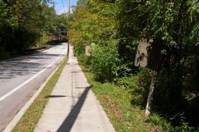
Photographed by David Seibert, October 11, 2009
2. Reynold’s Brigade Marker
Looking north, the Reynold's Brigade Marker can just be seen in the foreground (right), with the Howell's Mill marker just visible beyond it. The bridge over Peachtree Creek is just beyond the markers and before the traffic light.
Credits. This page was last revised on February 8, 2023. It was originally submitted on October 13, 2009, by David Seibert of Sandy Springs, Georgia. This page has been viewed 905 times since then and 27 times this year. Photos: 1, 2. submitted on October 13, 2009, by David Seibert of Sandy Springs, Georgia. • Craig Swain was the editor who published this page.
