Idyllwild in Riverside County, California — The American West (Pacific Coastal)
Logging Shaped This Landscape

Photographed by Craig Baker, September 15, 2023
1. Logging Marker
Logging was one of the most significant impacts on the natural landscape on the western side of the San Jacinto Mountains. Beginning in 1875 and lasting through the early 1900s, a number of logging camps and mills were established in the mountains. Large stands of ancient, old growth forests were harvested by the uncontrolled logging.
The logging boom was fed by the need for railroad ties for the Southern Pacific Railroad being laid in the San Gorgonio Pass, shipping crates for the citrus industry, and houses for the steadily increasing valley population.
Today, remnants of two logging camps and at least one lumber mill site have been identified in the western portion of the park. Much of the park landscape shows the scars of logging - cut tree stumps, logging roads and trails, and abandoned machinery.
Dedicated in 1937, Mount San Jacinto State Park was the culmination of over forty years of private and public attempts to preserve the San Jacinto wilderness from uncontrolled exploitation.
second marker:
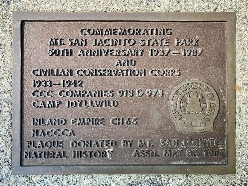
Commemorating Mt. San Jacinto State Park 50th anniversary 1937-1987 and Civilian Conservation Corps 1933-1942. CCC companies 913 & 974, Camp Idyllwild. Inland Empire Ch65 NACCCA. Plaque donated by Mt. San Jacinto Natural History Assn. May 30, 1987.
Topics and series. This historical marker is listed in these topic lists: Horticulture & Forestry • Industry & Commerce • Parks & Recreational Areas. In addition, it is included in the Civilian Conservation Corps (CCC) series list. A significant historical year for this entry is 1875.
Location. 33° 44.859′ N, 116° 42.903′ W. Marker is in Idyllwild, California, in Riverside County. It is on California 243. Located just inside the entrance to Mt. San Jacinto State Park Campground, west of highway 243. Touch for map.
this page online

Regionally, this marker is in Greater Los Angeles, in the Inland Empire, and in the Peninsular Ranges. It is also in the American Southwest. Globally, it is in North America, on the Ring of Fire, on the Pacific Rim, in the Western Hemisphere, in the Western World, and in the Anglosphere. Historically, it finds itself in what was once New Spain and also Mexico’s Alta California.
Other nearby markers. At least 8 other markers are within 2 miles of this marker, measured as the crow flies: The Idyllwild Monument (approx. ¼ mile away); Idyllwild Town Hall (approx. 0.3 miles away); Hoxie-Vance Cabin (approx. 0.3 miles away); Idyllwild Campground Pictograph (approx. 0.8 miles away); Donaldson Futuro (approx. 1.4 miles away); Camp Emerson (approx. 1½ miles away); Speed-of-Light Experiment (approx. 1.9 miles away); Tahquitz Rock History (approx. 2 miles away). Touch for a list and map of all markers in Idyllwild.
More about this marker. This campground is in the southwestern part of Mount San Jacinto
Photographed by Craig Baker, September 15, 2023
2. Civilian Conservation Corps Marker

Photographed by Craig Baker, September 15, 2023
3. Logging and CCC Markers
The Logging interpretive sign is at right, and the CCC plaque is at left.

Photographed by Craig Baker, September 15, 2023
4. Logging Wagon

Photographed by Craig Baker, September 15, 2023
5. Stone Bridge near Marker
Built by the CCC.
Photographed by Craig Baker, September 15, 2023
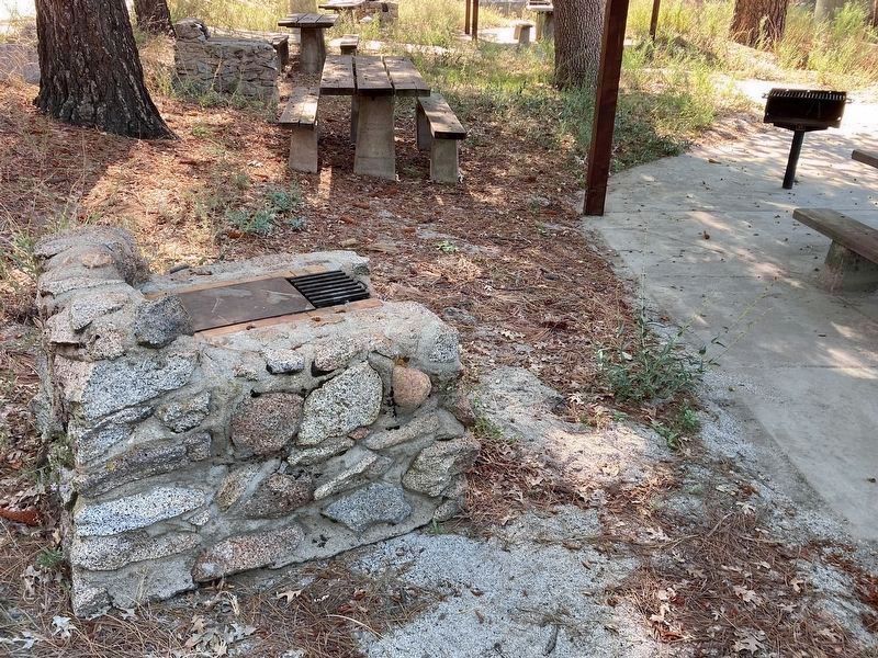
6. Stone Camp Stoves
Built by the CCC, located throughout the campground. A modern camp stove is at right.
Photographed by Craig Baker, September 15, 2023
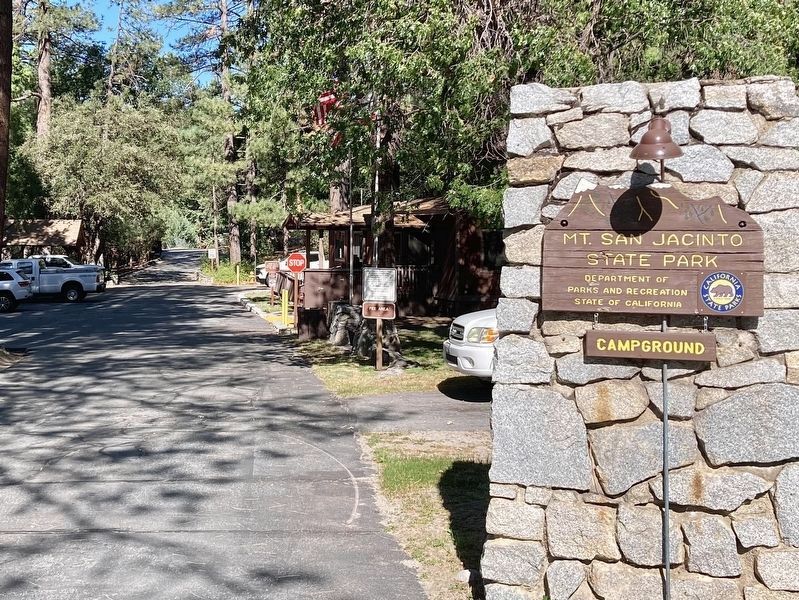
7. Park Entrance
The marker is near the parked vehicles at left.
Credits. This page was last revised on September 19, 2023. It was originally submitted on September 16, 2023, by Craig Baker of Sylmar, California. This page has been viewed 532 times since then and 80 times this year. Photos: 1, 2, 3, 4, 5, 6, 7. submitted on September 16, 2023, by Craig Baker of Sylmar, California.
