Cape Henlopen State Park near Lewes in Sussex County, Delaware — The American Northeast (Mid-Atlantic)
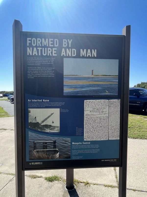
Formed By Nature And Man
Cape Henlopen State Park
— Delaware State Parks —
Long ago, this area was a freshwater marsh. It lay protected from ocean storms by the Great Dune and barrier beaches. As sea levels rose, saltwater marshes replaced freshwater marshes.
Starting in the 1800s, locals extracted salt from depressions in the marsh, called pannes, or pools. In 1966, the Division of Fish and Wildlife impounded the largest pool. This controlled mosquitoes, created wildlife habitat, and formed the pond you see today.
An Inherited Name
This is not the original Gordons Pond. The first was farther south, near present-day Henlopen Acres boat basin. In 1913, construction of the Lewes-Rehoboth Canal eliminated that pond, but the name was transferred to this new salt pool.
Mosquito Control
Today, Delaware's Mosquito Control Section manages water levels in Gordons Pond. Water control structures on opposite ends of the pond connect it to the canal.
In spring, workers lower water levels to reduce breeding habitat for mosquitos. In fall, they raise water levels to increase habitat for ducks and geese that spend the winter here.
[Captions:]
Above: Elements of nature and man adorn scenic views along Gordons Pond.
Left: Digging deep, a storm shovel works to build the Lewes-Rehoboth canal.
Right: This 1716 deed of sale transfers land to Thomas Gordon - the namesake of the pond. He and his family owned property in the area until the 1800s.
Left: This device regulates the pond's water levels - helping control mosquito populations.
Erected by Delaware State Parks.
Topics and series. This historical marker is listed in these topic lists: Animals • Parks & Recreational Areas • Waterways & Vessels. In addition, it is included in the Delaware State Parks series list. A significant historical year for this entry is 1966.
Location. 38° 44.532′ N, 75° 4.911′ W. Marker is near Lewes, Delaware, in Sussex County. It is in Cape Henlopen State Park. Marker is on Ocean Drive (County Road 300) 0.4 miles north of Robins Lane, on the right when traveling north. Touch for map. Marker is at or near this postal address: 9298 Ocean Dr, Lewes DE 19958, United States of America. Touch for directions.
Other nearby markers. At least 8 other markers are within 2 miles of this marker, measured as the crow flies. Whiskey Beach (within shouting distance of this marker); Standing Guard (approx. 0.4 miles away); Village Improvement Association (approx. 1˝ miles away); Children's Fishing Pier (approx. 1˝ miles away); Giovanni Da Verrazzano (approx. 1.6 miles away); Tommy Coveleski (approx. 1.7 miles
away); Public School in Rehoboth Beach (approx. 1.8 miles away); Walk the Boards (approx. 1.8 miles away). Touch for a list and map of all markers in Lewes.
Credits. This page was last revised on September 18, 2023. It was originally submitted on September 18, 2023, by Devry Becker Jones of Washington, District of Columbia. This page has been viewed 71 times since then and 20 times this year. Photos: 1, 2, 3. submitted on September 18, 2023, by Devry Becker Jones of Washington, District of Columbia.


