Wild River State Park near Almelund in Chisago County, Minnesota — The American Midwest (Upper Plains)
Looking For A Better Life
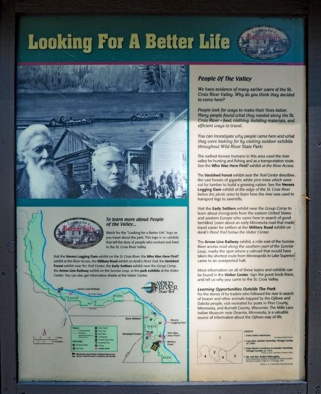
People Of The Valley
We have evidence of many earlier users of the St. Croix River Valley. Why do you think they decided to come here?
People look for ways to make their lives better. Many people found what they needed along the St. Croix River – food, clothing, building materials, and efficient ways to travel.
You can investigate why people came here and what they were looking for by visiting outdoor exhibits throughout Wild River State Park:
The earliest known humans in this area used the river for hunting and fishing and as a transportation route. See the Who Was Here First? exhibit at the River Access.
The Vanished Forest exhibit near the Trail Center describes the vast forests of gigantic white pine trees which were cut for lumber to build a growing nation. See the Nevers Logging Dam exhibit at the edge of the St. Croix River below the picnic area to learn how the river was used to transport logs to sawmills.
Visit the Early Settlers exhibit near the Group Camp to learn about immigrants from the eastern United States and western Europe who came here in search of good farmland. Learn about an early Minnesota road that made travel easier for settlers at the Military Road exhibit on Amik's Pond Trail below the Visitor Center.
The Arrow Line Railway exhibit, a mile east of the Sunrise River access road along the southern part of the Sunrise Loop, marks the spot where a railroad that would have taken the shortest route form Minneapolis to Lake Superior came to an unexpected halt.
More information on all of these topics and exhibits can be found in the Visitor Center. Sign the guest book there, and tell us why you came to the St. Croix Valley.
Learning Opportunities Outside the Park
For the stories of fur traders who followed the river in search of beaver and other animals trapped by the Ojibwe and Dakota people, visit recreated fur posts in Pine County, Minnesota, and Burnett County, Wisconsin. The Mille Lacs Indian Museum near Onamia, Minnesota, is a valuable source of information about the Ojibwe way of life.
1. Early Native Americans.
2. Log cabin, Amador Township, Chisago County, ca. 1930.
3. Peter Bjork's residence in Amador Township, Chisago County, ca. 1912.
4. Mr. and Mrs. Bethel Willoughby.
To learn more about People of the Valley...
Watch for the "Looking for a Better Life" logo as you travel about the park. This logo is on exhibits that tell the story of people
who worked and lived in the St. Croix Valley.
Visit the Nevers Logging Dam exhibit on the St. Croix River, the Who Was Here First? exhibit at the River Access, the Military Road exhibit on Amik's Pond Trail, the Vanished Forest exhibit near the Trail Center, the Early Settlers exhibit near the Group Camp, the Arrow Line Railway exhibit on the Sunrise Loop, or the park exhibits at the Visitor Center. You can also get information sheets at the Visitor Center.
Erected by Minnesota Department of Natural Resources.
Topics. This historical marker is listed in these topic lists: Native Americans • Railroads & Streetcars • Settlements & Settlers • Waterways & Vessels.
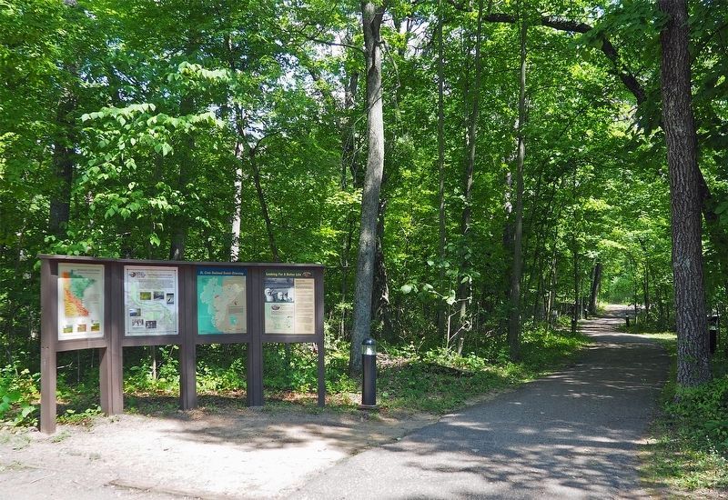
Location. 45° 31.137′ N, 92° 44.136′ W. Marker is near Almelund, Minnesota, in Chisago County. It is in Wild River State Park. The marker is at the start of the paved footpath to the visitor center from the visitor center parking lot. Touch for map. Marker is at or near this postal address: 39797 Park Trail, Taylors Falls MN 55084, United States of America. Touch for directions.
Other nearby markers. At least 8 other markers are within walking distance of this marker. Wild River State Park (here, next to this marker); Restored Prairies (about 400 feet away, measured in a direct line); Conifer Forests (about 400 feet away); The St. Croix River (about 400 feet away); A Conservation Legacy (about 400 feet away); Military Road (about 500 feet away); Who Was Here First? (approx. 0.4 miles away); What Was It Like (approx. 0.7 miles away). Touch for a list and map of all markers in Almelund.
Credits. This page was last revised on September 20, 2023. It was originally submitted on September 19, 2023, by McGhiever of Minneapolis, Minnesota. This page has been viewed 48 times since then and 8 times this year. Photos: 1, 2. submitted on September 19, 2023, by McGhiever of Minneapolis, Minnesota. • J. Makali Bruton was the editor who published this page.

