Charleston in Kanawha County, West Virginia — The American South (Appalachia)
1716 - 1783
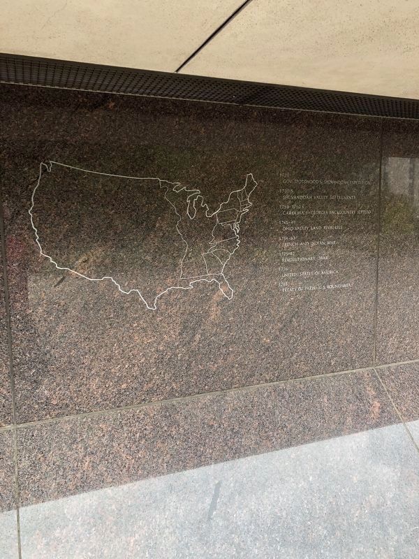
1716 Gov. Spotswood's Shenandoah Expedition
1730's Shenandoah Valley settlements
1750-1760's Carolina's-Georgia back country settled
1745-49 Ohio Valley land rivalries
1754-63 French and Indian War
1775-83 Revolutionary War
1776 United States of America
1783 Treaty of Paris - U.S. Boundaries
Erected 1976 by The State Building Commission of West Virginia.
Topics. This historical marker is listed in these topic lists: Colonial Era • Settlements & Settlers • War, French and Indian • War, US Revolutionary. A significant historical year for this entry is 1716.
Location. 38° 20.27′ N, 81° 36.82′ W. Marker is in Charleston, West Virginia, in Kanawha County. Marker can be reached from the intersection of Greenbrier Street (U.S. 60) and Quarrier Street, on the right when traveling north. Touch for map. Marker is at or near this postal address: 1900 Kanawha Blvd E, Charleston WV 25305, United States of America. Touch for directions.
Other nearby markers. At least 8 other markers are within walking distance of this marker. 1787 - 1818 (here, next to this marker); 1607 - 1681 (here, next to this marker); 1819 - 1853 (here, next to this marker); 980 A.D. - 1536 A.D. (a few steps from this marker); 30,000 B.C. - 1521 A.D. (a few steps from this marker); 1859 - 1863 (a few steps from this marker); 1837 - 1869 (a few steps from this marker); Timber (within shouting distance of this marker). Touch for a list and map of all markers in Charleston.
Credits. This page was last revised on September 25, 2023. It was originally submitted on August 5, 2021, by Devry Becker Jones of Washington, District of Columbia. This page has been viewed 120 times since then and 21 times this year. Last updated on September 23, 2023, by J.T. Lambrou of New Boston, Michigan. Photos: 1. submitted on August 5, 2021, by Devry Becker Jones of Washington, District of Columbia. 2. submitted on September 23, 2023, by J.T. Lambrou of New Boston, Michigan.

