Abstwind in Kitzingen, Bavaria, Germany — Central Europe
Willkommen in Abtswind
⎯⎯⎯
Welcome to Abstwind
Photographed by Andrew Ruppenstein, August 30, 2023
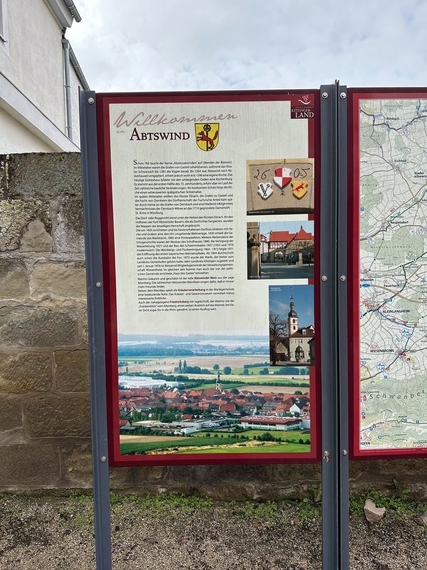
1. Willkommen in Abtswind / Welcome to Abstwind Marker

Im späten Mittelalter stellten das Kloster Ebrach, die Grafen zu Castell und die Fuchs von Dornheim die Dorfherrschaft; der Fuchs'sche Anteil kam später durch Heirat an die Grafen von Dernbach und anschließend infolge eines Vermächtnisses der Dernbach-Witwe an das 1714 gegründete Damenstift St. Anna in Würzburg.
Das Dorf- oder Ruggericht stand unter der Hoheit des Klosters Ebrach. An den Hoftoren der fünf Abtswinder Bauern, die als Dorfrichter fungierten, wurden die Wappen der jeweiligen Herrschaft angebracht.
Die um 1605 errichteten und
this page online
Weithin bekannt und geschätzt ist der edle Abtswinder Wein aus der Lage Altenberg. Die zahlreichen Abtswinder Weinfeste sorgen dafür, daß er immer mehr Freunde findet.
Neben dem Weinbau spielt die Kräuterverarbeitung in der Marktgemeinde eine bedeutende Rolle. Das Kräuter- und Gewürzmuseum vermittelt hierzu interessante
Photographed by Andrew Ruppenstein, August 30, 2023
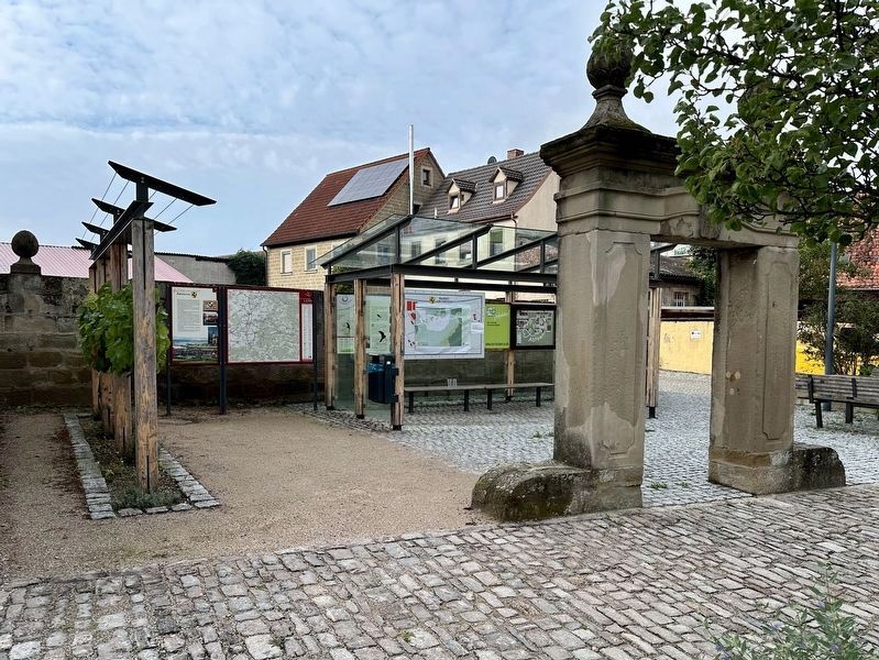
2. Willkommen in Abtswind / Welcome to Abstwind Marker — wide view
The marker is the leftmost of the information panels visible here, located in a small plaza on the south side of Hauptstraße.
Auch der nahegelegene Friedrichsberg mit Jagdschloß, der ebenso wie der „Frankenblick" vom Altenberg, einen weiten Ausblick auf das Maintal, bei klarer Sicht sogar bis in die Rhön gewährt, ist einen Ausflug wert.
(English translation:)
The name "Abatissaewinden" (Turn of the Abbess) appeared as early as 783. In the Middle Ages, the Counts of Castell were the fief rulers, while the Schwarzach monastery owned the bailiwick until 1281. Abtswind was a parish of Rüdenhausen until 1364, but probably only received its own church in 1396 . Today's church was a fortified church with the surrounding fields. It dates from the first half of the 15th century, but underwent numerous structural changes over time. The church's most valuable treasure is a late Gothic shrine altar that is well worth seeing.
In the late Middle Ages, the Ebrach Monastery, the Counts of Castell and the Fuchs von Dornheim ruled the village; Fuchs' share later was passed to the Counts of Dernbach through marriage and then, as a result of a bequest from the Dernbach widow, to the St. Anna women's monastery in Würzburg, founded in 1714.
The village-
Photographed by Andrew Ruppenstein, August 30, 2023
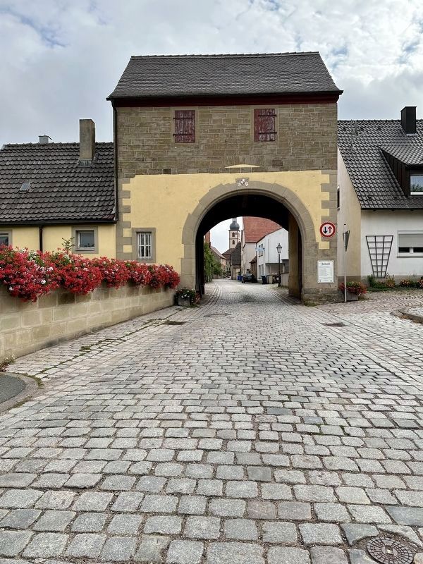
3. Town gate - looking east, into the town
The village gates, which were built around 1605 and have been preserved to this day, formed a defensive system surrounding the town with hedges and ditches. In 1830 the community received market rights and in 1885 a postal station. Further milestones in local history included the new construction of the school building in 1880, the installation of the water supply pipe in 1921, and the construction of the swimming pool in 1937 (modernized in 1955 and 1970). The vineyard and land consolidation took place from 1964 to 1972, and the first Bavarian wine trail opened in 1971. From 1964 on the highway passed nearby. In 1972 the community, which had previously been part of Gerolzhofen County, was redistricted into Kitzingen County. Since January 1, 1976, Abtswind has been a member of the Wiesentheid administrative community. In the same year, the “House of the Guest” built by the political community was inaugurated.
The noble Abtswinder wine, bearing the “Altenberg” appellation, is widely known and appreciated. The numerous Abtswinder wine festivals ensure that the number of its fans is always increasing.
In addition to viticulture, herb processing plays a significant role in the community. The Herb and Spice Museum provides information and insight on this activity.
Also the nearby Friedrichsberg with a hunting lodge, which is similar to the "Frankenblick" from Altenberg, provides a broad view of the Main valley, even as far as the Rhön on a clear day, and is worth visiting.
Topics. This historical marker is listed in these topic lists: Agriculture • Political Subdivisions • Settlements & Settlers. A significant historical year for this entry is 783 CE.
Location. 49° 46.237′ N, 10° 22.371′ E. Marker is in Abstwind, Bayern (Bavaria), in Kitzingen. It is on Hauptstraße, on the right when traveling east. Touch for map. Marker is in this post office area: Abstwind BY 97355, Germany. Touch for directions.

Regionally, this marker is in German Franconia. Globally, it is in Europe, the European Union, Atlantic Europe, Central Europe, the Schengen Area, Western Europe, and the Western World. Historically, it finds itself in what was once the Holy Roman Empire and also the former West Germany.
Other nearby markers. At least 8 other markers are within 6 kilometers of this marker, measured as the crow flies: Franz Alfons Wolpert (approx. 3.3 kilometers away); Wiesentheid (approx. 3.4 kilometers away); Schulinstrasse 14 (approx. 5.4 kilometers away); Schulinstrasse 7 (approx. 5.4 kilometers away); Schulinstrasse 1 (approx. 5.4 kilometers away); Stadtturm / City Tower (approx. 5.4 kilometers away); Karlsplatz 9 (approx. 5.4 kilometers away); Karlsplatz 7 (approx. 5.4 kilometers away).
Also see . . . Abtswind und seine Dorfgeschichte (Abstwind, in German). An extensive history of the town, written in 1986 by Ernst Zehnder. (Submitted on September 30, 2023.)
Credits. This page was last revised on September 30, 2023. It was originally submitted on September 28, 2023, by Andrew Ruppenstein of Lamorinda, California. This page has been viewed 229 times since then and 28 times this year. Photos: 1, 2. submitted on September 28, 2023, by Andrew Ruppenstein of Lamorinda, California. 3. submitted on September 30, 2023, by Andrew Ruppenstein of Lamorinda, California.
