Manteo in Dare County, North Carolina — The American South (South Atlantic)
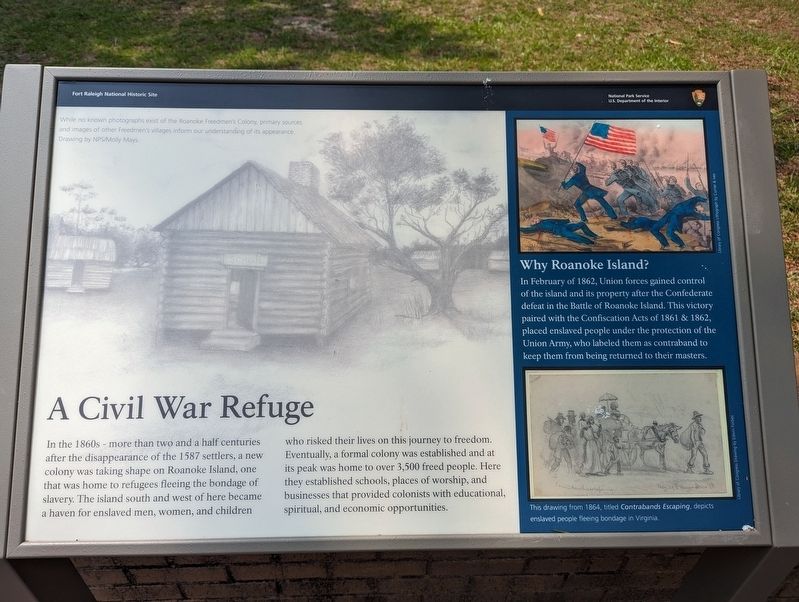
A Civil War Refuge
— Fort Raleigh National Historic Site —
Why Roanoke Island?
In February of 1862, Union forces gained control of the island and its property after the Confederate defeat in the Battle of Roanoke Island. This victory paired with the Confiscation Acts of 1861 & 1862, placed enslaved people under the protection of the Union Army, who labeled them as contraband to keep them from being returned to their masters.
(captions)
While no known photographs exist of the Roanoke Freedman's Colony, primary sources and images of other Freedmen's villages inform our understanding of its appearance. Drawing by NPS/Molly Mays.
This drawing from 1864, titled Contrabands Escaping, depicts enslaved people fleeing bondage in Virginia.
Erected by National Park Service, U.S. Department of the Interior.
Topics. This historical marker is listed in these topic lists: Abolition & Underground RR • African Americans • Settlements & Settlers • War, US Civil. A significant historical month for this entry is February 1862.
Location. 35° 56.212′ N, 75° 42.56′ W. Marker is in Manteo, North Carolina, in Dare County. Marker can be reached from Fort Raleigh Road, 0.3 miles north of U.S. 64. Touch for map. Marker is at or near this postal address: 1500 Fort Raleigh Rd, Manteo NC 27954, United States of America. Touch for directions.
Other nearby markers. At least 8 other markers are within walking distance of this marker. A Legacy of Freedom (here, next to this marker); First Light of Freedom (here, next to this marker); The New Fort in Virginia / Virginia Dare (within shouting distance of this marker); Exploring the Unknown (about 500 feet away, measured in a direct line); English Explorers' Earthwork (about 500 feet away); Reconstructed Past (about 500 feet away); Thomas Hariot Trail (about 600 feet away); Joachim Gans (approx. 0.3 miles away). Touch for a list and map of all markers in Manteo.
Also see . . . Fort Raleigh National Historic Site. National Park Service (Submitted on October 2, 2023.)
Credits. This page was last revised on October 2, 2023. It was originally submitted on September 28, 2023, by Sean C Bath of Silver Spring, Maryland. This page has been viewed 105 times since then and 41 times this year. Photo 1. submitted on September 28, 2023, by Sean C Bath of Silver Spring, Maryland. • Bernard Fisher was the editor who published this page.
