Stillwater Township in Washington County, Minnesota — The American Midwest (Upper Plains)
Brown's Creek Revival
— Brown's Creek State Trail —
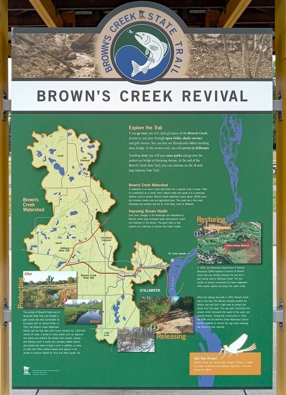
Explore the Trail
If you go east, you will catch glimpses of the Brown's Creek stream as you pass through open fields, shady ravines and golf courses. You can also see Minnesota's oldest standing stone bridge. At the eastern end, you will arrive in Stillwater.
Traveling west, you will pass near parks and go over the pedestrian bridge at Manning Avenue. At the end of the Brown's Creek State Trail, you can continue on the 18-mile long Gateway State Trail.
Brown's Creek Watershed
A watershed is an area of land that drains into a specific body of water. Think of a watershed as a funnel, which collects water and sends it to a particular wetland, pond or stream. Brown's Creek watershed covers about 19,000 acres and includes mostly rural and agricultural land. The creek has a few small tributaries and empties into the St. Croix River, north of Stillwater.
Improving Stream Health
Over time, changes in the landscape and alterations to Brown's Creek have increased water temperature, runoff and sediment in the stream. The good news is that projects are underway to improve the creek's health.
Restoring
In 1999, the Minnesota Department of Natural Resources (DNR) replaced a section of Brown's Creek that was flowing between the trail and a golf course west of McKusick Road. The new section of stream surrounded by native vegetation offers better habitat and keeps the water cooler.
Releasing
When the railroad was built in 1870, Brown's Creek was in the way. The railroad company pushed the stream over and built a high bank to protect the tracks from the water. The new path constricted the stream, which increased the speed of the water and caused erosion. During trail construction in 2014, the DNR and the Brown's Creek Watershed District worked together to remove the high bank releasing the stream to flow naturally.
Protecting
The portion of Brown's Creek east of McKusick Road that runs through a golf course was once surrounded by turf grass with no natural buffer. In 2012, the Brown's Creek Watershed District and the Oak Glen Golf Course restored the 1,300-foot section of creek. A buffer of native plants such as dogwood and willow now protects the stream from erosion, slowing and filtering runoff. A buffer also provides wildlife habitat, and shades the water to keep it cool. In addition, a series of pools and riffles (shallow areas) were placed in the stream to improve habitat for trout and other aquatic life.
Did You Know?
Brown's Creek was named after Joseph R. Brown, a soldier, fur trader, lumberman and politician
that lived in the area during the 1800s.
Erected by Minnesota Department of Natural Resources.
Topics. This historical marker is listed in these topic lists: Bridges & Viaducts • Environment • Railroads & Streetcars • Waterways & Vessels. A significant historical year for this entry is 1870.
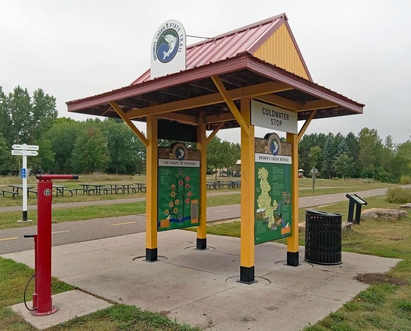
Location. 45° 4.206′ N, 92° 50.631′ W. Marker is near Stillwater, Minnesota, in Washington County. It is in Stillwater Township. Marker is at the intersection of Neal Avenue N. and the Brown's Creek State Trail, on the right when traveling south on Neal Avenue N.. The marker is in Brown's Creek Park, on a trailside kiosk marked "Coldwater Stop". Touch for map. Marker is at or near this postal address: 8312 Neal Avenue N, Stillwater MN 55082, United States of America. Touch for directions.
Other nearby markers. At least 8 other markers are within 2 miles of this marker, measured as the crow flies. Bridging Brown's Creek (approx. 0.8 miles away); Tamarack House (approx. 1.8 miles away); Indian Battleground (approx. 1.9 miles away); The Warden's House (approx. 1.9 miles away); St. Croix Lumber Mills / Stillwater Manufacturing Company (approx. 1.9 miles away); See You on the Trail / From Small Springs (approx. 1.9 miles away); Connolly Shoe Company Building (approx. 2 miles away); 226 East Myrtle Street (approx. 2 miles away). Touch for a list and map of all markers in Stillwater.
Credits. This page was last revised on October 2, 2023. It was originally submitted on September 30, 2023, by McGhiever of Minneapolis, Minnesota. This page has been viewed 52 times since then and 8 times this year. Photos: 1, 2. submitted on September 30, 2023, by McGhiever of Minneapolis, Minnesota. • J. Makali Bruton was the editor who published this page.

