Prince William Forest Park in Dumfries in Prince William County, Virginia — The American South (Mid-Atlantic)
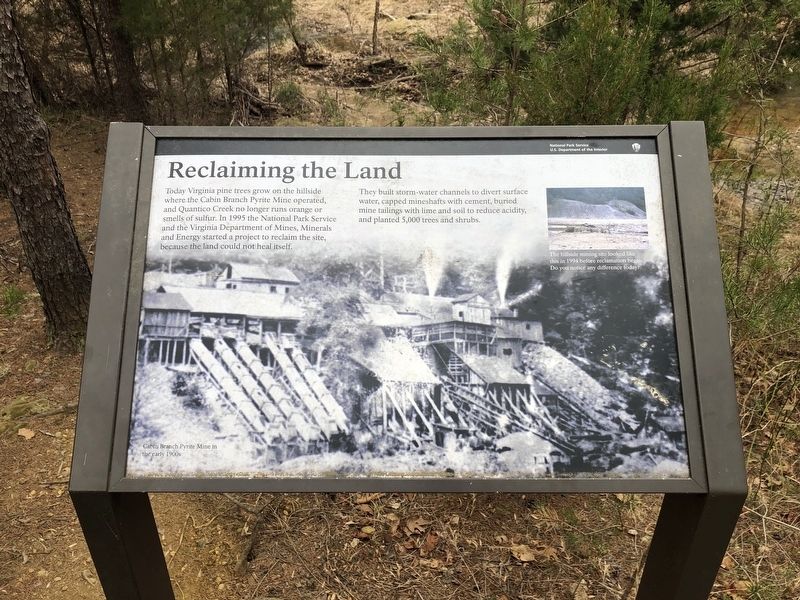
Reclaiming the Land
— National Park Service, U.S. Department of the Interior —
Today Virginia pine trees grow on the hillside where the Cabin Branch Pyrite Mine operated, and Quantico Creek no longer runs orange or smells of sulfur. In 1995 the National Park Service and the Virginia Department of Mines, Minerals and Energy started a project to reclaim the site, because the land could not heal itself.
They built storm-water channels to divert surface water, capped mineshafts with cement, buried mine tailings with lime and soil to reduce acidity, and planted 5,000 trees and shrubs.
Erected by National Park Service, U.S. Department of the Interior.
Topics. This historical marker is listed in these topic lists: Environment • Horticulture & Forestry • Industry & Commerce • Parks & Recreational Areas. A significant historical year for this entry is 1995.
Location. 38° 34.513′ N, 77° 20.905′ W. Marker is in Dumfries, Virginia, in Prince William County. It is in Prince William Forest Park. Marker is on Pyrite Mine Road, one mile east of Scenic Drive, on the right when traveling east. Touch for map. Marker is at or near this postal address: 17400 Pyrite Mine Rd, Dumfries VA 22025, United States of America. Touch for directions.
Other nearby markers. At least 8 other markers are within walking distance of this marker. Pyrite Mine (approx. ¼ mile away); Old Cabin Branch / Clarkson School (approx. 0.3 miles away); Little Union Baptist Church (approx. 0.3 miles away); a different marker also named Little Union Baptist Church (approx. 0.3 miles away); Pyrite Mine Road (approx. 0.9 miles away); Quantico Church (approx. one mile away); In Memory (approx. one mile away); Revolutionary War Patriots and War of 1812 Veterans (approx. one mile away). Touch for a list and map of all markers in Dumfries.
Credits. This page was last revised on October 23, 2023. It was originally submitted on March 12, 2021, by Devry Becker Jones of Washington, District of Columbia. This page has been viewed 105 times since then and 12 times this year. Last updated on October 3, 2023, by N. Jozsa of Woodbridge, Virginia. Photos: 1, 2. submitted on March 12, 2021, by Devry Becker Jones of Washington, District of Columbia.

