
Leesylvania in Prince William County, Virginia — The American South (Mid-Atlantic)
War in the Chesapeake
Star-Spangled Banner National Historic Trail
| — | National Park Service, U.S. Department of the Interior | — |
![War in the Chesapeake Marker [Left Panel] image. Click for full size.](Photos5/516/Photo516825.jpg?412202095000PM "War in the Chesapeake Marker [Left Panel]. Click for full size.")
Photographed by Devry Becker Jones (CC0), April 12, 2020
1. War in the Chesapeake Marker [Left Panel]
(left panel)
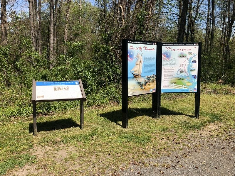
During the War of 1812 the young United States was embroiled in conflict with Great Britain. From 1812 to 1815 Americans fought to protect their rights and economic independence. They faced superior enemy forces on the homefront and the high seas.
The strategically important Chesapeake Bay region felt the brunt of the war, choked by shipping blockades and ravaged by enemy raids. The events in the region were crucial to the outcome of the war.
Though there was no clear victor at the end of the war, the United States protected its democracy ad emerged with heightened stature on the world stage.
(right panel)
National Historic Trail traces the War of 1812 in the Chesapeake. Along the trail you'll encounter tangible evidence of the war and stories that bring the people and events to life. Discover the far reaching impacts of the war on this country and the world.
Experience the Trail
★ Drive through rural landscapes and historic communities.
★ Paddle or cruise waterways where British and American troops once traveled
★ Witness
this page online
★ View the original Star-Spangled Banner flag and visit the house where it was made
★ Hike or bike trails with stops at historic sites and scenic overlooks.
★ Join commemorative events throughout the region
To learn more, visit:
www.starspangledtrail.net
www.nps.gov/stsp
www.pwcgov.org/history
Erected by National Park Service, U.S. Department of the Interior.
Topics and series. This historical marker is listed in these topic lists: War of 1812 • Waterways & Vessels. In addition, it is included in the Star-Spangled Banner National Historic Trail series list. A significant historical year for this entry is 1812.
Location. 38° 36.329′ N, 77° 16.64′ W. Marker is in Leesylvania, Virginia, in Prince William County. It is on Neabsco Road 0.1 miles west of Kenilworth Court, on the right when traveling west. Touch for map. Marker is at or near this postal address: 2100 Wessex Ct, Woodbridge VA 22191, United States of America. Touch for directions.

Regionally, this marker is in the Washington Metropolitan Area, in Northern Virginia, and in the Piedmont. It is also in the American
!["O! say can you see..." Marker [Right panel] image. Click for full size.](Photos5/516/Photo516826.jpg?412202095100PM "\"O! say can you see...\" Marker [Right panel]. Click for full size.")
Photographed by Devry Becker Jones (CC0), April 12, 2020
2. "O! say can you see..." Marker [Right panel]
Other nearby markers. At least 8 other markers are within walking distance of this marker: Confederate Winter Camps (here, next to this marker); Leesylvania (within shouting distance of this marker); Julie J. Metz Amphitheater (within shouting distance of this marker); Neabsco Ironworks & Mills (about 700 feet away, measured in a direct line); Collo. Richard Blackburn (approx. half a mile away); Stones, but No Bones (approx. 0.6 miles away); The Burying Ground (approx. 0.6 miles away); Neabsco Creek (approx. 0.6 miles away). Touch for a list and map of all markers in Leesylvania.
Credits. This page was last revised on December 1, 2023. It was originally submitted on April 12, 2020, by Devry Becker Jones of Washington, District of Columbia. This page has been viewed 412 times since then and 20 times this year. Last updated on October 3, 2023, by N. Jozsa of Woodbridge, Virginia. Photos: 1, 2, 3. submitted on April 12, 2020, by Devry Becker Jones of Washington, District of Columbia. • Bernard Fisher was the editor who published this page.
