Leesylvania in Prince William County, Virginia — The American South (Mid-Atlantic)
Neabsco Ironworks & Mills
1747
| — | Metz Wetlands | — |
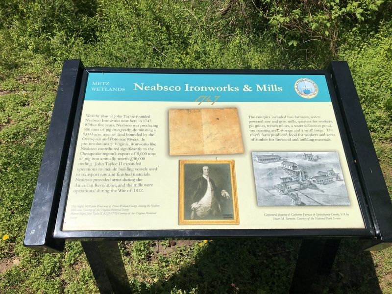
Wealthy planter John Tayloe founded Neabsco Ironworks near here in 1747. Within five years, Neabsco was producing 600 tons of pig iron yearly, dominating a 9,000-acre tract of land bounded by the Occoquan and Potomac Rivers. In pre-revolutionary Virginia, ironworks like Neabsco contributed significantly to the Chesapeake region's export of 5,000 tons of pic iron annually, worth £30,000 sterling. John Tayloe II expanded operations to include building vessels used to transport raw and finished materials. Neabsco provided arms during the American Revolution, and the mills were operational during the War of 1812.
The complex included two furnaces, water-powered saw and grist mills, quarters for workers, pit mines, trench mines, a water collection pond, ore roasting area, storage and a small forge. The tract's farm produced food for workers and acres of timber for firewood and building materials.
Erected by Prince William County Department of Public Works.
Topics. This historical marker is listed in these topic lists: Colonial Era • Industry & Commerce • War of 1812 • War, US Revolutionary. A significant historical year for this entry is 1747.
Location. 38° 36.356′ N,
this page online

Regionally, this marker is in the Washington Metropolitan Area, in Northern Virginia, and in the Piedmont. It is also in the American South, specifically in the Upper South, in the Mid-Atlantic, and on the Eastern Seaboard. Globally, it is in the North Atlantic Region, North America, the Western Hemisphere, the Western World, and the Anglosphere. Historically, it finds itself in what was once the territory of the Mississippian Culture, one of the original Thirteen Colonies, one of the Confederate States of America, and the Antebellum South.
Other nearby markers. At least 8 other markers are within walking distance of this marker: Julie J. Metz Amphitheater (about 500 feet away, measured in a direct line); Leesylvania (about 700 feet away); Confederate Winter Camps (about
Credits. This page was last revised on December 1, 2023. It was originally submitted on April 12, 2020, by Devry Becker Jones of Washington, District of Columbia. This page has been viewed 500 times since then and 39 times this year. Last updated on October 3, 2023, by N. Jozsa of Woodbridge, Virginia. Photos: 1, 2. submitted on April 12, 2020, by Devry Becker Jones of Washington, District of Columbia. • Bernard Fisher was the editor who published this page.
