
Leesylvania in Prince William County, Virginia — The American South (Mid-Atlantic)
Neabsco Iron Works
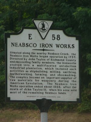
Photographed by Kevin White, August 24, 2007
1. Neabsco Iron Works Marker
Erected 2000 by Department of Historic Resources. (Marker Number E-58.)
Topics and series. This historical marker is listed in these topic lists: Colonial Era • Industry & Commerce • War of 1812 • War, US Revolutionary. In addition, it is included in the Virginia Department of Historic Resources (DHR) series list. A significant historical year for this entry is 1737.
Location. 38° 36.522′ N, 77° 17.425′ W. Marker is in Leesylvania, Virginia, in Prince William County. It is at the intersection of Neabsco Road (County Route
this page online

Regionally, this marker is in the Washington Metropolitan Area, in Northern Virginia, and in the Piedmont. It is also in the American South, specifically in the Upper South, and in the Mid-Atlantic. Globally, it is in the North Atlantic Region, North America, the Western Hemisphere, the Western World, and the Anglosphere. Historically, it finds itself in what was once the territory of the Mississippian Culture, one of the original Thirteen Colonies, one of the Confederate States of America, and the Antebellum South.
Other nearby markers. At least 8 other markers are within walking distance of this marker: Neabsco Ironworks & Mills (approx. 0.6 miles away); Passing Blackburn House (approx. 0.7 miles away); Julie J. Metz Amphitheater (approx. 0.7 miles away); a different marker also named Leesylvania (approx. ¾ mile away); Native Americans from Eastern Prince William County (approx. ¾ mile away); Confederate Winter Camps
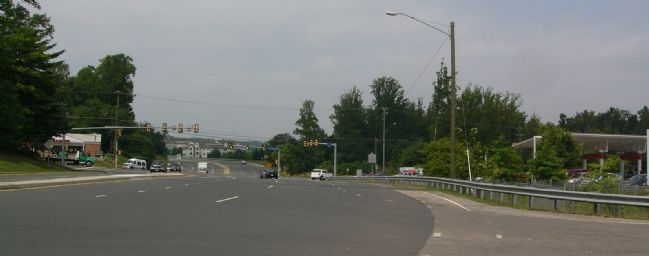
Photographed by Kevin White, August 24, 2007
2. Neabsco Iron Works Marker
Photograph is taken from Neabsco Road, facing West toward Jefferson Davis Highway.
Other markers no longer nearby. Events Along Neabsco Creek (was about 700 feet away, measured in a direct line but has been confirmed missing); “Leesylvania” (was approx. 0.2 miles away but has been confirmed missing).
More about this marker. The Iron Works mentioned on this marker are also referenced in nearby markers, “Events Along Neabsco Creek”, “Leesylvania”, and “Neabsco Mills Ironworks.”
Credits. This page was last revised on October 7, 2023. It was originally submitted on August 24, 2007, by Kevin W. of Stafford, Virginia. This page has been viewed 2,920 times since then and 100 times this year. Last updated on October 3, 2023, by N. Jozsa of Woodbridge, Virginia. Photos: 1, 2. submitted on August 24, 2007, by Kevin W. of Stafford, Virginia. • Bill Pfingsten was the editor who published this page.
