
Near Dale City in Prince William County, Virginia — The American South (Mid-Atlantic)
Neabsco Mills Ironworks
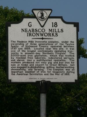
Photographed by Kevin White, August 15, 2007
1. Neabsco Mills Ironworks Marker
Erected 1994 by Department of Historic Resources. (Marker Number G-18.)
Topics and series. This historical marker is listed in these topic lists: Colonial Era • Industry & Commerce • War of 1812 • War, US Revolutionary. In addition, it is included in the Virginia Department of Historic Resources (DHR) series list. A significant historical year for this entry is 1737.
Location. 38° 37.167′ N, 77° 17.912′ W. Marker is near Dale
this page online

Regionally, this marker is in the Washington Metropolitan Area, in Northern Virginia, and in the Piedmont. It is also in the American South, specifically in the Upper South, in the Mid-Atlantic, and on the Eastern Seaboard. Globally, it is in the North Atlantic Region, North America, the Western Hemisphere, the Western World, and the Anglosphere. Historically, it finds itself in what was once the territory of the Mississippian Culture, one of the original Thirteen Colonies, one of the Confederate States of America, and the Antebellum South.
Other nearby markers. At least 8 other markers are within walking distance of this marker: Dumfries Rest Area (a few steps from this marker); Like to Eat? (within shouting distance of this marker); a different marker also named Like to Eat? (about 700 feet away, measured in a direct line); Freedom High School Sundial Memorial (approx. half a mile
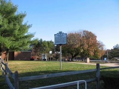
Photographed by Craig Swain, November 22, 2008
2. Neabsco Mills Ironworks Marker
Located in the southbound rest area.
Another marker is no longer nearby. Events Along Neabsco Creek (was approx. ¾ mile away but has been confirmed missing).
Regarding Neabsco Mills Ironworks. The Ironworks mentioned on this marker are also referenced in nearby markers, “Events Along Neabsco Creek”, “Leesylvania”, and “Neabsco Iron Works.”
Although no orignal structures remain, you can still see the old mill race (water channel) for the foundry and other evidence of the complex. Pictures 2 and 3 show a hole dug for a building’s foundation along Neabsco Creek.
Also see . . .
1. Neabsco Iron Works Geocache. For those of you who enjoy a good hike and have a GPS, this link will give you the coordinates of a two stage geocache located on the site of the Neabsco Iron Works. You may have to register with www.geocaching.com in order to view the information. (Submitted on August 17, 2007, by Kevin W. of Stafford, Virginia.)
2. Additional Pictures of Neabsco Iron works.

Photographed by Bill Coughlin, March 31, 2025
3. Neabsco Mills Ironworks Marker
3. Additional Information on Neabsco Iron Works. (Submitted on June 15, 2011, by Michael Veax of Fredericksburg, Virginia.)
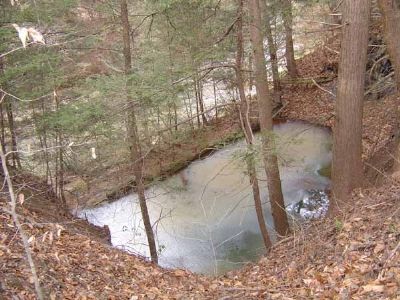
December 26, 2004
4. Looking down on some remains of Neabsco Iron Works
Site is south of the rest area. Picture is taken from the southeast corner, looking northwest. Neabsco Creek is in the background.
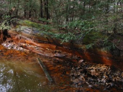
March 9, 2002
5. Iron and Water don't mix.
Rusty water in the remains of Neabsco Iron Works.
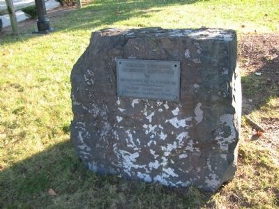
Photographed by Craig Swain, November 22, 2008
6. Rest Stop Dedication
A few paces from the marker is this dedication stone reading:
Dumfries Rest Area
Dedicated May 11, 1963
by
Mrs. Lyndon B. Johnson
Plaque presented by
Virginia Travel Council
Dedicated May 11, 1963
by
Mrs. Lyndon B. Johnson
Plaque presented by
Virginia Travel Council
Credits. This page was last revised on April 25, 2025. It was originally submitted on August 16, 2007, by Kevin W. of Stafford, Virginia. This page has been viewed 3,661 times since then and 89 times this year. Last updated on October 3, 2023, by N. Jozsa of Woodbridge, Virginia. Photos: 1. submitted on August 16, 2007, by Kevin W. of Stafford, Virginia. 2. submitted on November 29, 2008, by Craig Swain of Leesburg, Virginia. 3. submitted on April 16, 2025, by Bill Coughlin of Woodland Park, New Jersey. 4, 5. submitted on August 16, 2007, by Kevin W. of Stafford, Virginia. 6. submitted on November 29, 2008, by Craig Swain of Leesburg, Virginia. • Bill Pfingsten was the editor who published this page.
