Oldtown in Winston-Salem in Forsyth County, North Carolina — The American South (South Atlantic)
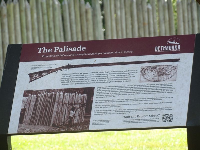
The Palisade
Protecting Bethabara and its neighbors during a turbulent time in history.
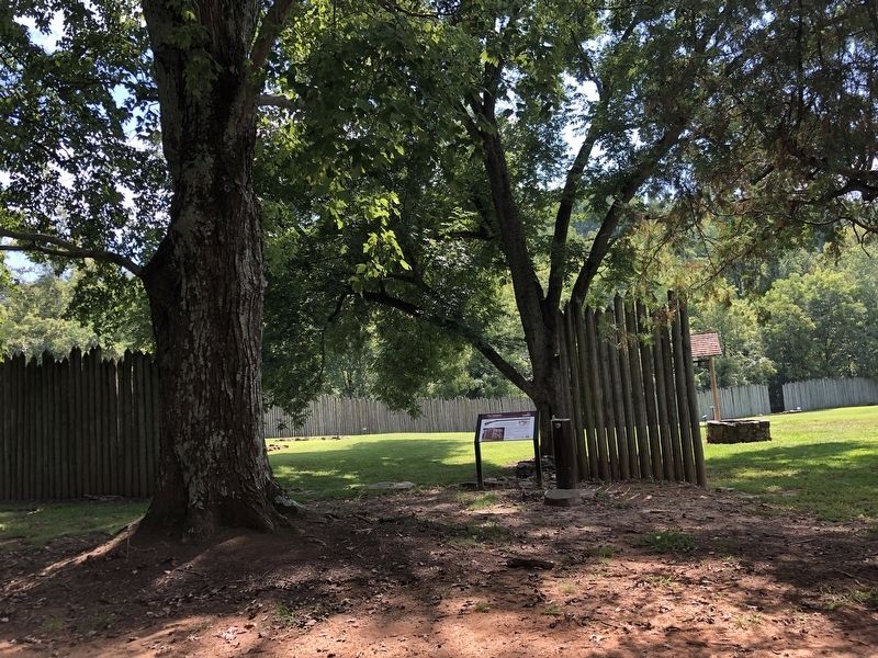
Moravians settled Bethabara just before the outbreak of war in the colonies. Though most of the major battles were fought farther north, the town still felt the effects of war. Local militia trampled crops and caused drunken disorder during musters near the town. Trade with surrounding settlements dwindled and supplies grew source as threats of attack drew closer. In response to a rumor that the Cherokee had switched alliance to the French, the Moravians erected a defensive palisade, or fortified wall, around Bethabara and the mill site. Many refugees along the Yadkin River took shelter with the Moravians during the next few years, especially in 1759 when their homes were raided by the Cherokee during the Cherokee War.
Due to overcrowded conditions in the forts, disease spread fast, culminating in a deadly typhus outbreak in 1759 that took the lives of both refugees and Moravians alike, including Bethabara's physician, Dr. Kalberlahn.
When the war ended in 1763, tensions eased and the fort was demolished in 1764. Salem, meant to be founded much sooner, was finally established in 1766.
In 2012, Historic Bethabara Park, Inc. took down the first reconstructed palisade fort that was falling into disrepair and replaced it with a new one. Both reconstructed forts were placed in the exact location of the original, which was found through Dr. Stanley South's archaeological work.
[Captions]
• Top: Christoph Vogler rifle, ca. 1785-1795, Salem, NC Collection of Old Salem Museums & Gardens, Acc. 5715.1. Gift of the McGee family in memory of Janet Berrier McGee and Ray Ellis Berrier
• Bottom left: The first palisade reconstruction was built by Dr. Stanley South and his team after excavating Bethabara's foundations.
Erected by Historic Bethabara Park, Inc. (Marker Number 7.)
Topics. This historical marker is listed in these topic lists: Forts and Castles • War, French and Indian • Wars, US Indian. A significant historical year for this entry is 1754.
Location. 36° 9.327′ N, 80° 17.855′ W. Marker is in Winston-Salem, North Carolina, in Forsyth County. It is in Oldtown. Marker is on Bethabara Road, 0.1 miles south of Bethania Station Road, on the right when traveling south. Touch for map. Marker is at or near this postal address: 2163 Bethabara Rd, Winston Salem NC 27106, United States of America. Touch for directions.
Other nearby markers. At least 8 other markers are within walking distance of this marker. The Foundations (a few steps from this marker); Palisade Fort (a few steps from this marker); Congregation Store 1759 & 1764 (a few steps from this marker); Pottery Shop 1755 (a few steps from this marker); Congregation Kitchen 1766 (a few steps from this marker); Bell House (within shouting distance of this marker); Well 1763 (within shouting distance of this marker); Gemeinhaus 1756 (within shouting distance of this marker). Touch for a list and map of all markers in Winston-Salem.
Also see . . . The Palisade. The Moravians were not immune to the fighting, and as stories of families attacked by Native Americans reached Bethabara, the Brethren decided to build a palisade around the village houses, “making them safe before the first incursion of the Indians should take place.” (Historic Bethabara Park, Inc.) (Submitted on October 21, 2023, by Duane and Tracy Marsteller of Murfreesboro, Tennessee.)
Credits. This page was last revised on October 21, 2023. It was originally submitted on October 6, 2023, by Duane and Tracy Marsteller of Murfreesboro, Tennessee. This page has been viewed 57 times since then and 10 times this year. Photos: 1, 2. submitted on October 6, 2023, by Duane and Tracy Marsteller of Murfreesboro, Tennessee.

