Juniata Township near Duncansville in Blair County, Pennsylvania — The American Northeast (Mid-Atlantic)
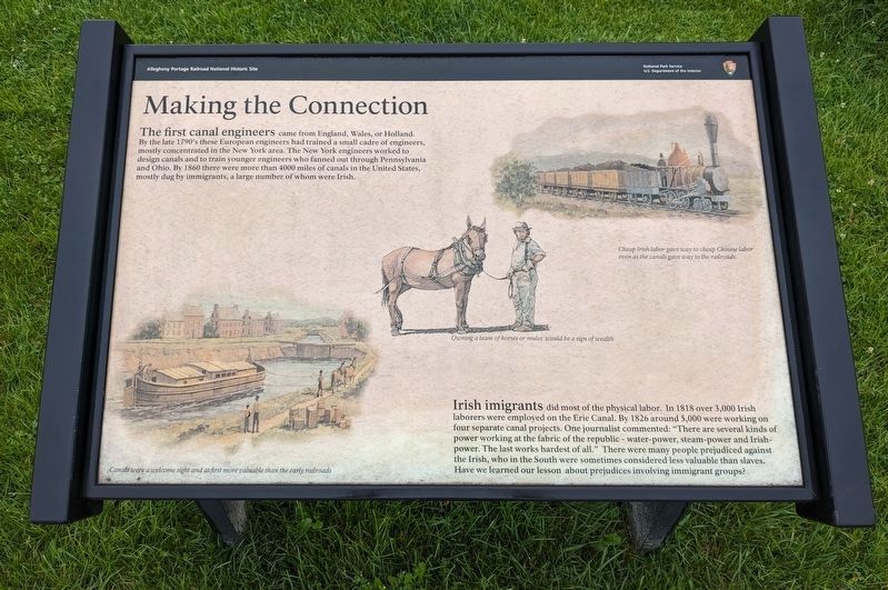
Making the Connection
— Allegheny Portage Railroad National Historic Site —
Irish imigrants [sic] did most of the physical labor. In 1818 over 3,000 Irish laborers were employed on the Erie Canal. By 1826 around 5,000 were working on four separate canal projects. One journalist commented: "There are several kinds of power working at the fabric of the republic - water-power, steam-power and Irish-power. The last works hardest of all." There were many people prejudiced against the Irish, who in the South were sometimes considered less valuable than slaves. Have we learned our lesson about prejudices involving immigrant groups?
(caption) Cheap Irish labor gave way to cheap Chinese labor even as the canals gave way to the railroads.
(caption) Owning a team of horses of mules would be a sign of wealth
(caption) Canals were a welcome sight and at first more valuable than the early railroads
Erected by National Park Service, U.S. Department of the Interior.
Topics. This historical marker is listed in these topic lists: Immigration • Industry & Commerce • Waterways & Vessels.
Location. 40° 24.494′ N, 78° 27.623′ W. Marker is near Duncansville, Pennsylvania, in Blair County. It is in Juniata Township. Marker is on Dry Run Road, on the right when traveling west. Touch for map. Marker is in this post office area: Duncansville PA 16635, United States of America. Touch for directions.
Other nearby markers. At least 8 other markers are within 4 miles of this marker, measured as the crow flies. Staying Alive (approx. 0.3 miles away); Blair Homestead (approx. half a mile away); Fort Fetter (approx. 3 miles away); Jaycee Memorial Park (approx. 3.6 miles away); Canal Basin (approx. 3.6 miles away); Hiding Incline 8 (approx. 3.7 miles away); Freedom Township Volunteer Fire Company Charter Membership (approx. 3.7 miles away); Veterans Memorial (approx. 3.7 miles away). Touch for a list and map of all markers in Duncansville.
Credits. This page was last revised on October 16, 2023. It was originally submitted on October 8, 2023. This page has been viewed 55 times since then and 9 times this year. Photos: 1, 2. submitted on October 8, 2023. 3. submitted on October 14, 2023. • Bill Pfingsten was the editor who published this page.


