Noble Township in St. Marys in Auglaize County, Ohio — The American Midwest (Great Lakes)
Six Mile Creek Aqueduct
⎯⎯⎯
The Miami & Erie Canal

September 25, 2023
1. Six Mile Creek Aqueduct side of marker
Six Mile Creek Aqueduct. Canal aqueducts provide transportation of canal waters over natural waterways, allowing for reliable boat passage. The multi-arch masonry and formed concrete flume of the Six Mile Creek Aqueduct create a unique bi-level structure with the upper level carrying the towpath while the canal traverses the lower level. Stoplogs. set against the outer archways face. manage the canal's water level. resulting in a cascade of water into the creek below. In 2018 and 2019, the aqueduct suffered a series of failures due to deterioration and exceptional rain events. With assistance from local and state agencies, the Ohio Department of Natural Resources prevented complete loss of the structure and successfully restored the aqueduct.
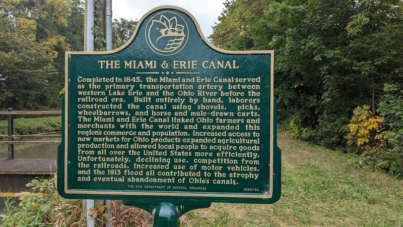
The Miami & Erie Canal. Completed in 1845, the Miami and Erie Canal served as the primary transportation artery between western Lake Erie and the Ohio River before the railroad era. Built entirely by hand. laborers constructed the canal using shovels, picks, wheelbarrows, and horse and mule-drawn carts. The Miami and Erie Canal linked Ohio farmers and merchants with the world
this page online
Erected 2022 by Ohio Department of Natural Resources. (Marker Number 2202-02.)
Topics and series. This historical marker is listed in these topic lists: Bridges & Viaducts • Industry & Commerce • Waterways & Vessels. In addition, it is included in the The Miami & Erie Canal series list. A significant historical year for this entry is 2018.
Location. 40° 37.565′ N, 84° 20.802′ W. Marker is in St. Marys, Ohio, in Auglaize County. It is in Noble Township. It is on Saint Marys Kossuth Road (Ohio Route 66) one mile south of Barber-Werner Rd.. Marker is located on the towpath next to the Miami-Erie Canal. Touch for map. Marker is in this post office area: Saint Marys OH 45885, United States of America. Touch for directions.

Regionally,
Photographed by Heath Mash, September 25, 2023
2. The Miami & Erie Canal side of marker
Other nearby markers. At least 8 other markers are within 4 miles of this marker, measured as the crow flies: Bloody Bridge (approx. 0.6 miles away); Walnut Grove Church Bell (approx. 1.9 miles away); Lock 14 (approx. 2.1 miles away); Lock 14 on the Miami and Erie Canal (approx. 2.1 miles away); Veterans Memorial (approx. 2.3 miles away); Broadwell Mill (approx. 3.1 miles away); St. Patrick Catholic Church (approx. 3.3 miles away); Noble Township Community Park (approx. 3½ miles away). Touch for a list and map of all markers in St. Marys.

Photographed by Craig Doda, November 8, 2023
3. Six Mile Creek Aqueduct / The Miami & Erie Canal Marker

Photographed by Craig Doda, November 8, 2023
4. Six Mile Creek Aqueduct
Credits. This page was last revised on December 29, 2023. It was originally submitted on October 8, 2023. This page has been viewed 686 times since then and 72 times this year. Photos: 1, 2. submitted on October 8, 2023. 3, 4. submitted on November 9, 2023, by Craig Doda of Napoleon, Ohio. • Bill Pfingsten was the editor who published this page.
