Roseville in Placer County, California — The American West (Pacific Coastal)
Maidu Interpretive Center
Photographed by Syd Whittle, October 16, 2009
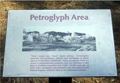
1. Petroglyph Area Marker
Topics. This historical marker is listed in these topic lists: Indigenous Peoples and Communities • Notable Places. A significant historical year for this entry is 1972.
Location. 38° 44.28′ N, 121° 14.76′ W. Marker is in Roseville, California, in Placer County. It can be reached from Johnson Ranch Drive. Marker is located on the trail, a short walk from the Museum building. Coordinates are of the entrance to the museum. Touch for map. Marker is at or near this postal address: 1960 Johnson Ranch Drive, Roseville CA 95661, United States of America. Touch for directions.

Regionally, this marker is in California’s Sacramento Metro,
this page online
Other nearby markers. At least 8 other markers are within 3 miles of this marker, measured as the crow flies: Roseville Korean War Veterans Memorial (approx. 0.3 miles away); Roseville - Placer County Vietnam Memorial (approx. 2 miles away); Benito Juarez (approx. 2.1 miles away); Roseville V.F.W. Post 1661 Veterans Memorial (approx. 2.1 miles away); Roseville Veterans Memorial (approx. 2.1 miles away); Reuben F. Nelson Footbridge (approx. 2.1 miles away); Railroad Hobbies Building (approx. 2.1 miles away); Garbolino Building (approx. 2.1 miles away). Touch for a list and map of all markers in Roseville.
Regarding Maidu Interpretive Center. The Maidu Interpretive Center consists of a museum with several permanent and rotating exhibits, and a mile long interpretive trail. Indoor flash photos
Photographed by Syd Whittle, October 16, 2009
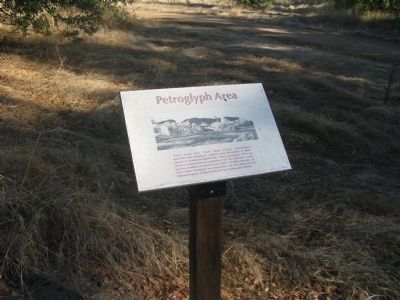
2. Petroglyph Area Marker
Also see . . . The Maidu. A very informative history of the Maidu people of Northern California. (Submitted on October 18, 2009, by Syd Whittle of Mesa, Arizona.)
Photographed by Syd Whittle, October 16, 2009
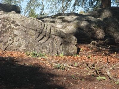
3. Petroglyphs
Photographed by Syd Whittle, October 16, 2009
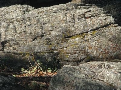
4. Petroglyphs
Photographed by Syd Whittle, October 16, 2009
5. Grinding Rocks/Bedrock Mortars
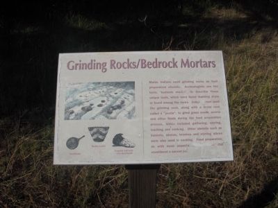
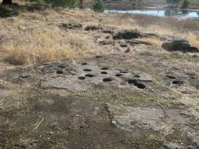
Maidu Indians used grinding rocks as food preparation utensils. Archeologists use the term, “bedrock mortars” to describe these unique tools, which were found standing alone or found among rocks. Indian women used the grinding rock, along with a linear rock called a “pestle”, to grind grass seeds, acorns and other foods during the food preparation process, which included gathering, storing, teaching and cooking. Other utensils such as baskets, stones, brushes and stirring sticks were also used in cooking. Food preparation, as with most aspects [...] was considered a sacred job.
Photographed by Syd Whittle, October 16, 2009
6. Grinding Rocks and Bedrock Mortars
Photographed by Syd Whittle, October 16, 2009
7. Grinding Rocks
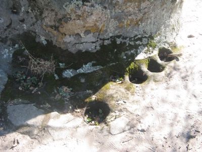
These grinding rocks are located at the base of a "ceremonial rock" seen earlier on the trail.
Credits. This page was last revised on November 13, 2020. It was originally submitted on October 18, 2009, by Syd Whittle of Mesa, Arizona. This page has been viewed 2,904 times since then and 57 times this year. Photos: 1, 2, 3, 4, 5, 6, 7. submitted on October 18, 2009, by Syd Whittle of Mesa, Arizona.
