Greenwood in Albemarle County, Virginia — The American South (Mid-Atlantic)
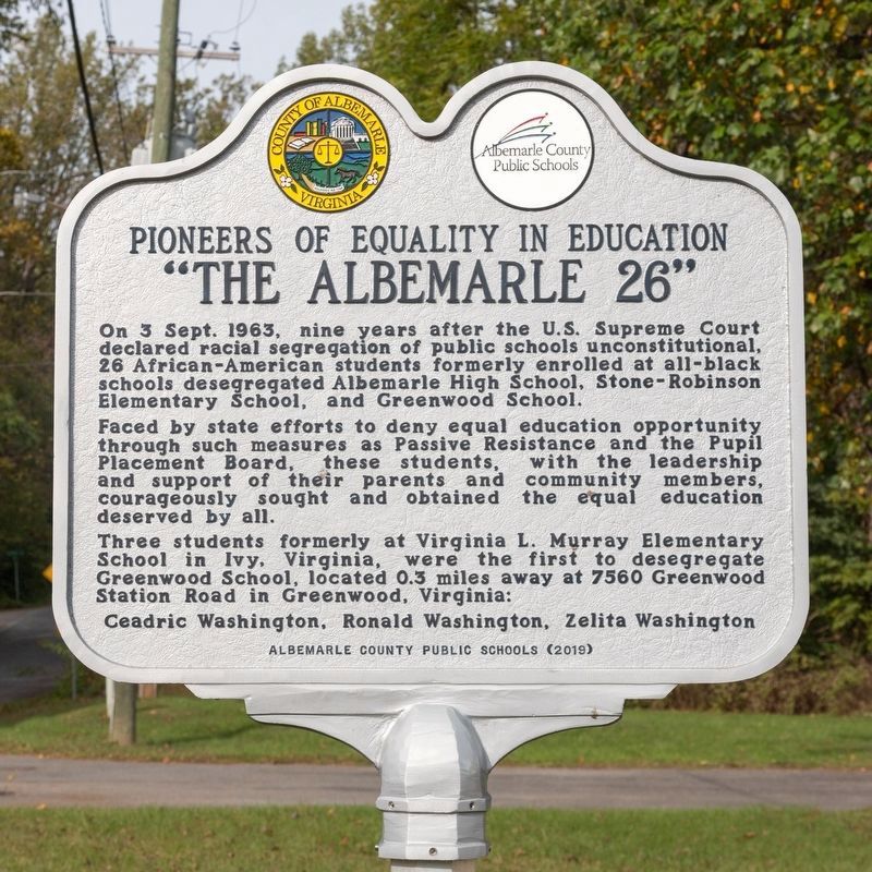
“The Albemarle 26”
Pioneers of Equality in Education
Photographed by J. J. Prats, October 11, 2023
1. “The Albemarle 26” Marker
Faced by state efforts to deny equal education opportunity through such measures as Passive Resistance and the Pupil Placement Board, these students, with the leadership and support of their parents and community members, courageously sought and obtained the equal education deserved by all.
Three students formerly at Virginia L. Murray Elementary School in Ivy, Virginia, were the first to desegregate Greenwood School, located 0.3 miles away at 7560 Greenwood Station Road in Greenwood, Virginia:
Ceadric Washington, Ronald Washington, Zelita Washington.
Erected 2019 by Albemarle County Public Schools.
Topics. This historical marker is listed in these topic lists: African Americans • Civil Rights • Education. A significant historical date for this entry is September 3, 1963.
Location. 38° 3.298′ N, 78° 45.355′ W. Marker is in
this page online

Regionally, this marker is in the Piedmont and in Central Virginia. It is also in the American South and specifically in the Upper South. Globally, it is in North America, the Western Hemisphere, the Western World, and the Anglosphere. Historically, it finds itself in what was once the territory of the Mississippian Culture, one of the original Thirteen Colonies, one of the Confederate States of America, and the Antebellum South.
Other nearby markers. At least 8 other markers are within 5 miles of this marker, measured as the crow flies: Mirador (approx. 1.7 miles away); VDOT Workers’ Memorial (approx. 2.1 miles away); The Rothwell Family ... / Elisha Wm. Robertson ... (approx. 2.6 miles away); a different marker also named Mirador (approx. 2.6 miles away);
Photographed by J. J. Prats, October 11, 2023
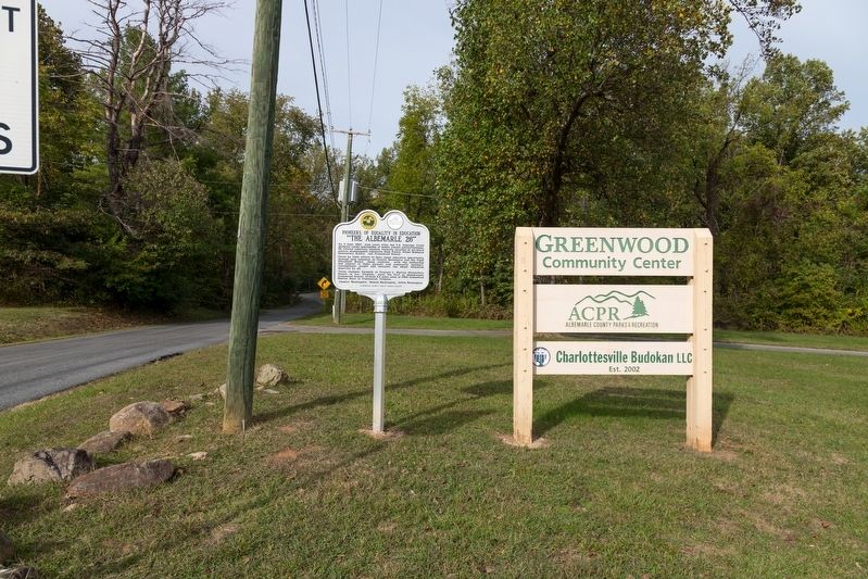
2. “The Albemarle 26” Marker
Related markers. Click here for a list of markers that are related to this marker. There are three historical markers in Albemarle County with this title. For all three markers, the first paragraph is the same.

Photographed by J. J. Prats, October 24, 2024
3. The Former Greenwood Elementary School
The school building is a quarter mile south and around the corner from the marker, on Greenwood Station Road. Today the building is a private residence, currently under renovation. It is marked with no trespassing signs.
The cornerstone for this school building was laid in 1921, and it taught all grades until 1953, when county high schools were consolidated into Albemarle High School in Charlottesville. The elementary school that remained closed in 1983.
The cornerstone for this school building was laid in 1921, and it taught all grades until 1953, when county high schools were consolidated into Albemarle High School in Charlottesville. The elementary school that remained closed in 1983.
Credits. This page was last revised on October 27, 2024. It was originally submitted on October 11, 2023, by J. J. Prats of Powell, Ohio. This page has been viewed 566 times since then and 73 times this year. Photos: 1, 2. submitted on October 11, 2023, by J. J. Prats of Powell, Ohio. 3. submitted on October 27, 2024, by J. J. Prats of Powell, Ohio.
