Colesville in Montgomery County, Maryland — The American Northeast (Mid-Atlantic)
The Commonwealth Farm
Remarkable Montgomery: Untold Stories
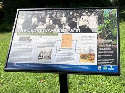
For nearly 60 years, this land was part of the Commonwealth Farm, home to a women's commune that began in Belton, Texas in the late 1860s under the leadership of Martha McWhirter (1827-1904). Women's lives in 1860s Texas were often marked by subordinate status, grief, and isolation. The Belton women found community with each other through a prayer group and eventually through dreams that they interpreted as divine instruction to leave their husbands and establish communal households together. There, they could follow their beliefs in celibacy and spiritual sanctification. For the first time, they controlled their home lives, labor, and earnings. After establishing several successful businesses, the women gradually overcame hostility to their unusual lifestyle, though the perception of their 'strangeness' lingered. Membership peaked at 50 in 1880.
In 1898, they used their accumulated wealth to retire to Washington, D.C. There they ran a boarding house and small farm, but left time to pursue arts, culture, and social causes including women's suffrage. As it had in Texas, the commune's financial success relied in part on the labor of people of color who lived and worked alongside the women but were not admitted as members. Membership gradually dwindled as the founders died and as some younger women left. In 1903, the Commonwealth bought a 120-acre farm north of Colesville. It acquired wooded land, productive fields and orchards, and a c. 1875 farmhouse from carpenter Charles Collinsgru. Commonwealth members tended livestock and produced butter, eggs, milk, fruit, and vegetables. Always enterprising, they expanded the farmhouse and ran it as the Commonwealth Farm, an upscale country restaurant and retreat.
Through the 1930s, the farm was a popular destination for Washington elites, where the women served their "famous chicken dinners" to wives of senators and diplomats and those looking to escape the city heat in summer.
More Recent History
In 1946, only two members were living and most of the farmland was sold. Martha McWhirter Scheble (1883-1983), a second-generation Commonwealth member named in honor of Martha McWhirter, lived on the land until her death in 1983. A stone retaining wall that once lined the driveway is still visible from New Hampshire Avenue.
Erected 2023 by Montgomery Parks.
Topics. This historical marker is listed in these topic lists: Agriculture • Women.
Location. 39° 5.853′ N, 76° 59.842′ W. Marker is in Colesville, Maryland, in Montgomery County. Marker can be reached from Piping Rock Drive. Located in Peachwood Neighborhood Park, between the parking lot and the tennis courts. Touch for map. Marker is at or near this postal address: 611 Piping Rock Dr, Silver Spring MD 20905, United States of America. Touch for directions.
Other nearby markers. At least 8 other markers are within 3 miles of this marker, measured as the crow flies. Khmer Rouge Genocide Memorial (approx. one mile away); Smithville Colored School (approx. 1˝ miles away); Conduit Track Switch and Crossover (approx. 1.8 miles away); Fawcett's Mill (approx. 1.8 miles away); Snowden's Mill (approx. 2.2 miles away); Edmonston's Mill (approx. 2.3 miles away); Valley Mill (approx. 2.4 miles away); a different marker also named Valley Mill (approx. 2.4 miles away).
Credits. This page was last revised on January 31, 2024. It was originally submitted on October 17, 2023, by Julianne Mangin of Silver Spring, Maryland. This page has been viewed 71 times since then and 31 times this year. Photo 1. submitted on October 17, 2023, by Julianne Mangin of Silver Spring, Maryland. • Bill Pfingsten was the editor who published this page.
Editor’s want-list for this marker. A wide shot of the marker and its surroundings. • Can you help?
