Grove Hill in Clarke County, Alabama — The American South (East South Central)
Salt Pans and Furnaces
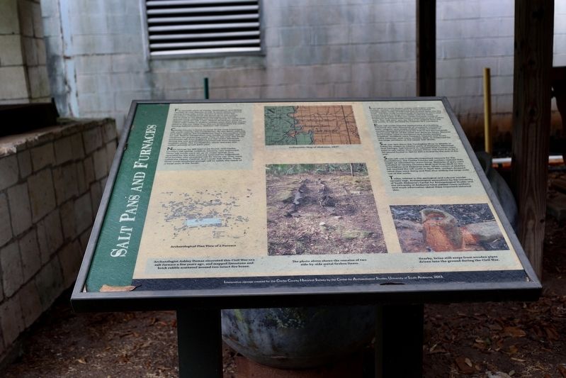
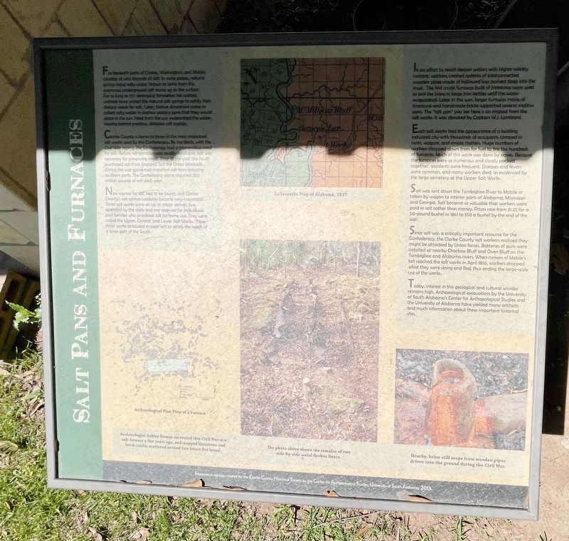
Far beneath parts of Clarke, Washington, and Mobile counties sit vast deposits of salt. In some places, natural springs bring salty water known as brine from this enormous underground salt dome up to the surface. For as long as this geological formation has existed, animals have visited the natural salt springs to satisfy their dietary needs for salt. Later, Native Americans came to collect salty water in shallow pottery pans that they would place in the sun. Heat from the sun evaporated the water, leaving behind precious, delicious salt crystals.
Clark County is home to three of the most important salt works used by the Confederacy. By the 1860s with the Civil War fighting the Confederacy had a tremendous need for salt. Before refrigeration was readily available salt was necessary for preserving meat. Prior to the war, the South purchased salt from England, but the Union blockaded southern ports. The Confederacy alone required 300 million pounds of salt each year.
New Sources of salt had to be found, and Clarke County's salt springs suddenly became very important. Three salt works were set up at major springs, a town operated by the state, and one reserved for individuals and families who processed salt for home use. They were called the Upper, Central, and Lower Salt Works. These three works produced enough salt to satisfy the needs of a large part of the South.
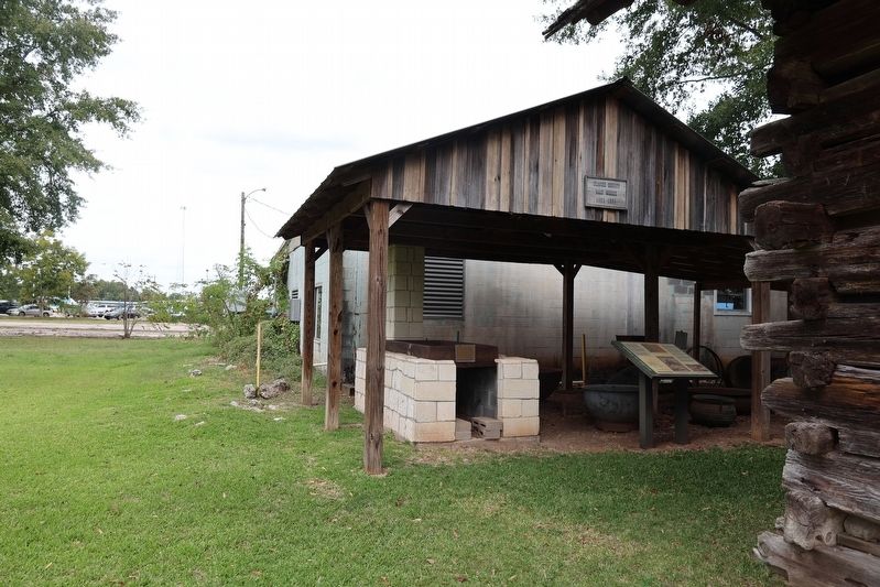
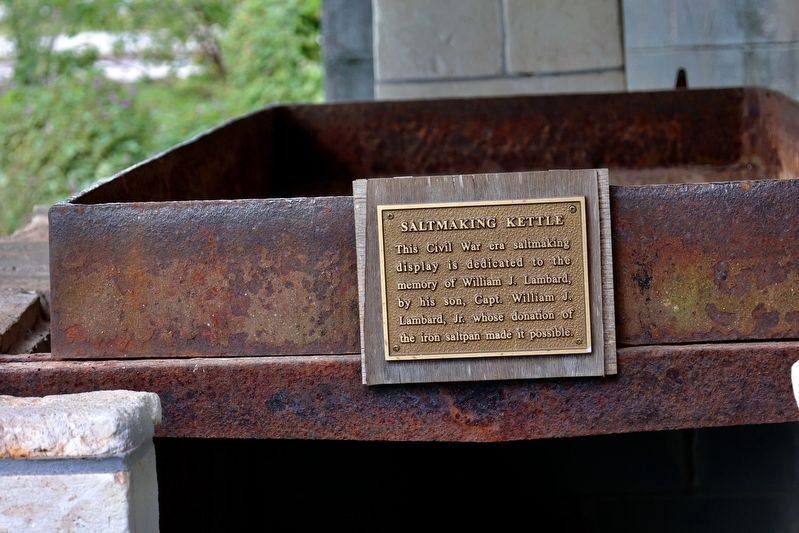
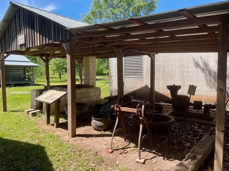
In an effort to reach deeper waters with higher salinity content, workers created systems of interconnected wooden pipes made of hollowed logs pushed deep into the mud. The first crude furnaces built of limestone were used to boil the brine in large iron kettles until the water evaporated. Later in the war, larger furnaces made of limestone and handmade bricks supported several shallow pans. The "salt pan" you see here is an original from the salt works. It was donated by Captain W.J. Lambard.
Each salt work had the appearance of a bustling industrial city with thousands of occupants camped in tents, wagons, and simple shelters. Huge numbers of workers chopped down trees for fuel to fire the hundreds of furnaces. Much of this work was done by slaves. Because the furnaces were so numerous and closely packed together, accidents were frequent. Diseases and fevers were common, and many workers died, as evidenced by the large cemetery at the Upper Salt Works.
Salt was sent down the Tombigbee River to Mobile or taken by wagon to the interior ports of Alabama, Mississippi, and Georgia. Salt became so valuable that workers were paid in salt rather than money. Prices rose from $1.25 for a 50-pound bushel in 1861 to $50 a bushel by the end of the war.
Since salt was a critically important resource for the Confederacy, the Clarke County salt workers realized they might be attacked by Union forces. Batteries of guns were installed at nearby Choctaw Bluffs and Oven Bluff on the Tombigbee and Alabama rivers. When rumors of Mobile's fall reached the salt works in April 1865, workers dropped what they were doing and fled, thus ending the large-scale use of the works.
Today, interest in this geological and cultural wonder remains high. Archaeological excavations by the University of South Alabama's Center for Archaeological Studies and the University of Alabama have yielded many artifacts and much information about these important historical sites.
Captions
Lower Left: Archaeological Plan View of a Furnace. Archaeologist Ashley Dumas excavated this Civil War-era salt furnace a few years ago, and mapped limestone and brick rubble scattered around two intact fireboxes.
Upper Middle: LaTourette Map of Alabama 1837
Lower Middle: The photo above shows the remains of two side-by-side metal firebox liners.
Lower Right: Nearby, brine still seeps from wooden pipes driven into the ground during the Civil War.
Erected 2013 by Clarke County Historical Society and the Center for Archaeological Studies Univerity of
South Alabama.
Topics. This historical marker is listed in these topic lists: Native Americans • War, US Civil. A significant historical month for this entry is April 1865.
Location. 31° 42.633′ N, 87° 46.632′ W. Marker is in Grove Hill, Alabama, in Clarke County. Marker is at the intersection of West Cobb Street and North Jackson Street (Alabama Route 295) on West Cobb Street. Marker is part of the Living History of Clarke County Museum. Touch for map. Marker is at or near this postal address: 116 W Cobb St, Grove Hill AL 36451, United States of America. Touch for directions.
Other nearby markers. At least 8 other markers are within walking distance of this marker. Turner Corncrib (here, next to this marker); Josiah and Lucy Martin Mathews Cabin (a few steps from this marker); Creagh Law Office (within shouting distance of this marker); Clarke County Soldiers Of The American Revolution (within shouting distance of this marker); Colored and White Soldiers of World War I (within shouting distance of this marker); The Alston-Cobb House (within shouting distance of this marker); Grove Hill, Alabama (about 500 feet away, measured in a direct line); Clarke County Courthouse (about 700 feet away). Touch for a list and map of all markers in Grove Hill.
Also see . . . Salt Works, Clarke County, Alabama. Salt is more precious than gold in a society without practical refrigeration. During the Civil War era, salt was necessary for curing meat to feed the residents. and more significantly, the armies of the Confederacy. (Submitted on October 19, 2023, by Sandra Hughes Tidwell of Killen, Alabama, USA.)
Credits. This page was last revised on April 13, 2024. It was originally submitted on October 19, 2023, by Sandra Hughes Tidwell of Killen, Alabama, USA. This page has been viewed 141 times since then and 69 times this year. Photos: 1, 2, 3, 4. submitted on October 19, 2023, by Sandra Hughes Tidwell of Killen, Alabama, USA. 5, 6. submitted on April 13, 2024, by Mark Hilton of Montgomery, Alabama. • James Hulse was the editor who published this page.
Editor’s want-list for this marker. Clear readable closeup photo of the marker. • Can you help?
