
Fort Davis in Jeff Davis County, Texas — The American South (West South Central)
Smith-Carlton Adobe House
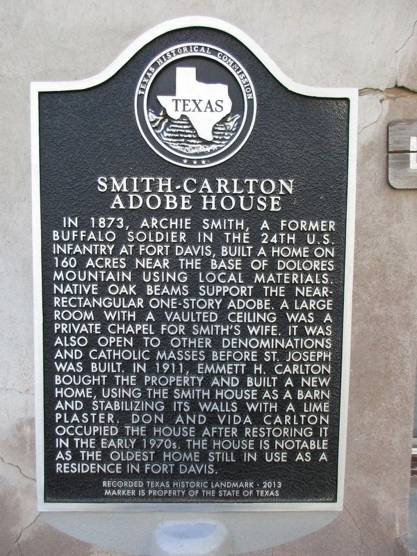
Photographed by Jeff Leichsenring, October 8, 2023
1. Smith-Carlton Adobe House Marker
Erected 2013 by Texas Historical Commission. (Marker Number 17533.)
Topics. This historical marker is listed in these topic lists: African Americans • Agriculture • Settlements & Settlers. A significant historical year for this entry is 1873.
Location. 30° 34.985′ N, 103° 53.628′ W. Marker is in Fort Davis, Texas, in Jeff Davis County. It can be reached from South Front Street
this page online

Regionally, this marker is in Texas’ Trans-Pecos & Big Bend Region. It is also in the American Southwest. Globally, it is in North America, a Gulf of Mexico state, the Western Hemisphere, the Western World, and the Anglosphere. Historically, it finds itself in what was once New Spain, the Republic of Texas, and one of the Confederate States of America.
Other nearby markers. At least 8 other markers are within walking distance of this marker: Pioneer Cemetery (approx. 0.3 miles away); Jeff Davis County (approx. 0.3 miles away); Jeff Davis County Jail (approx. 0.3 miles away); Fort Davis United Methodist Church (approx. 0.3 miles away); Confederate President Jefferson Davis (approx. 0.4 miles away); Memorial Square (approx. 0.4 miles away); Jeff Davis County Courthouse (approx. 0.4 miles away); Jeff Davis County Library (approx. 0.4 miles away). Touch for a list and map of all markers in
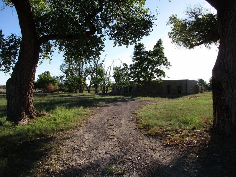
Photographed by Jeff Leichsenring, October 8, 2023
2. Smith-Carlton Adobe House and Marker
Credits. This page was last revised on December 1, 2024. It was originally submitted on October 21, 2023, by Jeff Leichsenring of Garland, Texas. This page has been viewed 352 times since then and 55 times this year. Photos: 1, 2. submitted on October 21, 2023, by Jeff Leichsenring of Garland, Texas. • James Hulse was the editor who published this page.
