Near Flagler Beach in Flagler County, Florida — The American South (South Atlantic)
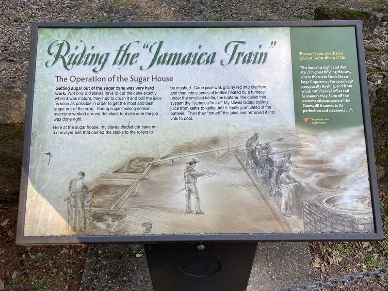
Riding the "Jamaica Train"
The Operation of the Sugar House
Here at the sugar house, my slaves placed cut cane on a conveyer belt that carried the stalks to the rollers to be crushed. Cane juice was gravity fed into clarifiers and then into a series of kettles heated by a furnace under the smallest kettle, the batterie. We called this system the "Jamaica Train." My slaves ladled boiling juice from kettle to kettle until it finally granulated in the batterie. Then they "struck" the juice and removed it into vats to cool.
Thomas Tryon, a Barbados colonist, wrote this in 1700:
"the Servants night and day stand in great Boyling Houses, where there are Six or Seven large Coppers or Furnaces kept perpetually Boyling; and from which with heavy Ladles and Scummers they Skim off the excrementitious parts of the Canes, till it comes to its perfection and cleanness…”
(caption) Workers in the sugar house.
Erected by Florida State Parks.
Topics. This historical marker is listed in these topic lists: African Americans • Agriculture • Colonial Era. A significant historical year for this entry is 1700.
Location. 29° 26.135′ N, 81° 8.6′ W. Marker is near Flagler Beach, Florida, in Flagler County. Marker can be reached from Old Kings Road South, 0.3 miles south of Audubon Way, on the left when traveling south. Located in Bulow Plantation Ruins Historic State Park. Touch for map. Marker is at or near this postal address: 3501 Old Kings Road S, Flagler Beach FL 32136, United States of America. Touch for directions.
Other nearby markers. At least 8 other markers are within walking distance of this marker. Just just a spoonful of sugar (here, next to this marker); Beyond the Plantation (a few steps from this marker); Driven by Sweat & Steam (a few steps from this marker); Bulow Sugar Mill (about 500 feet away, measured in a direct line); The Bulow Plantation House (approx. 0.3 miles away); Indigo Production (approx. 0.4 miles away); Slave Cabin Area (approx. 0.4 miles away); Bulow Ville Plantation House (approx. 0.4 miles away). Touch for a list and map of all markers in Flagler Beach.
Also see . . . Bulow Plantation Ruins Historic State Park. Florida State Parks (Submitted on October 25, 2023.)
Credits. This page was last revised on October 25, 2023. It was originally submitted on October 22, 2023, by Connor Olson of Kewaskum, Wisconsin. This page has been viewed 119 times since then and 65 times this year. Photos: 1, 2. submitted on October 22, 2023, by Connor Olson of Kewaskum, Wisconsin. • Bernard Fisher was the editor who published this page.

