Cumberland - Estates in Ottawa, Ontario — Central Canada (North America)
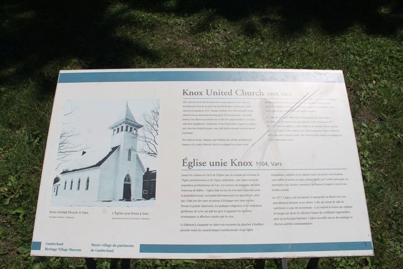
Knox United Church 1904, Vars
Église unie Knox 1904, Vars
Photographed by Robert Rusaw, June 22, 2023
1. Knox United Church 1904, Vars Marker

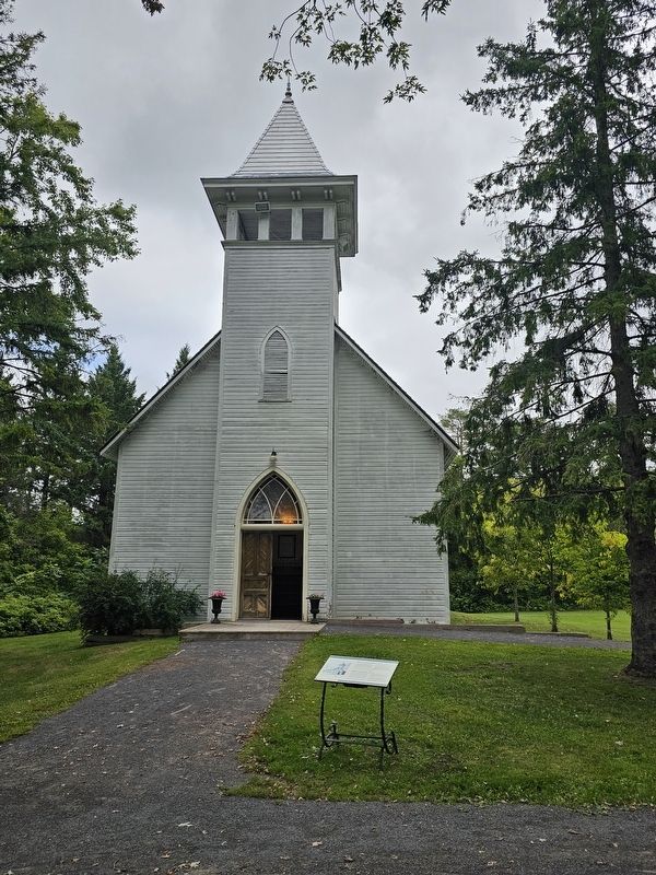
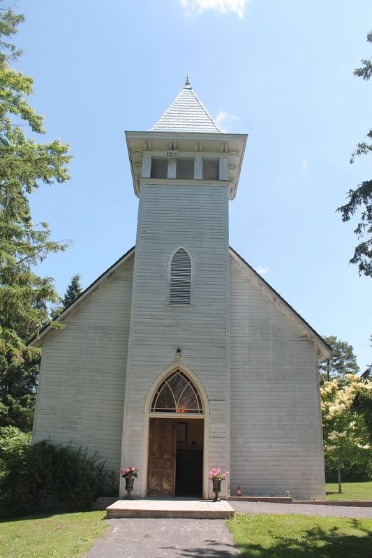
The balloon-frame, shiplap-clad building has all the architectural features of a Gothic Revival church, as adapted to a more rural architectural style. It has a steeple, gabled and painted arch opening above the windows and doors. The main entrance is crowned by a bell tower capped by a silver funal and double brackets.
The church, complete with interior furnishings and stained glass windows, was deconsecrated and relocated to the Museum in 1977. Although the rear addition, which served as the Sunday school, was not rebuilt, a replica of the original drive shed houses the Tanner collection of hearses and a funeral coach. The church is
this page online
Ce bâtiment à charpente en claire-voie recouvert de planches à feuillure possède toutes les caractéristiques architecturales d'une église néogothique, adaptées à un contexte rural. Les portes et les fenêtres sont coiffées d'arches en ogive peintes, tandis que l'entrée principale est surmontée d'un clocher couronné d'un fleuron d'argent et orné d'une double console.
En 1977, l'église a été sécularisée et transportée au Musée avec son ameublement intérieur
Photographed by Robert Rusaw, September 14, 2023
2. Knox United Church 1904, Vars Marker
Erected by Cumberland Heritage Village Museum.
Topics. This historical marker is listed in this topic list: Religion & Religious Structures. A significant historical year for this entry is 1904.
Location. 45° 31.06′ N, 75° 23.448′ W. Marker is in Ottawa, Ontario. It is in Cumberland - Estates. It can be reached from Chemin Old Montreal Road. This marker is located on the grounds of the Cumberland Heritage Village Museum. Touch for map. Marker is at or near this postal address: 2940 Ch Old Montreal Rd, Ottawa ON K4C 1G2, Canada. Touch for directions.

Regionally, this marker is in Eastern Ontario. It is also in Central Canada. Globally, it is in North America, the Western Hemisphere, the Western World, and the Anglosphere. Historically, it finds itself in what was once a British colony, the Viceroyalty of New France,
Photographed by Robert Rusaw, June 22, 2023
3. Knox United Church 1904, Vars Marker
Other nearby markers. At least 8 other markers are within 5 kilometers of this marker, measured as the crow flies: Canadian National Railways Station (1908, Vars) (a few steps from this marker); Foubert House / Maison de Foubert (within shouting distance of this marker); Sentier Jean-Lapointe (1913-1977) (approx. 3.6 kilometers away in Québec); Le commerce de proximité à Masson (approx. 3.7 kilometers away in Québec); Église et dévotion à Masson (approx. 3.7 kilometers away in Québec); Les Servantes de Jésus-Marie (approx. 3.7 kilometers away in Québec); Dompter la rivière, créer des industries (approx. 3.9 kilometers away in Québec); Fondation de la municipalité de Masson (approx. 4 kilometers away in Québec). Touch for a list and map of all markers in Ottawa.
Credits. This page was last revised on March 25, 2025. It was originally submitted on September 27, 2023, by Robert Rusaw of Massena, New York. This page has been viewed 360 times since then and 42 times this year. Last updated on October 22, 2023, by Robert Rusaw of Massena, New York. Photos: 1. submitted on September 27, 2023, by Robert Rusaw of Massena, New York. 2, 3. submitted on September 28, 2023, by Robert Rusaw of Massena, New York. • J. Makali Bruton was the editor who published this page.
