Rimini in Clarendon County, South Carolina — The American South (South Atlantic)
Richardson Graves
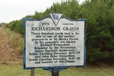
Photographed by Mike Stroud, 2009
1. Richardson Graves Marker
Erected 1970 by Clarendon County Historical Society. (Marker Number 14-3.)
Topics. This historical marker is listed in this topic list: Cemeteries & Burial Sites.
Location. 33° 38.299′ N, 80° 29.323′ W. Marker is in Rimini, South Carolina, in Clarendon County. It is on Old River Road (State Highway 14-76), on the right when traveling south. Located just south of Kennette Trail 2.2 miles from Rimini. Touch for map. Marker is in this post office area: Summerton SC 29148, United States of America. Touch for directions.

Regionally, this marker is in South Carolina’s Pee Dee and in Santee Cooper Country. It is also in the American South and specifically in the Deep South. Globally, it is in North America, the Western Hemisphere, the Western
this page online
Other nearby markers. At least 8 other markers are within 8 miles of this marker, measured as the crow flies: Halfway Swamp: (approx. one mile away); Encounter at Halfway Swamp / Site of Original St. Mark's Church (approx. 1.2 miles away); Good Hope Picnic (approx. 5.7 miles away); Andrews Chapel Church (approx. 6.1 miles away); Col. David Dubose Gaillard (approx. 6.3 miles away); Pine Grove Evangelical Lutheran Church (approx. 6.4 miles away); Liberty Hill Church / Pioneers in Desegregation (approx. 6.6 miles away); Fort Watson (approx. 7½ miles away). Touch for a list and map of all markers in Rimini.
Another marker is no longer nearby. Encounter At Halfway Swamp / Site Of Original St. Mark's Church (was approx. 1.2 miles away but has been replaced with another marker now near it).
Regarding Richardson Graves. "Richardson Cemetery",
One of the most historic graveyards in the region, Richardson
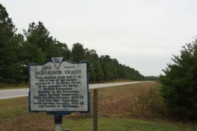
Photographed by Mike Stroud, October 11, 2009
2. Richardson Graves Marker as seen looking south along Old River Road ( State Road 14-76)
(The Clarendon County Archives and History Center)
Also see . . . Richardson Cemetery. Swamp Fox Trail website entry (Submitted on August 29, 2026, by Larry Gertner of New York, New York.)
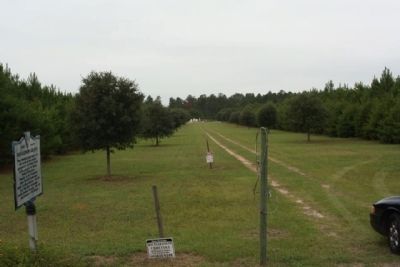
Photographed by Mike Stroud, October 11, 2009
3. Richardson Graves Marker at the cemetery driveway
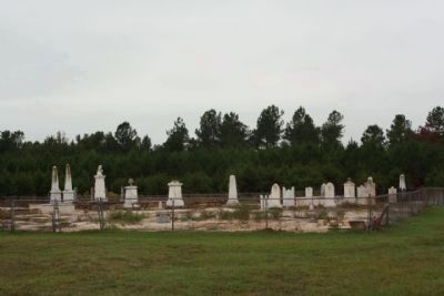
Photographed by Mike Stroud, October 11, 2009
4. Richardson Graves ; Presently the cemetery is closed - under renovation
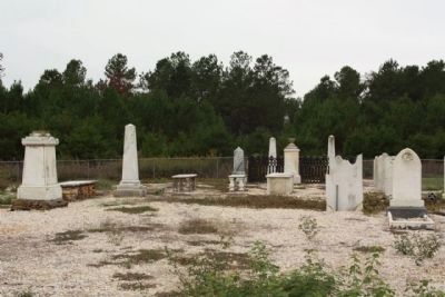
Photographed by Mike Stroud, October 11, 2009
5. Richardson Graves
Far left is Gen. Richard Richardson gravesite
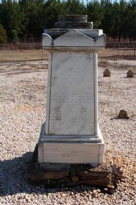
Photographed by Mike Stroud, January 19, 2010
6. General Richard Richardson
to the memory of
General Richard
Richardson
who departed this life
in September 1780
aged 76 years.
He died while a prisoner
and under the parole of
the British who permitted
him in his illness
to leave John's Island
where he was confined
to close the last moments
of his life in the bosom
of his numerous
family.
Beneath this marble
his venerated remains repose
which is erected to his memory
by James Burchill Richardson
his eldest son by his second
and last marriage.
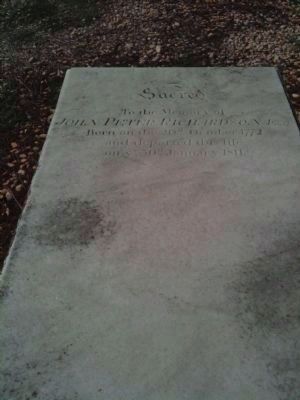
Photographed by Cindy Bullard, February 20, 2010
7. John Peter Richardson Sr. Grave Marker
Son of Richard Richardson and Father of Gov. James Burchell Richardson and Gov. John Peter Richardson Jr.
Inscription:
SACRED to the Memory of John Peter Richardson Esq'r Born on the 20th October 1772 and departed this life on ye 30th January 1811
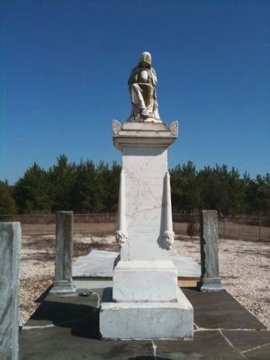
Photographed by Cindy Bullard, February 20, 2010
8. James Burchell Richardson Grave Marker
Inscription:
In Memory of James Burchell Richardson Born on the 28th October 1770 Died on the 28th April 1836 Aged 66 years and 6 months
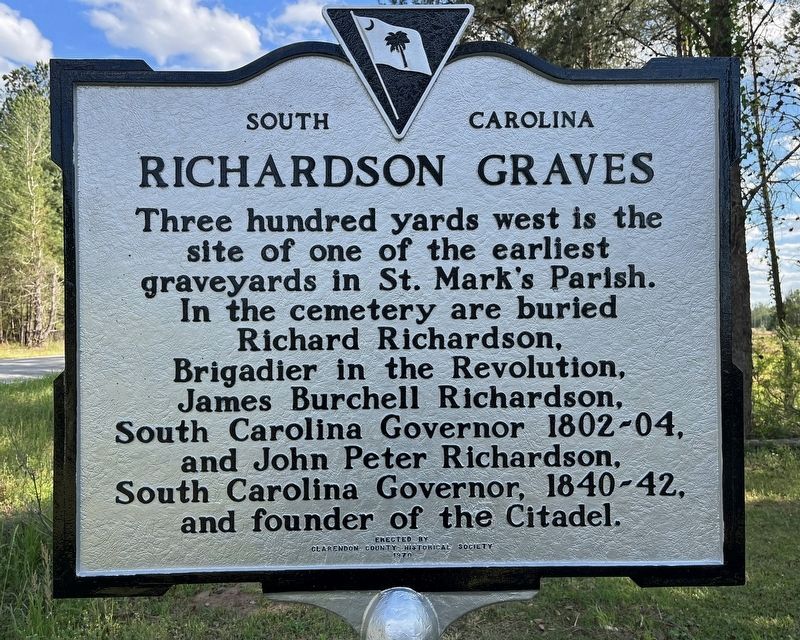
Photographed by C Summers, April 7, 2024
9. Richardson Graves Marker
Richardson Graves marker was repainted this year.
Credits. This page was last revised on August 29, 2026. It was originally submitted on October 21, 2009, by Mike Stroud of Bluffton, South Carolina. This page has been viewed 4,364 times since then and 187 times this year. Photos: 1, 2, 3, 4, 5. submitted on October 22, 2009, by Mike Stroud of Bluffton, South Carolina. 6. submitted on January 20, 2010, by Mike Stroud of Bluffton, South Carolina. 7, 8. submitted on February 21, 2010, by David Bullard of Seneca, South Carolina. 9. submitted on June 21, 2024, by C Summers of Manning, South Carolina. • Craig Swain was the editor who published this page.
