White Swan Township near Pickstown in Charles Mix County, South Dakota — The American Midwest (Upper Plains)
Fort Randall Area
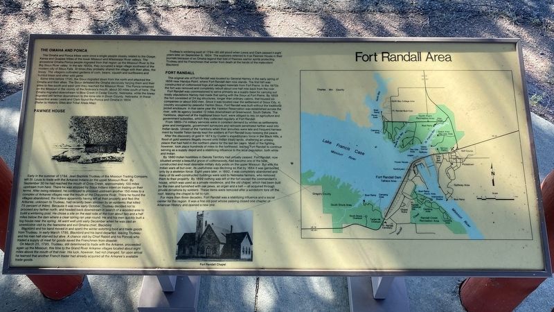
The Omaha and Ponca
The Omaha and Ponca tribes were once a single people closely related to the Osage, Kansa and Quapaw tribes of the lower Missouri and Mississippi River valleys. The ancestoral Omaha-Ponca people migrated from that region up the Missouri River to the Big Sioux River valley. In the late 1600s, they occupied a large village southeast of the modern city of Sioux Falls. At times they probably shared the village with their allies, the Ioway. The villagers cultivated gardens of corn, beans, squash and sunflowers and hunted bison and other wild game.
Some time before 1700, the Sioux migrated down from the north and attacked the Omaha and their allies. The Sioux defeated the Omaha decisively forcing them and their allies to flee south and west until they reached the Missouri River. The Ponca remained on the Missouri in the vicinity of the Niobrara's mouth, about 30 miles south of here. The Omaha migrated downstream to Bow Creek in Cedar County, Nebraska, while the Ioway migrated still farther downstream to the Ionia site in Dixon County, Nebraska. In these respective areas Lewis and Clark found the Ponca and Omaha in 1804.
(Refer to Historic Sites and Tribal Areas Map)
Pawnee House
Early in the summer of 1794, Jean Baptiste Trudeau of the Missouri Trading Company, left St. Louis to trade with the Arikaree Indians on the upper Missouri River. By September 30 he had reached the mouth of Crow Creek, approximately 100 miles upstream from here. There he was stopped by Sioux Indians intent on trading on their terms. After being released, he continued to proceed upstream another 150 miles to a complex of Arikaree villages near the mouth of the Cheyenne River. There he found the villages abandoned, the Indians apparently having left all their property and fled (the Arikaree, unknown to Trudeau, had recently been stricken by an epidemic that killed 75 percent of them). Because it was now early October, Trudeau decided not to proceed any farther north, and headed back downstream in search of a wooded area to build a wintering post. He chose a site on the east side of the river about two and a half miles below the dam where a clear spring ran year-round. He and his men quickly built a log house near the spring. All went well until early December when he was paid an unwelcome visit by the fearsome and evil Omaha chief, Blackbird.
Blackbird and his band moved in and spent the winter extorting food and trade goods from Trudeau. In early March 1795, Blackbird and his band departed, leaving Trudeau and his men half-starved but alive. A chance visit by Chief Rabbit and his Poncas who traded a supply of meat for goods saved the Frenchmen from disaster.
On March 25, 1795, Trudeau, still determined to trade with the Arikaree, proceeded again up the Missouri, this time to the Grand River Arikaree villages located about eight miles above the mouth of that river. His luck, however, had not changed, for upon arrival he learned that another French trader had already acquired all the Arikaree's available trade goods.
Trudeau's winter post of 1794–95 still stood when Lewis and Clark passed it eight years later on September 8, 1804. The explorers referred to it as Pawnee House in their journals because of an Omaha legend that told of Pawnee warrior spirits protecting Trudeau and his Frenchmen that winter from death at the hands of the malevolent Blackbird.
Fort Randall
The original site of Fort Randall was located by General Harney in the early spring of 1856 near Handys Point, where Fort Randall dam now stands. The first fort was constructed of cottonwood logs and salvaged materials from Fort Pierre. In the 1870s the fort was removed and completely rebuilt about one-half mile back from the river.
Fort Randall was commissioned to serve primarily as a supply base for carrying out treaty stipulations Harney had made that spring with the Sioux at Fort Pierre. By 1859 the fort consisted of 24 log structures, longer than ordinary cabins, that housed six companies or about 500 men. Since it was located near the settlement of Sioux City, in country occupied by peaceful Yanton Sioux, Fort Randall was built without the traditional picket enclosure. In that same year the Yankton Reservation was established across the river, with its agency located 12 miles downstream at Greenwood, South Dakota. The Yanktons, deprived of the traditional bison hunt, were obliged to rely on agriculture and government subsidies, which they collected regularly at Fort Randall.
From 1865–74 military services were in constant demand by whites as settlements grew and immigrants, government surveyors and railroads penetrated farther west into Indian lands. Unrest of the Yanktons when their annuities were late and frequent harrassment by hostile Teton bands kept the soldiers at Fort Randall busy keeping the peace.
After the discovery of gold in 1874 by Custer's expeditionary force in the Black Hills, a flood of gold seekers illegally moved onto Indian treaty lands, shattering an uneasy peace that had held in the northern plains for the last ten years. Most of the fighting, however, took place hundreds of miles to the northwest, leaving Fort Randall to continue serving as a supply depot and a stabilizing influence to the local population, both white and Indian.
By 1880 Indian hostilities in Dakota Territory had virtually ceased. Fort Randall, now situated amidst a beautiful grove of cottonwoods, had become one of the best constructed and most desirable military duty posts on the upper Missouri. But with the Indian wars all but over, its usefulness was declining so that by 1884 it was garrisoned only by a skeleton force. Eight years later, in 1892, it was completely abandoned and many of its well-constructed buildings were sold to Nebraska farmers, who removed them to their property. By 1899 nothing was left of the fort except the commandant's house, which was used as a private residence, and the old chapel, which had been built by the men and furnished with oak pews, an organ and a bell — all acquired through private donations by soldiers. These items were removed after a windstorm tore off the roof, leaving the chapel to fall to ruin.
For more then three decades, Fort Randall was a stabilizing influence and a social center for the region. It was a fine old post whose passing closed one chapter of American History and opened a new one.
Fort Randall Chapel
Topics. This historical marker is listed in these topic lists: Exploration • Forts and Castles • Native Americans • Waterways & Vessels. A significant historical date for this entry is September 30, 1794.
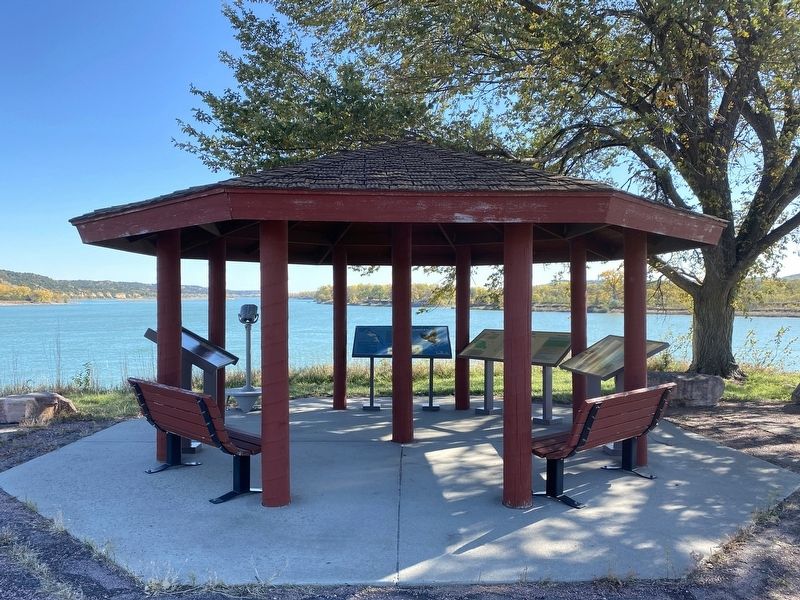
Location. 43° 3.342′ N, 98° 32.998′ W. Marker is near Pickstown, South Dakota, in Charles Mix County. It is in White Swan Township. Located at the interpretive shelter above the fishing area at the Fort Randall Dam. Touch for map. Marker is in this post office area: Lake Andes SD 57356, United States of America. Touch for directions.
Other nearby markers. At least 8 other markers are within walking distance of this marker. Missouri River (here, next to this marker); A Gathering Place for Eagles (here, next to this marker); Fort Randall Eagle Roost (a few steps from this marker); Welcome to Randall Creek Recreation Area (approx. 0.3 miles away); Supply & Demand (approx. 0.6 miles away); Frontier Firepower (approx. 0.6 miles away); Crime & Punishment (approx. 0.6 miles away); In Sickness & in Health (approx. 0.6 miles away). Touch for a list and map of all markers in Pickstown.
Related markers. Click here for a list of markers that are related to this marker.
Credits. This page was last revised on October 25, 2023. It was originally submitted on October 25, 2023. This page has been viewed 56 times since then and 18 times this year. Photos: 1, 2. submitted on October 25, 2023.

