Goliad in Goliad County, Texas — The American South (West South Central)
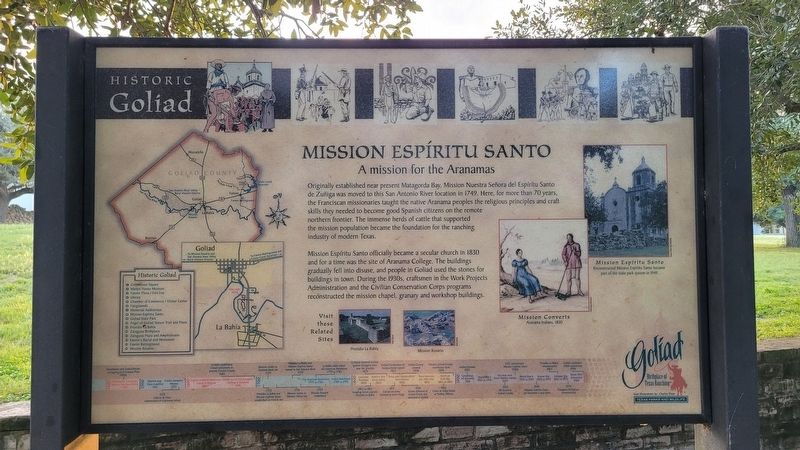
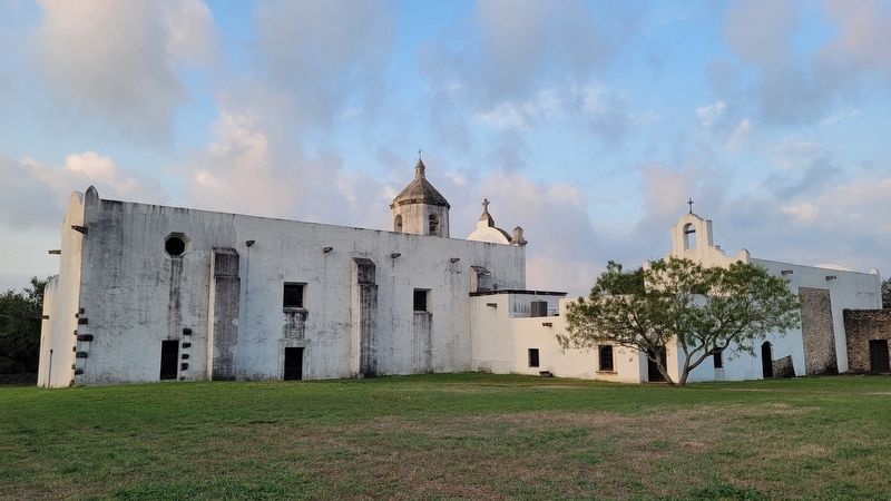
Mission Espíritu Santo
A mission for the Aranamas
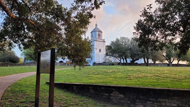
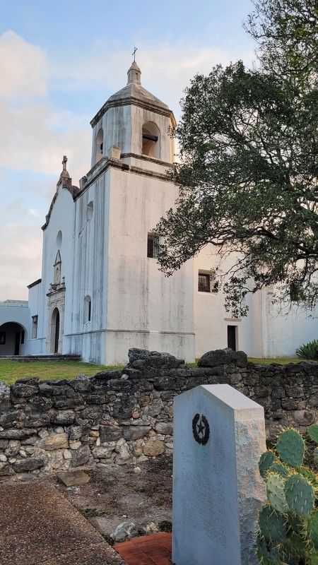
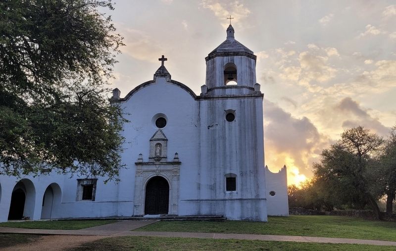
Mission Espíritu Santo officially became a secular church in 1830 and for a time was the site of Aranama College. The buildings gradually fell into disuse, and people in Goliad used the stones for buildings in town. During the 1930s, craftsmen in the Work Projects Administration and the Civilian Conservation Corps programs reconstructed the mission chapel, granary and workshop buildings.
Captions
Middle Right: Mission Espíritu Santo
Reconstructed Mission Espiritu Santo became part of the state park system In 1949.
Lower Right: Mission Converts
Aranama Indians, 1830
Timeline
1400
1400s Karankawas and Coahuiltecans Occupying Gulf Coastal Plain
1492 Christopher Columbus lands in the New World
1500
1519 Spanish map Texas coastline
1521 Cortez conquers Mexico
1528 Cabeza de Vaca shipwrecked on Galveston Island
1600
1607 English establish Jamestown colony in Virginia
1616 Dutch record first European landing in Australia
1685 La Salle establishes French settlement in present Victoria County
1700
1722 Presidio La Bahía and Mission Espíritu Santo established on French site
1724 Mission moves to Tonkawa Bank site
1726 Mission moves to Mission Valley site
1749 Presidio La Bahía and Mission Espíritu Santo moved to San Antonio River
1754 Mission Rosario established
1775 to 1783 The American Revolution
1779 to 1782 La Bahía cattle drives aid American Revolution
1789 to 1793 French Revolution
1800
1803 Louisiana Purchase
1812 to 1821 Invading forces capture Presidio La Bahia
1823 Austin's first Texas colony
1829 La Bahía renamed Goliad Ignacio Zaragoza born near the presidio
1831 Goliad missions released to local clergy
1835 Goliad Declaration of Independence signed
1836 Texans defeated at Coleto Creek and executed at Goliad
1836 Texas wins independence from Mexico
1836 Goliad County created
1845 Texas becomes the 28th state
1861 to 1865 American Civil War
1862 Cinco de Mayo battle at Puebla, Mexico
1894 Present Goliad County courthouse built
1900
1901 Spindletop oil discovery
1902 Goliad tornado
1914 to 1918 World War I
1929 The New York Stock Market crashes
1929 Oil found in Goliad County
1930s CCC reconstructs Mission Espíritu Santo
1939 to 1945 World War II
1949 Mission Espíritu Santo site becomes a state park
1950 to 1953 Korean War
1965 to 1973 Vietnam War
1967 Presidio La Bahia reconstructed
1974 Zaragoza Birthplace reconstructed
1989 Berlin Wall dismantled
1999 Goliad celebrates 250th anniversary
2000
Erected by Historic Goliad.
Topics. This historical marker is listed in these topic lists: Churches & Religion • Education • Hispanic Americans • Native Americans. A significant historical year for this entry is 1749.
Location. 28° 39.405′ N, 97° 23.232′ W. Marker is in Goliad, Texas, in Goliad County. Marker is on Park Road 6, 0.1 miles west of U.S. 183, on the right when traveling west. The marker is located along the pathway to Mission Espíritu Santo near the park headquarters. Touch for map. Marker is at or near this postal address: 108 Park Rd 6, Goliad TX 77963, United States of America. Touch for directions.
Other nearby markers. At least 8 other markers are within walking distance
of this marker. Cattle Drive from La Bahia (within shouting distance of this marker); Mission Nuestra Senora del Espiritu Santo de Zuniga (within shouting distance of this marker); Aranama College (within shouting distance of this marker); Site of the Mission Nuestra Seńora del Espiritu Santo de Zúńiga (within shouting distance of this marker); A Native Texas Mission (within shouting distance of this marker); Judge James Arthur White and the Civilian Conservation Corps at Goliad State Park (about 800 feet away, measured in a direct line); Strength of Stone (approx. 0.2 miles away); Goliad Memorial Auditorium (approx. 0.3 miles away). Touch for a list and map of all markers in Goliad.
More about this marker. The marker is located on the grounds of the Goliad State Park and Historic Site which requires a small entrance fee to access.
Also see . . .
1. Mission Nuestra Seńora del Espíritu Santo de Zúńiga. Wikipedia
Mission Nuestra Seńora del Espíritu Santo de Zúńiga, also known as Aranama Mission or Mission La Bahía, was a Roman Catholic mission established by Spain in 1722 in the Viceroyalty of New Spain—to convert native Karankawa Indians to Christianity. Together with its nearby military fortress, Presidio La Bahía, the mission upheld Spanish territorial claims in the New World against encroachment from France. The third and final location near Goliad, Texas is maintained now as part of Goliad State Park and Historic Site.(Submitted on October 29, 2023, by James Hulse of Medina, Texas.)
2. Aranama Indians. Texas State Historical Association (TSHA)
The Aranama (Aname, Arrenamus, Auranean, Hazaname, Jaraname, Xaraname) Indians lived along the lower Guadalupe and San Antonio rivers near the coast. Although the evidence is scant, most writers today classify the Aranamas as Coahuiltecan speakers. Attempts to link them with groups named in the narrative of Álvar Núńez Cabeza de Vaca (Muruame) and in records of the La Salle expedition (Anachorema, Erigoana, Quara) have not been very convincing; the affiliations must be considered only as probabilities. Most of what is known about the Aranamas comes from Spanish mission records.(Submitted on October 29, 2023, by James Hulse of Medina, Texas.)
Credits. This page was last revised on October 29, 2023. It was originally submitted on October 28, 2023, by James Hulse of Medina, Texas. This page has been viewed 69 times since then and 23 times this year. Photos: 1, 2, 3, 4, 5. submitted on October 29, 2023, by James Hulse of Medina, Texas.
