Near Beverly in Randolph County, West Virginia — The American South (Appalachia)
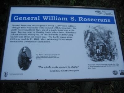
General William S. Rosecrans
Rich Mountain Battlefield
"The whole earth seemed to shake."
David Hart, Rich Mountain guide
Topics. This historical marker is listed in this topic list: War, US Civil. A significant historical date for this entry is July 11, 1861.
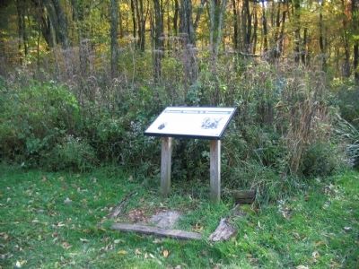
Location. 38° 51.955′ N, 79° 56.017′ W. Marker is near Beverly, West Virginia, in Randolph County. Marker is on Rich Mountain Road / Files Creek Road (County Route 37-8), on the right when traveling east. The marker is located in the Rich Mountain Battlefield. Touch for map. Marker is in this post office area: Beverly WV 26253, United States of America. Touch for directions.
Other nearby markers. At least 8 other markers are within walking distance of this marker. Battle Of Rich Mountain (a few steps from this marker); The Hart House (a few steps from this marker); Rich Mountain / Hart House (within shouting distance of this marker); Battle of Rich Mountain (within shouting distance of this marker); The Stable Yard (within shouting distance of this marker); Site of Old Hart House (within shouting distance of this marker); Rich Mountain (within shouting distance of this marker); Welcome to Rich Mountain Battlefield (within shouting distance of this marker). Touch for a list and map of all markers in Beverly.
More about this marker. On the lower left is a portrait of Rosecrans. Gen. William S. Rosecrans personally led a final charge across the turnpike, driving Confederate defenders from Rich Mountain. On the right is a drawing depicting Rosecrans' troops advancing through the wilds of Rich Mountain to attack Confederates at the Hart Farm.
Also see . . .
1. General Rosecrans. Biography of General Rosecrans from the Rich Mountain Battlefield site. (Submitted on October 24, 2009, by Craig Swain of Leesburg, Virginia.)
2. William Rosecrans. Wikipedia biography. (Submitted on October 25, 2009, by Jeff Conner of Norfolk, Virginia.)

Photographed By Craig Swain
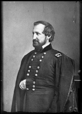
3. General William S. Rosecrans
Wartime portrait of General Rosecrans.
[Civil War photographs, 1861-1865 / compiled by Hirst D. Milhollen and Donald H. Mugridge, Washington, D.C. : Library of Congress, 1977. No. 0975]
Click for more information.
[Civil War photographs, 1861-1865 / compiled by Hirst D. Milhollen and Donald H. Mugridge, Washington, D.C. : Library of Congress, 1977. No. 0975]
Click for more information.
Credits. This page was last revised on January 6, 2024. It was originally submitted on October 23, 2009, by Craig Swain of Leesburg, Virginia. This page has been viewed 1,113 times since then and 46 times this year. Last updated on January 5, 2024, by Carl Gordon Moore Jr. of North East, Maryland. Photos: 1, 2. submitted on October 23, 2009, by Craig Swain of Leesburg, Virginia. 3. submitted on October 24, 2009, by Craig Swain of Leesburg, Virginia. • J. Makali Bruton was the editor who published this page.

