McDowell in Highland County, Virginia — The American South (Mid-Atlantic)
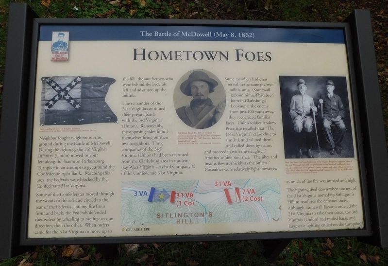
Hometown Foes
The Battle of McDowell (May 8, 1862)
Neighbor fought neighbor on this ground during the Battle of McDowell. During the fighting, the 3rd Virginia Infantry (Union) moved to your left along the Staunton-Parkersburg Turnpike in an attempt to get around the Confederate right flank. Reaching this area, the Federals were blocked by the Confederate 31st Virginia.
Some of the Confederates moved through the woods to the left and circled to the rear of the Federals. Taking fire from front and back, the Federals defended themselves by wheeling to fire first in one direction, then the other. When orders came for the 31st Virginia to move up to the hill, the southerners who were behind the Federals left and advanced up the hillside.
The remainder of the 31st Virginia continued their private battle with the 3rd Virginia (Union). Remarkably, the opposing sides found themselves firing on their own neighbors. Three companies of the 3rd Virginia (Union) had been recruited from the Clarksburg area in modern-day West Virginia - as had Company C of the Confederate 31st Virginia.
Some members had even served in the same pre-war militia unit. (Stonewall Jackson himself had been born in Clarksburg.) Looking at the enemy from just 100 yards away, they recognized familiar faces. Union soldier Andrew Price late recalled that "The [31st Virginia] came close to the 3rd, and saluted them, and called them by name, and proceeded with the slaughter." Another soldier said that, "The jibes and insults flew as thickly as the bullets." Casualties were relatively light, however, as much of the fire was hurried and high.
The fighting died down when the rest of the 31st Virginia moved up Sitlington's Hill to reinforce the defenses there. Although Stonewall Jackson ordered the 21st Virginia to take their place, the 3rd Virginia (Union) had pulled back, and largescale fighting ended on the turnpike.
(Captions):
Early war flag of the 31st Virginia Infantry.
Image Courtesy of West Virginia and Regional History Center.
Pvt. Elijah Leach Co. B 31st Virginia was mustered into service at West View in Augusta County on April 30, 1862, just days before the Battle of McDowell.
Image Courtesy of the Library of Congress.
Men like these two from Richwood West Virginia fought on opposite sides of the war. Although they did not participate in the Battle of McDowell, they are a good example of neighbors fighting against each other which occurred at McDowell when the 31st Virginia and 3rd Virginia met on the field of battle.
Image Courtesy of the Finley Taylor.
Erected by Shenandoah Valley Battlefields Foundation.
Topics. This historical marker is listed in this topic list: War, US Civil. A significant day of the year for for this entry is May 31.
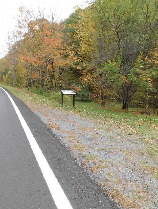
Location. 38° 19.85′ N, 79° 28.909′ W. Marker is in McDowell, Virginia, in Highland County. Marker is on Highland Turnpike (U.S. 250) 0.3 miles east of Water Tank Road (Virginia Route 656), on the right when traveling east. Touch for map. Marker is at or near this postal address: 9468 Highland Turnpike, Mc Dowell VA 24458, United States of America. Touch for directions.
Other nearby markers. At least 8 other markers are within walking distance of this marker. Battle of McDowell (approx. 0.4 miles away); McDowell VA - May 8, 1862 (approx. 0.4 miles away); McDowell Presbyterian Church (approx. 0.4 miles away); Commemorating The Battle Of McDowell (approx. 0.4 miles away); The Church and Cemetery (approx. 0.4 miles away); a different marker also named Battle of McDowell (approx. 0.4 miles away); Felix Hull House (approx. half a mile away); a different marker also named Battle of McDowell (approx. half a mile away). Touch for a list and map of all markers in McDowell.
Credits. This page was last revised on November 8, 2023. It was originally submitted on November 8, 2023, by Bradley Owen of Morgantown, West Virginia. This page has been viewed 75 times since then and 24 times this year. Photos: 1, 2. submitted on November 8, 2023, by Bradley Owen of Morgantown, West Virginia.

