North Riverfront Park in Alpena in Alpena County, Michigan — The American Midwest (Great Lakes)
Welcome to the Alpena Water Level Station
— Great Lakes Maritime Heritage Trail —
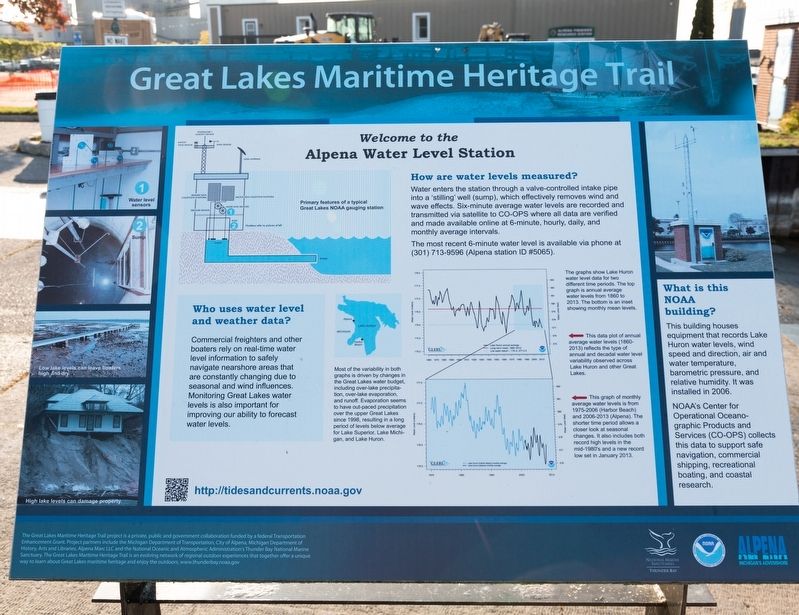
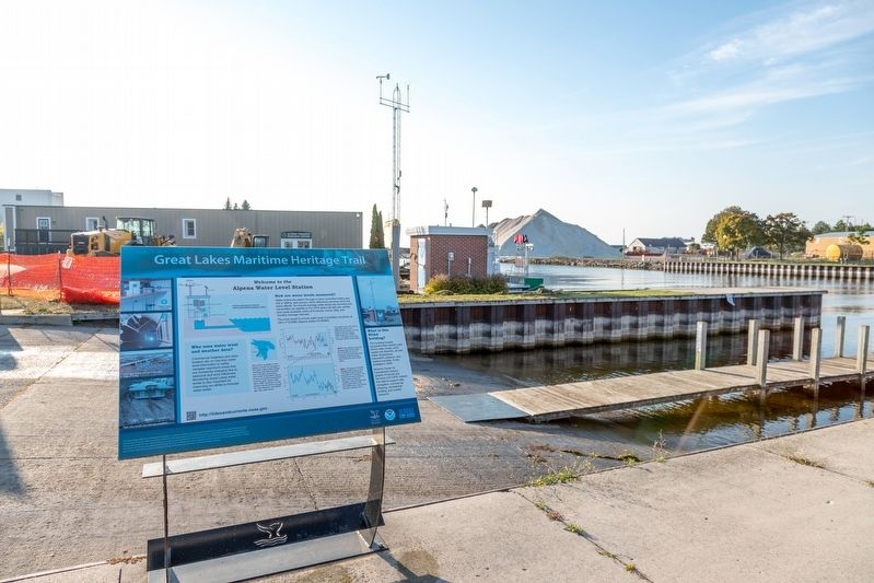
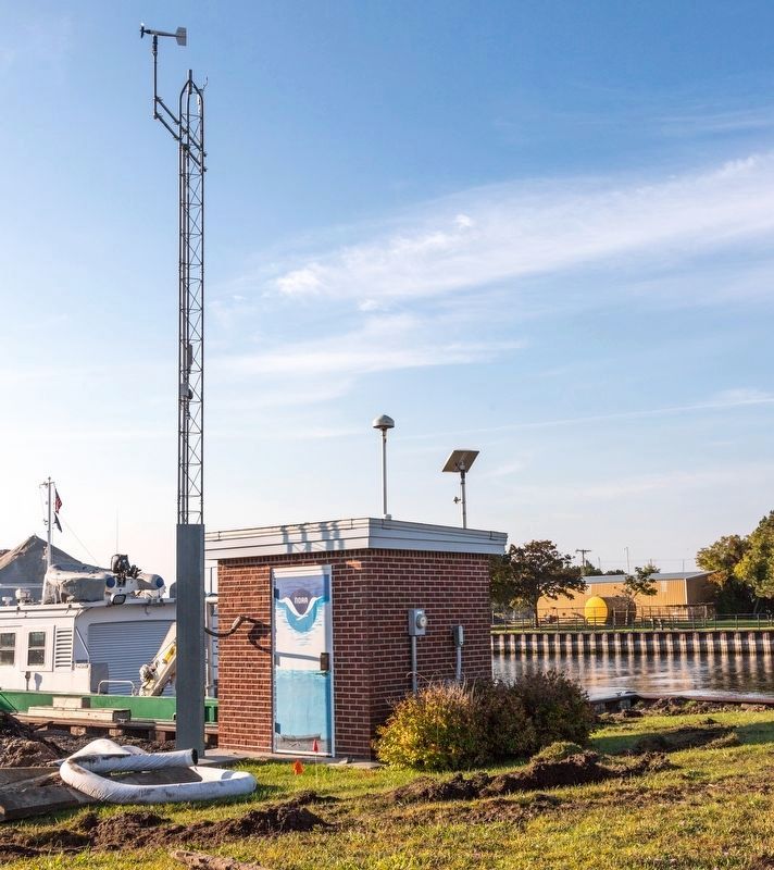
What is this NOAA building? This building houses equipment that records Lake Huron water levels, wind speed and direction, air and water temperature, barometric pressure, and relative humidity. It was installed in 2006. NOAA’s Center for Operational Oceano- graphic Products and Services (CO-OPS) collects this data to support safe navigation, commercial shipping, recreational boating, and coastal research.
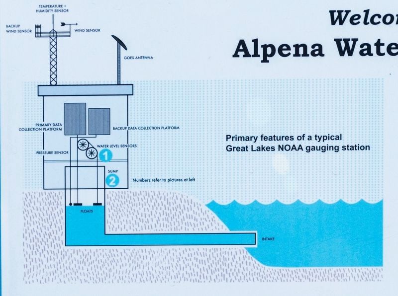
How are water levels measured? Water enters the station through a valve-controlled intake pipe into a stilling well (sump), which effectively removes wind and wave effects. Six-minute average water levels are recorded and transmitted via satellite to CO-OPS where all data are verified and made available online at 6-minute, hourly, daily, and monthly average interval The most recent 6-minute water level is available via phone at (301) 713-9596 (Alpena station ID #5065).
Who uses water level and weather data? Commercial freighters and other boaters rely on real-time water level information to safely navigate nearshore areas that are constantly changing due to seasonal and wind influences. Monitoring Great Lakes water levels is also important for improving our ability to forecast water levels.
Erected by Great Lakes Maritime Heritage Trail, the National Oceanic and Atmospheric Administration, and Alpena, Michigan’s Advenshore.
Topics. This historical marker is listed in these topic lists: Environment • Waterways & Vessels. A significant historical year for this entry is 2006.
Location. 45° 3.791′ N, 83° 25.724′ W. Marker is in Alpena, Michigan, in Alpena County. It is in North Riverfront Park. Marker is at the intersection of East Fletcher Street and Ford Avenue, on the right when traveling east on East Fletcher Street. Touch for map. Marker is at or near this postal address: 160 E Fletcher St, Alpena MI 49707, United States of America. Touch for directions.
Other nearby markers. At least 8 other markers are within walking distance of this marker. Thunder Bay National Maritime Sanctuary (within shouting distance of this marker); Nordmeer (within shouting distance of this marker); Abby’s Story (within shouting distance of this marker); Thomas Stafford Dog Park (within shouting distance of this marker); The Third Ward (about 300 feet away, measured in a direct line); Montana (about 300 feet away); Winter Layup (about 300 feet away); Grecian (about 400 feet away). Touch for a list and map of all markers in Alpena.
More about this marker. This interpretive panel is illustrated with a diagram, a map of Lake Huron marking Alpena and Harbor Beach, two graphs, and five photographs. The diagram shows the “primary features of a typical Great Lakes NOAA gauging station.” The two graphs are captioned,
The graphs show Lake Huron water level data for two different time periods. The top graph is annual average water levels from 1860 to 2013. The bottom is an inset showing monthly levels.The photographs, clockwise from top right, are (1) a photograph of this station, (2) “High lake levels can damage property,” (3) “Low lake levels can leave boaters high and dry,” (4) a photograph of the sump, and (5) a photograph of the water level sensors.
[First Graph] This data plot of annual average water levels (1860-2013) reflects the type of annual and decadal water level variability observed across Lake Huron and other Great Lakes.
[Second Graph] This graph of monthly average water levels is from 1975-2006 (Harbor Beach)and 2006-2013 (Alpena). The shorter time period shows a closer look at seasonal changes. It also includes both record high levels in the mid-1980s and a new record low set in January 2013.
Most of the variability in both graphs is driven by changes in The Great Lakes water budget including over-lake precipitation, over-lake evaporation, and runoff. Evaporation seems to have out-paced precipitation over the upper Great Lakes since 1998, resulting in a along period of levels below average for Lake Superior, Lake Michigan, and Lake Huron.
At the bottom left is this description
of the Great Lakes Maritime Heritage Trail:
The Great Lakes Maritime Heritage Trail project is a private, public and government collaboration funded by a federal Transportation Enhancement Grant. Project partners include the Michigan Department of Transportation, City of Alpena, Michigan Department of History, Arts and Libraries, Alpena Marc LLC and the National Oceanic and Atmospheric Administration's Thunder Bay National Marine Sanctuary. The Great Lakes Maritime Heritage Trail is an evolving network of regional outdoor experiences that together offer a unique way to learn about Great Lakes maritime heritage and enjoy the outdoors. www.thunderbay.noaa.gov
Also see . . . TidesAndCurrents.noaa.gov/. (Submitted on November 10, 2023.)
Credits. This page was last revised on November 10, 2023. It was originally submitted on November 10, 2023, by J. J. Prats of Powell, Ohio. This page has been viewed 64 times since then and 21 times this year. Photos: 1, 2, 3, 4. submitted on November 10, 2023, by J. J. Prats of Powell, Ohio.


