Near McDowell in Highland County, Virginia — The American South (Mid-Atlantic)
Anthony's Burg
Post-Civil War African American Community
— The Civil War Era in Highland County —
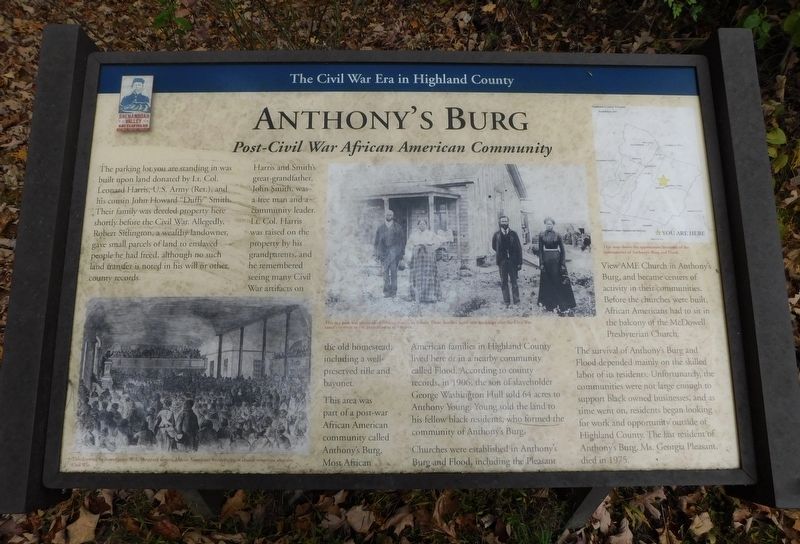
The parking lot you are standing in was built upon land donated by Lt. Col. Leonard Harris, U.S. Army (Ret.), and his cousin John Howard "Duffy" Smith. Their family was deeded property here shortly before the Civil War. Allegedly, Robert Sitlington, a wealthy landowner, gave small parcels of land to enslaved people he had freed, although no such land transfer is noted in his will or other county records.
Harris and Smith's great-grandfather, John Smith, was a free man and a Community leader. Lt. Col. Harris was raised on the property by his grandparents, and he remembered seeing many Civil War artifacts on the old homestead, including a well-preserved rifle and bayonet.
This area was part of a post-war African American community called Anthony's Burg. Most African American families in Highland County lived here or in a nearby community called Flood. According to county records, in 1906, the son of slaveholder George Washington Hull sold 64 acres to Anthony Young. Young sold the land to his fellow black residents, who formed the community of Anthony's Burg.
Churches were established in Anthony's Burg and Flood, including the Pleasant View AME Church in Anthony's Burg, and became centers of activity in their communities. Before the churches were built, African Americans had to sit in the balcony of the McDowell Presbyterian Church.
The survival of Anthony's Burg and Flood depended mainly on the skilled labor of its residents. Unfortunately, the communities were not large enough to support black owned businesses, and as time went on, residents began looking for work and opportunity outside of Highland County. The last resident of Anthony's Burg, Ms. Georgia Pleasant, died in 1975.
(Captions):
This drawing by famed artist W. L. Sheppard depicts African Americans worshipping at church sometime after the Civil War.
This is a post war photo of an African American family. These families faced new hardships after the Civil War.
Image Courtesy of the Encyclopedia of Virginia.
This map shows the approximate locations of the communities of Anthony's Burg and Flood.
Erected 2022 by Shenandoah Valley Battlefields Foundation.
Topics. This historical marker is listed in these topic lists: African Americans • Churches & Religion • War, US Civil. A significant historical year for this entry is 1906.
Location. 38° 19.467′ N, 79° 27.948′ W. Marker is near McDowell, Virginia, in Highland County. Marker is on Highland Turnpike (U.S. 250) 1½ miles east of Water Tank Road (Virginia Route 656), on the right when traveling east. Located at the pull-off for the trailhead for the McDowell Battlefield hiking trail. Touch for map. Marker is in this post office area: Mc Dowell VA 24458, United States of America. Touch for directions.
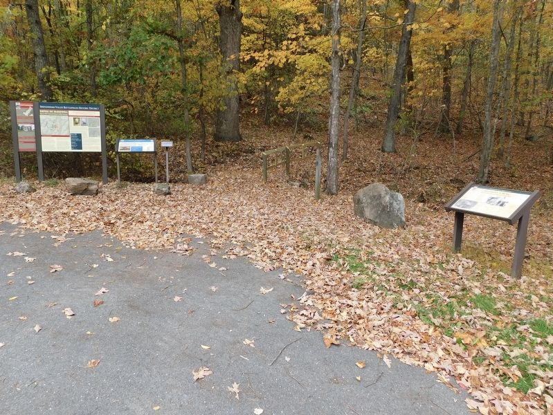
Other nearby markers. At least 8 other markers are within walking distance of this marker. Battle of McDowell (here, next to this marker); A Road From The Past (within shouting distance of this marker); Confederates Hold the High Ground (about 500 feet away, measured in a direct line); Two Plans Of Attack (approx. 0.2 miles away); Moving Uphill (approx. ¼ mile away); The Ravines (approx. 0.3 miles away); The Confederate Right (approx. 0.4 miles away); Sitlington's Hill (approx. 0.4 miles away). Touch for a list and map of all markers in McDowell.
Credits. This page was last revised on January 19, 2024. It was originally submitted on November 10, 2023, by Bradley Owen of Morgantown, West Virginia. This page has been viewed 72 times since then and 34 times this year. Photos: 1, 2. submitted on November 10, 2023, by Bradley Owen of Morgantown, West Virginia.

