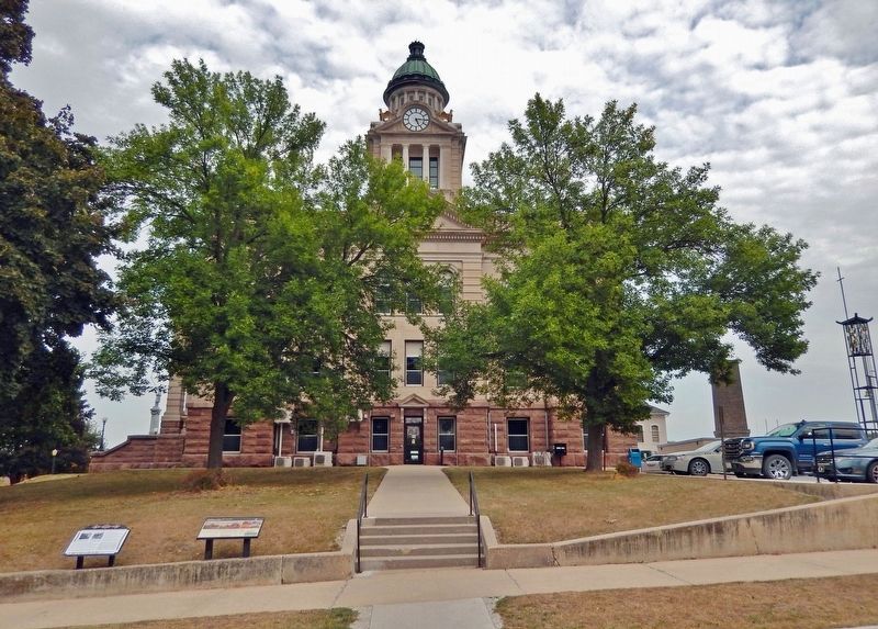
Decorah in Winneshiek County, Iowa — The American Midwest (Upper Plains)
Decorah, Northeast Iowa, & the Neutral Ground
Inscription.
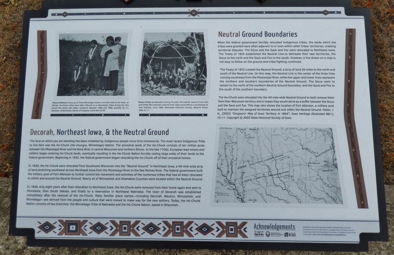
The land on which you are standing has been inhabited by Indigenous people since time immemorial. The most recent Indigenous Tribe to live here was the Ho-Chunk (Ho-chungra, Winnebago) Nation. The ancestral lands of the Ho-Chunk consists of ten million acres between the Mississippi River and the Rock River in central Wisconsin and northern Illinois. In the late 1700s, European lead miners and settlers began entering Ho-Chunk lands, eventually resulting in the Ho-Chunk Nation forcibly ceding large areas of their lands to the federal government. Beginning in 1832, the federal government began relocating the Ho-Chunk off of their ancestral homes.
In 1840, the Ho-Chunk were relocated from Southwest Wisconsin into the "Neutral Ground" in Northeast Iowa, a 40-mile wide strip of land stretching southwest across Northeast Iowa from the Mississippi River to the Des Moines River. The federal government built the military post of Fort Atkinson to further control the movement and activities of the numerous tribes that had all been relocated to within and around the Neutral Ground. Nearly all of Winneshiek and Allamakee Counties were located within the Neutral Ground.
In 1848, only eight years after their relocation to Northeast Iowa, the Ho-Chunk were removed from their home again and sent to Minnesota, then South Dakota, and finally to a reservation in Northeast Nebraska. The town of Decorah was established immediately after the removal of the Ho-Chunk. Many familiar place names — including Decorah, Waukon, Winneshiek, and Winnebago — are derived from the people and culture that were moved to make way for the new settlers. Today, the Ho-Chunk Nation consists of two branches: the Winnebago Tribe of Nebraska and the Ho-Chunk Nation, based in Wisconsin.
Neutral Ground Boundaries
When the federal government forcibly relocated Indigenous tribes, the lands which the tribes were granted were often adjacent to or even within other tribes' territories, creating territorial disputes. The Sioux and the Sauk and Fox were relocated to Northeast Iowa. The Treaty of 1825 established the Neutral Line to delineate their new territories, the Sioux to the north and the Sauk and Fox to the south. However, a line drawn on a map is not easy to follow on the ground and tribal fighting continued.
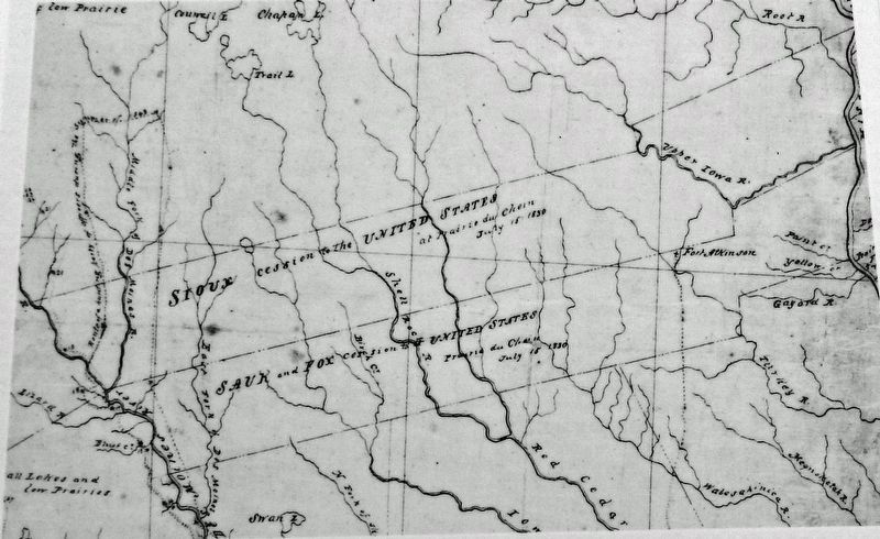
The Treaty of 1832 created the Neutral Ground, a strip of land 20 miles to the north and south of the Neutral Line. On this map, the Neutral Line is the center of the three lines running southwest from the Mississippi River, while the upper and lower lines represent the northern and southern boundaries of the Neutral Ground. The Sioux were to remain to the north of the northern Neutral Ground boundary, and
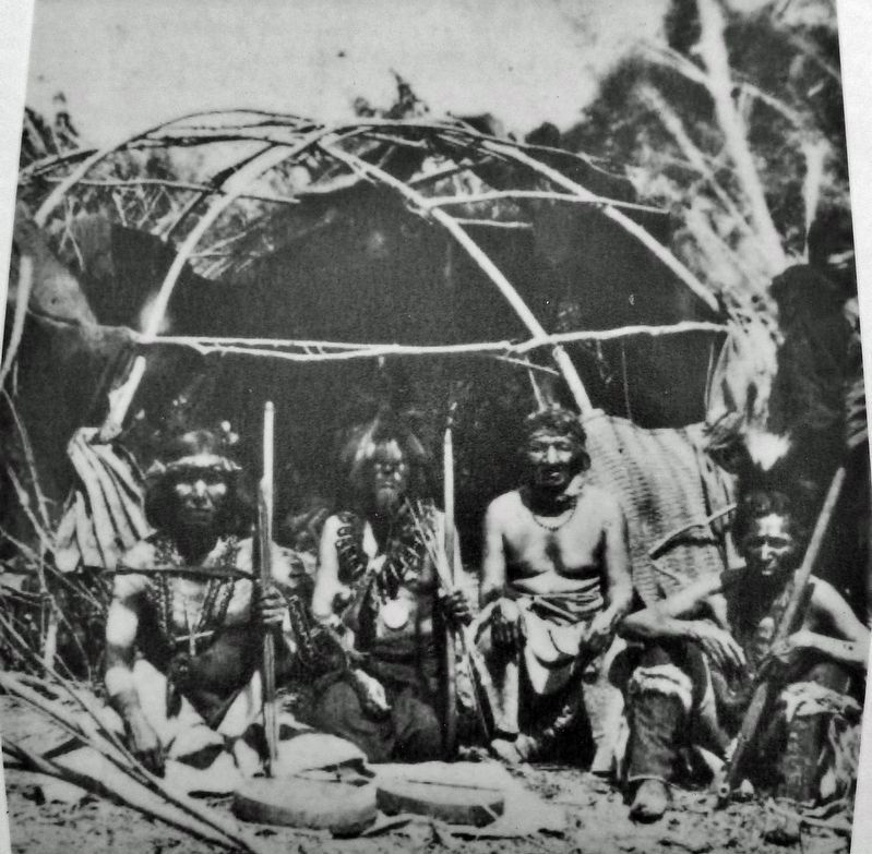
United States Library of Congress, LCCN 95514379
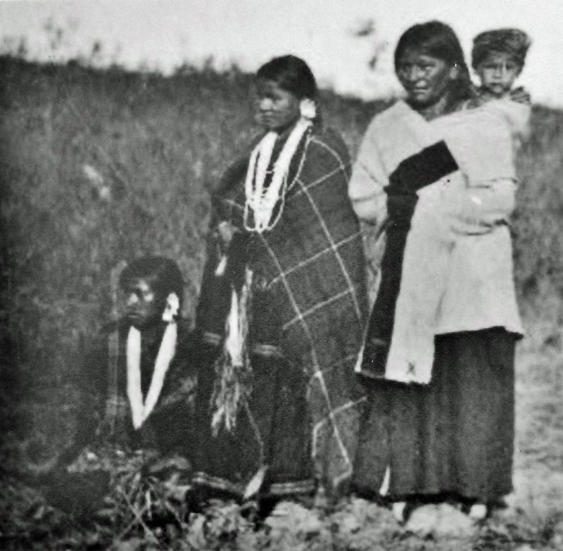
2. Marker detail: Three Winnebago Women
Close up of three Winnebago women, one with child on her back, on hillside. Ho-Chunk tribes were often referred to as Winnebago tribes during the time period this photo was taken, sometime between 1868 and 1880, possibly by C.L. Hamilton.
The Ho-Chunk were relocated into the 40-mile-wide Neutral Ground to both remove them from their Wisconsin territory and in hopes they would serve as a buffer between the Sioux and the Sauk and Fox. This map also shows the location of Fort Atkinson, a military post built to maintain the assigned territories around and within the Neutral Ground.
Indigenous communities have been present in Northeast Iowa since time immemorial, but much of their story is not widely known. This panel is one in a series that provides a brief exploration of the history of the indigenous communities in this region. Lean more at northeastiowarcd.org/fullhistory.
Topics. This historical marker is listed in these topic lists: Forts and Castles • Native Americans • Settlements & Settlers • Waterways & Vessels. A significant historical year for this entry is 1832.
Location. 43° 18.17′ N, 91° 47.298′ W. Marker is in Decorah, Iowa, in Winneshiek County. Marker is on Court Street just south of West Main Street, on the left when traveling south. The marker is located beside the sidewalk on the west side of the Winneshiek County Courthouse. Touch for map. Marker is at or near this postal address: 201 West Main Street, Decorah IA 52101, United States of America. Touch for directions.
Other nearby markers. At least 8 other markers are within walking distance of this marker. To Build, or Not To Build (here, next to this marker); Replica of the Statue of Liberty
(within shouting distance of this marker); Decorah: A Walk into the Past (within shouting distance of this marker); "The Biggest Day in the History of the County" (within shouting distance of this marker); a different marker also named Decorah: A Walk into the Past (about 300 feet away, measured in a direct line); Winnebago Street (about 300 feet away); a different marker also named Decorah: A Walk into the Past (about 500 feet away); a different marker also named Decorah: A Walk into the Past (about 500 feet away). Touch for a list and map of all markers in Decorah.
Also see . . .
1. Telling the full history: Northeast Iowa's "Neutral Ground". Excerpt:
Indigenous communities have called Northeast Iowa home since time immemorial, but the story of their presence in this region is not widely known and, in some cases, is misunderstood. Understanding the “Neutral Ground” is essential to understanding Northeast Iowa during the historic period (post-1673). During periods of westward expansion by settlers across America, many Indigenous tribes were forcibly relocated from their homelands, including the most recent tribe to have a significant tribal presence in Northeast Iowa, the Ho-Chunk (Ho-chungra, Winnebago).(Submitted on November 12, 2023, by Cosmos Mariner of Cape Canaveral, Florida.)
2. Tracing the treaties: How they affected American Indians and Iowa. Excerpt:
Before white settlers transformed a wilderness prairie into a state that would become the agricultural capital of the United States, it belonged to American Indian tribes like the Sac and Fox. All of that would change through a series of 368 treaties and executive orders used by the U.S. government from 1776 to 1886 to seize more than 1.5 billion acres from America’s indigenous people.(Submitted on November 12, 2023, by Cosmos Mariner of Cape Canaveral, Florida.)
Credits. This page was last revised on November 12, 2023. It was originally submitted on November 11, 2023, by Cosmos Mariner of Cape Canaveral, Florida. This page has been viewed 426 times since then and 349 times this year. Photos: 1, 2, 3, 4, 5, 6. submitted on November 12, 2023, by Cosmos Mariner of Cape Canaveral, Florida.
