San Juan Bautista in San Benito County, California — The American West (Pacific Coastal)
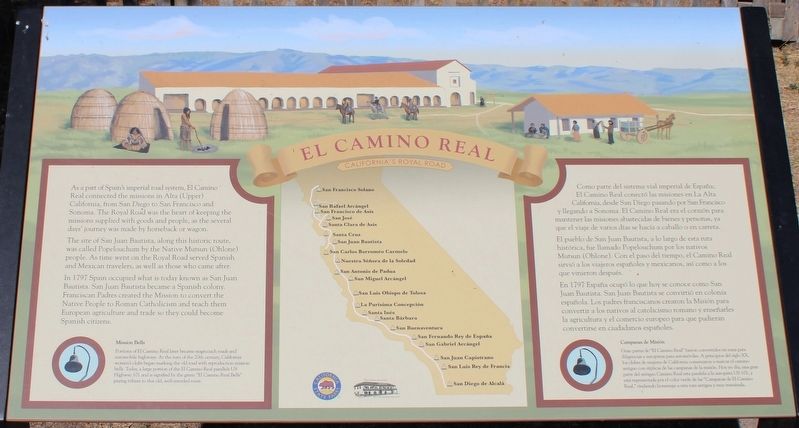
El Camino Real
California’s Royal Road
The site of San Juan Bautista, along this historic route, was called Popelouchum by the Native Mutsun (Ohlone) people. As time went on, the Royal Road served Spanish and Mexican travelers, as well as those who came after.
In 1797 Spain occupied what is today known as San Juan Bautista. San Juan Bautista became a Spanish colony. Franciscan Padres created the Mission to convert the Native People to Roman Catholicism and trach them European agriculture and trade so they could become Spanish citizens.
Mission Bells
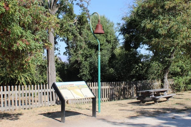
Portions of El Camino Real later became stagecoach roads and automobile highways. At the turn of the 20th century, California women’s clubs began marking the old road with reproduction mission bells. Today, a large portion of the El Camino Real parallels US Highway 101 and is signified by the green “El Camino Real Bells” paying tribute to this old, well-traveled route.
Como parte del Sistema vial imperial de España; El Camino Real conectó las misiones en La Alta California, desde San Diego pasando por San Francisco y llegando a Sonoma. El Camino Real era el corazón para mantener las misiones abastecidas de bienes y personas, ya que el viaje de varios días se hacía a caballo o en carreta.
El pueblo de San Juan Bautista, a lo largo de esta ruta histórica, fue llamado Popelouchum por los nativos Mutsun (Ohlone). Con el paso del tiempo, el Camino Real sirvió a los viajeros españoles y mexicanos, así como a los que vinieron después.
En 1797 España ocupó lo que hoy se conoce como San Juan Bautista. San Juan Bautista se convirtió en colonia española. Los padres franciscanos crearon le Misión para convertir a los nativos al catolicismo romano Y enseñarles le agricultura y el comercio europeo para que pudieran convertirse en ciudadanos españoles.
Campanas de Misión
Gran partes de “El Camino Real” fueron convertidos en rutas para diligencias y autopistas para automóviles. A principios del siglo XX, los clubes de mujeres de California comenzaron a marcar el camino antiguo con réplias de las campanas de la misión. Hoy en día, una gran parte del antiguo Camino Real esta paralela a la autopista US 101, y está representada por el color verde de las “Campanas de El Camino Real” rindiendo homenaje a esta ruta Antigua y muy transitada.
Erected by California Department of Parks & Recreation.
Topics. This historical marker is listed in these topic lists: Churches & Religion • Exploration • Native Americans • Roads & Vehicles. A significant historical year for this entry is 1797.
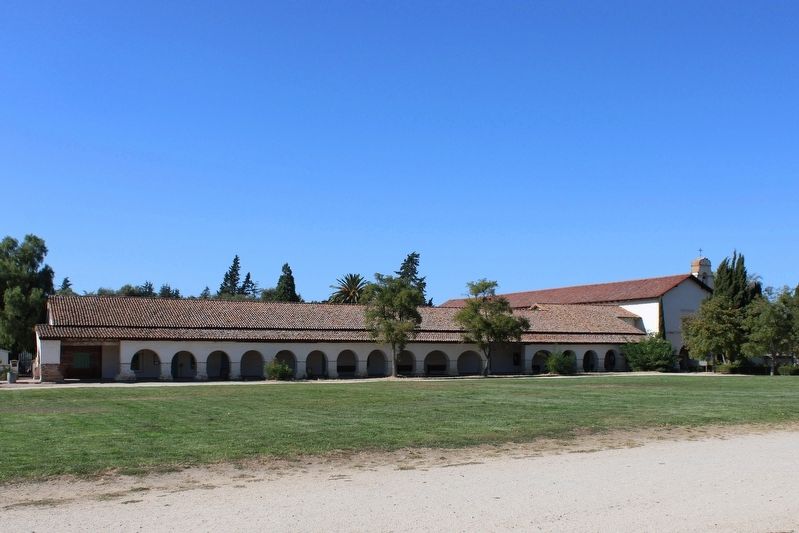
Location. 36° 50.728′ N, 121° 32.111′ W. Marker is in San Juan Bautista, California, in San Benito County. Marker is on 2nd Street north of Washington Street, on the right when traveling north. The resin marker is on the northwest side of the mission lawn, below an El Camino Real bell. Touch for map. Marker is at or near this postal address: 406 2nd Street, San Juan Bautista CA 95045, United States of America. Touch for directions.
Other nearby markers. At least 8 other markers are within walking distance of this marker. Vicky’s Cottage (within shouting distance of this marker); Mission San Juan Bautista (within shouting distance of this marker); The San Andreas Fault Exhibit & El Camino Real Earthquake Walk (within shouting distance of this marker); a different marker also named El Camino Real (within shouting distance of this marker); Mission Cemetery (within shouting distance of this marker); Castro/Breen Adobe and Plaza Hotel (about 300 feet away, measured in a direct line); Castro - Breen Adobe (about 300 feet away); San Juan Bautista Plaza Historic District (about 300 feet away). Touch for a list and map of all markers in San Juan Bautista.
Also see . . . The Royal Road, aka The King’s Highway. California Mission Guide
"The “royal road” was in fact a modest dirt footpath. As the mission system grew and traffic increased, the simple trail became a dirt road wide enough to accommodate carts and wagons.(Submitted on November 12, 2023, by Joseph Alvarado of Livermore, California.)
The first portion was not paved until 1912, when a small section in the San Francisco Bay Area became the first paved highway in California."
Credits. This page was last revised on November 12, 2023. It was originally submitted on November 12, 2023, by Joseph Alvarado of Livermore, California. This page has been viewed 56 times since then and 21 times this year. Photos: 1, 2, 3. submitted on November 12, 2023, by Joseph Alvarado of Livermore, California.


