Elkhart in Elkhart County, Indiana — The American Midwest (Great Lakes)
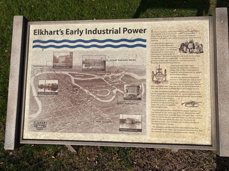
Elkhart's Early Industrial Power
— Elkhart - 1800's —
Elkhart’s rise as an early industrialized community can be tied directly to its rivers and the power they provided. Water flowing through a system of dams and raceways, known as hydraulics, generated the power for many types of industry.
In 1840, Elkhart's founding father, Dr. Havilan Beardsley, constructed a dam on Christiana Creek near what is now the Water Works property. From there, a canal was dug south to the St. Joseph River. The canal divided into two races, one for a flour mill and the other for a paper mill. You can still see the remnants of the paper mill race near the intersection Beardsley and Edwardsburg Avenues.
There were three other major hydraulic developments in Elkhart’s history. Two of them dominated the "lowlands" area between the St. Joseph and the Elkhart Rivers.
The first one, developed by Vincent Voisinet in 1870 and later sold to Clark Lane, was located on the east bank of the Elkhart River between East Jackson Blvd. and Elkhart Ave. Over the years, the raceway powered a flour mill, plow works, a woolen factory and a paper factory.
In 1868 the Elkhart Hydraulic Co. constructed a dam across the St. Joseph River thus creating the second hydraulic works. Some of the major industries operating from this site included: G. Conn Band Instruments, Elkhart Knitting Co., and Sage Brothers Harvest Queen flour mill. Today this area is occupied by Easy Shopping Place.
The third development called the St. Joseph Hydraulic Co. was located on the north side of the St. Joseph River and drew its power from raceways above the same dam. Later in 1892 the Home Electric Light and Power Co. erected a power plant on this race below the dam near the mouth of Christiana Creek. This company was an early provider of electrical power to the city.
The hydraulics and the industries they powered saw their demise begin in the 1890's due to frequent flooding, fires, and the eventual conversion to alternative power sources.
Topics. This historical marker is listed in these topic lists: Agriculture • Horticulture & Forestry • Settlements & Settlers • Waterways & Vessels. A significant historical year for this entry is 1840.
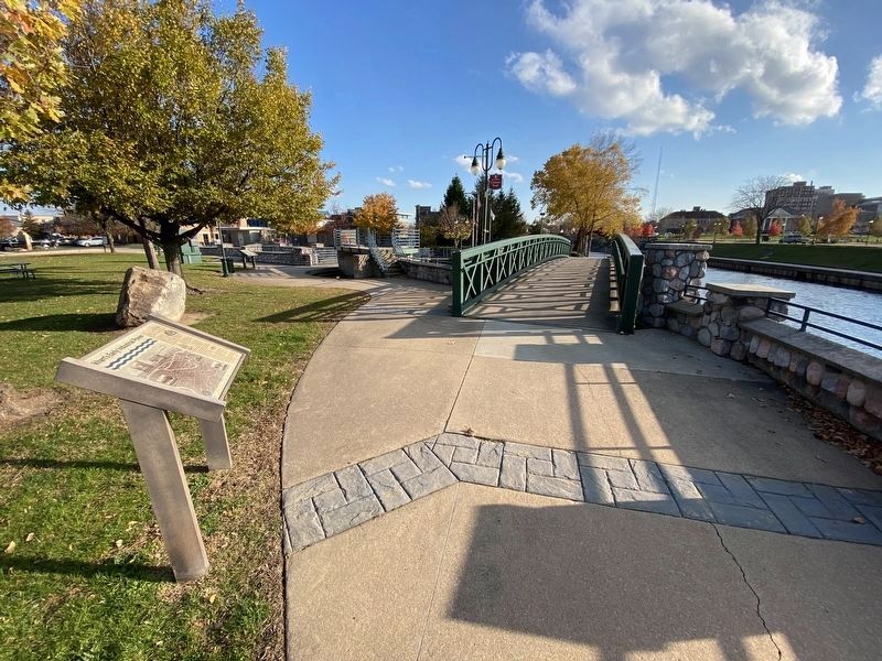
Location. 41° 41.212′ N, 85° 58.249′ W. Marker is in Elkhart, Indiana, in Elkhart County. Marker can be reached from Nibco Parkway just south of East Lexington Avenue, on the right when traveling south. Marker is on the River Walk Culture Trail on the east side of the Elkhart River and just north of the Nibco Water and Ice Park. Touch for map. Marker is at or near this postal address: 303 Nibco Parkway, Elkhart IN 46516, United States of America. Touch for directions.
Other nearby markers. At least 8 other markers are within walking distance of this marker. The Power of Water in Elkhart (about 300 feet away, measured in a direct line); Elkhart River Dam Removal (approx. 0.2 miles away); Elkhart Carnegie Public Library (approx. 0.2 miles away); C.G. Conn Company (approx. 0.2 miles away); E. Hill Turnock (approx. 0.2 miles away); Elkhart County Revolutionary Soldiers Memorial (approx. 0.2 miles away); Charles Gordone (approx. 0.2 miles away); Elkhart High School (approx. ¼ mile away). Touch for a list and map of all markers in Elkhart.
Credits. This page was last revised on November 18, 2023. It was originally submitted on November 13, 2023, by Lou Donkle of Valparaiso, Indiana. This page has been viewed 66 times since then and 34 times this year. Photos: 1, 2, 3. submitted on November 13, 2023, by Lou Donkle of Valparaiso, Indiana. • Devry Becker Jones was the editor who published this page.


