Near Williamsburg in James City County, Virginia — The American South (Mid-Atlantic)
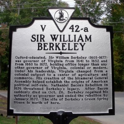
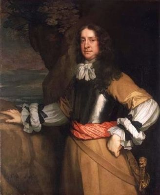
Sir William Berkeley
Erected 2008 by Department of Historic Resources. (Marker Number V 42-a.)
Topics and series. This historical marker is listed in these topic lists: Colonial Era • Settlements & Settlers. In addition, it is included in the Virginia Department of Historic Resources (DHR) series list. A significant historical month for this entry is January 1677.
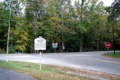
Location. 37° 15.18′ N, 76° 48.025′ W. Marker is near Williamsburg, Virginia, in James City County. Marker is at the intersection of Greensprings Road (Virginia Route 614) and John Tyler Highway (Virginia Route 5), on the right when traveling south on Greensprings Road. Touch for map. Marker is in this post office area: Williamsburg VA 23188, United States of America. Touch for directions.
Other nearby markers. At least 8 other markers are within 2 miles of this marker, measured as the crow flies. Bacon's Rebellion (approx. 0.7 miles away); Governor's Land (approx. ¾ mile away); a different marker also named Governor’s Land (approx. 1½ miles away); Green Spring Road (approx. 1½ miles away); Church on the Main (approx. 1½ miles away); Battle Of Green Spring (approx. 1½ miles away); Battle of Green Spring (approx. 1½ miles away); Battle of Green Spring Memorial (approx. 1.7 miles away). Touch for a list and map of all markers in Williamsburg.
Also see . . .
1. Sir William Berkeley. Virtual Jamestown Interpretive Essays (Submitted on October 25, 2009.)
2. William Berkeley. Wikipedia (Submitted on October 25, 2009, by Jeff Conner of Norfolk, Virginia.)
Credits. This page was last revised on November 9, 2021. It was originally submitted on October 25, 2009, by Bernard Fisher of Richmond, Virginia. This page has been viewed 1,672 times since then and 26 times this year. Photos: 1, 2, 3. submitted on October 25, 2009, by Bernard Fisher of Richmond, Virginia.


