Elkhart in Elkhart County, Indiana — The American Midwest (Great Lakes)
Elkhart River Dam Removal
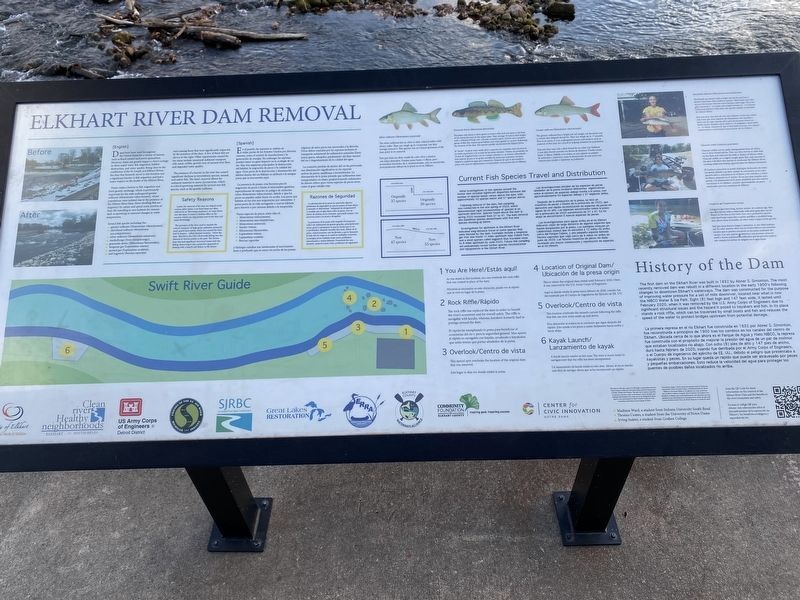
Dams have been used throughout the United States for a variety of reasons such as flood control and power generation. However, dams can greatly impact a river's ecology in three major ways: fish migration, habitat destruction, and water quality. Being close to the confluence of the St. Joseph and Elkhart Rivers, the dam that formerly stood in this location was a significant barrier to fish migration and had a major impact on the health of the Elkhart River.
Dams create a barrier to fish migration and limit genetic exchange, which is particularly important for the state endangered greater redhorse (Moxostoma valenciennesi), whose populations were isolated due to the presence of the Elkhart River Dam. River dwelling fish are migratory by nature and spend some portion of their life travelling to new habitats for reasons such as spawning or seasonal changes in water temperature.
Several fish species including the greater redhorse (Moxostoma valenciennesi), shorthead redhorse (Moxostoma macrolepidotum), silver redhorse (Moxostoma anisurum), muskellunge (Esox masquinongy), greenside darter (Etheostoma blennioides), longnose gar (Lepisosteus osseus), spotted gar (Lepisosteus oculatus), and logperch (Percina caprodes) were among those that were significantly impacted by the presence of the dam. A few of these fish are shown to the right. Other impairments caused by the dams include unnatural sediment transport (silt, sand, cobble, gravel); loss of natural river flow, and degraded water quality.
The presence of a barrier in the river has caused significant declines in invertebrate species, mussel, and native fish. The dam's removal allows for sediment material to move downstream, which is critical spawning material for several rare fish species, such as the greater redhorse.
Safety Reasons
Lastly, the removal of the dam has helped avoid certain safety issues. Low head dams are often referred to as "drowning machines". As water flows over the dam, it creates a turbine effect in the current, which can trap people next to the dam and cause drownings.
The presence of the dam used to impede the critical transport of large grain sediment, primarily sand, gravel and cobble, which has caused the river bed to deepen - called channel incision - below the dam. This led to the City's Riverwalk falling into the channel at various points in the past. The former dam also had significant structural issues and was failing. Removing it was a proactive approach to dealing with a breach and failure in the future.
Current Fish Species Travel and Distribution
Initial investigations of fish species around the former dam revealed significant disparities between the number of species below versus above the dam, with approximately 50 species below and 37 species above.
Following removal of the dam, fish sampling was conducted in the late spring of 2020, which demonstrated rapid recolonization of species in an upstream direction. Species found above the dam in spring 2020 increased from 37 to 47. The dam removal also benefited species downstream with five new species showing up below.
Investigations far upstream in the Elkhart River indicated long-distance travel of some species that were blocked by the dam. Examples include a longnose gar that was found 12 miles upstream near Oxbow Park, and a small species called logperch that travelled close to 8 miles upstream by June 2020. Future fish sampling will undoubtedly reveal further species recolonization and repopulation in the Elkhart River.
History of the Dam
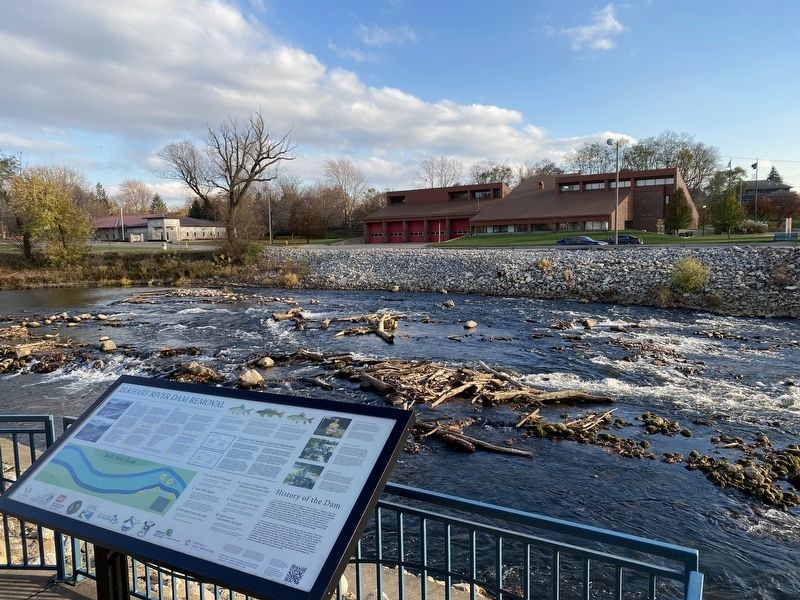
The first dam on the Elkhart River was built in 1832 by Abner S. Simonton. The most recently removed dam was rebuilt in a different location in the early 1900's following changes to downtown Elkhart's waterways. The dam was constructed for the purpose of improving water pressure for a set of mills downriver, located near what is now the NIBCO Water & Ice Park. Eight (8) feet high and 147 feet wide, it lasted until February 2020, when it was removed by the U.S. Army Corps of Engineers due to significant structural issues and the hazard it posed to kayakers and fish. In its place stands a rock riffle, which can be traversed by small boats and fish and reduces the speed of the water to protect bridges upstream from potential damage.
Erected by City of Elkhart, Clean river Healthy neighborhoods, US Army Corps of Engineers, Friends of the St. Joe River, St. Joseph River Basin Commission, Great Lakes Restoration, Elkhart River Recreation Association, Elkhart County Waterways Alliance, Community Foundation of Elkhart County, Center for Civic Innovation - Notre Dame.
Topics. This historical marker is listed in these topic lists: Animals • Environment • Industry & Commerce • Waterways & Vessels. A significant historical year for this entry is 1832.
Location. 41° 41.111′ N, 85° 58.087′ W. Marker is in Elkhart, Indiana, in Elkhart County. Marker can be reached from South Elkhart Avenue south of Nibco Parkway, on the right when traveling north. Marker is on the north side of the Elkhart River along the River Walk Culture Trail on the south side of the INOVA Federal Credit Union building. Touch for map. Marker is at or near this postal address: 358 South Elkhart Avenue, Elkhart IN 46516, United States of America. Touch for directions.
Other nearby markers. At least 8 other markers are within walking distance of this marker. The Power of Water in Elkhart (about 700 feet away, measured in a direct line); Elkhart's Early Industrial Power (approx. 0.2 miles away); C.G. Conn Company (approx. ¼ mile away); Bucklen Opera House (approx. ¼ mile away); Charles Gordone (approx. 0.3 miles away); Elkhart Carnegie Public Library (approx. 0.3 miles away); Elkhart County Revolutionary Soldiers Memorial (approx. 0.3 miles away); Elkhart High School (approx. 0.3 miles away). Touch for a list and map of all markers in Elkhart.
Credits. This page was last revised on November 18, 2023. It was originally submitted on November 14, 2023, by Lou Donkle of Valparaiso, Indiana. This page has been viewed 56 times since then and 19 times this year. Photos: 1, 2. submitted on November 14, 2023, by Lou Donkle of Valparaiso, Indiana. • Devry Becker Jones was the editor who published this page.
Editor’s want-list for this marker. A wide shot of the marker showing the entire marker. • Can you help?

