Lincoln Township near Onawa in Monona County, Iowa — The American Midwest (Upper Plains)
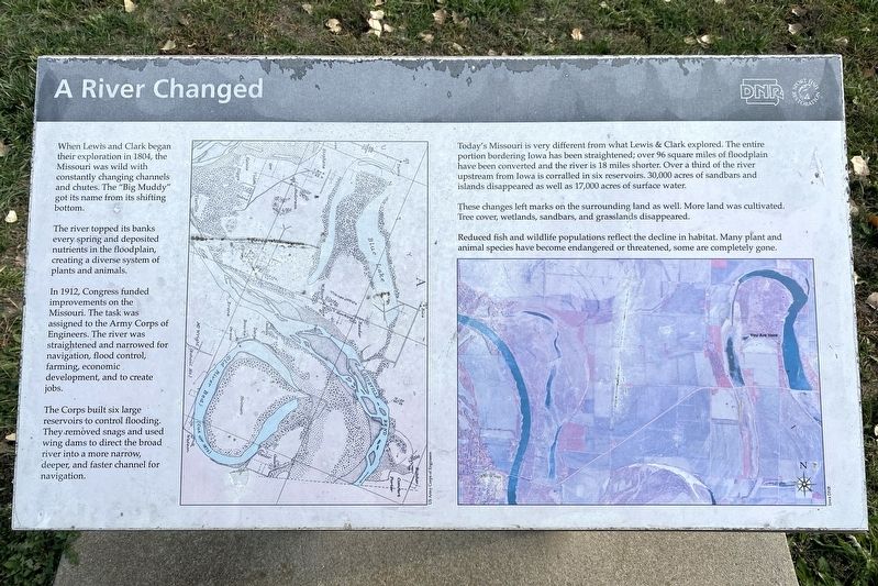
A River Changed
The river topped its banks every spring and deposited nutrients in the floodplain, creating a diverse system of plants and animals.
In 1912, Congress funded improvements on the Missouri. The task was assigned to the Army Corps of Engineers. The river was straightened and narrowed for navigation, flood control, farming, economic development, and to create jobs.
The Corps built six large reservoirs to control flooding. They removed snags and used wing dams to direct the broad river into a more narrow, deeper, and faster channel for navigation.
Today's Missouri is very different from what Lewis & Clark explored. The entire portion bordering Iowa has been straightened; over 96 square miles of floodplain have been converted and the river is 18 miles shorter. Over a third of the river upstream from Iowa is corralled in six reservoirs. 30,000 acres of sandbars and islands disappeared as well as 17,000 acres of surface water.
These changes left marks on the surrounding land as well. More land was cultivated. Tree cover, wetlands, sandbars, and grasslands disappeared.
Reduced fish and wildlife populations reflect the decline in habitat. Many plant and animal species have become endangered or threatened, some are completely gone.
Erected by Iowa DNR, Sport Fish Restoration.
Topics. This historical marker is listed in these topic lists: Environment • Exploration • Waterways & Vessels. A significant historical year for this entry is 1804.
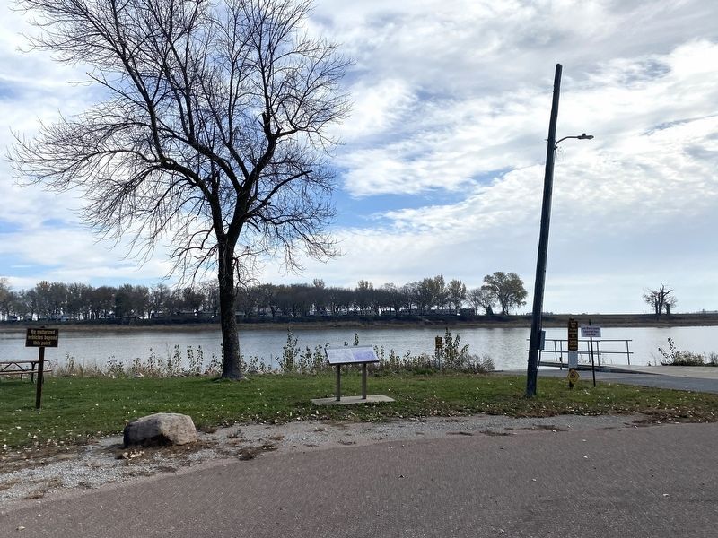
Location. 42° 2.676′ N, 96° 9.624′ W. Marker is near Onawa, Iowa, in Monona County. It is in Lincoln Township. Marker can be reached from Park Loop, 0.9 miles north of 225th Street, on the right when traveling north. Located in Lewis and Clark State Park. Touch for map. Marker is at or near this postal address: 21914 Park Loop, Onawa IA 51040, United States of America. Touch for directions.
Other nearby markers. At least 8 other markers are within 4 miles of this marker, measured as the crow flies. Prairies in the Hills (about 700 feet away, measured in a direct line); "Coupe A Jarcke" (about 700 feet away); Preparation Valley (about 700 feet away); Visiting Blackbird's Grave (about 700 feet away); Open and Boundless Prairie (about 700 feet away); The Lewis & Clark Expedition (about 700 feet away); Second Camping Ground in Monona County (approx. ¼ mile away); Onawa Freedom Rock Veterans Memorial (approx. 3.2 miles away). Touch for a list and map of all markers in Onawa.
Credits. This page was last revised on November 16, 2023. It was originally submitted on November 16, 2023. This page has been viewed 55 times since then and 20 times this year. Photos: 1, 2. submitted on November 16, 2023.

